
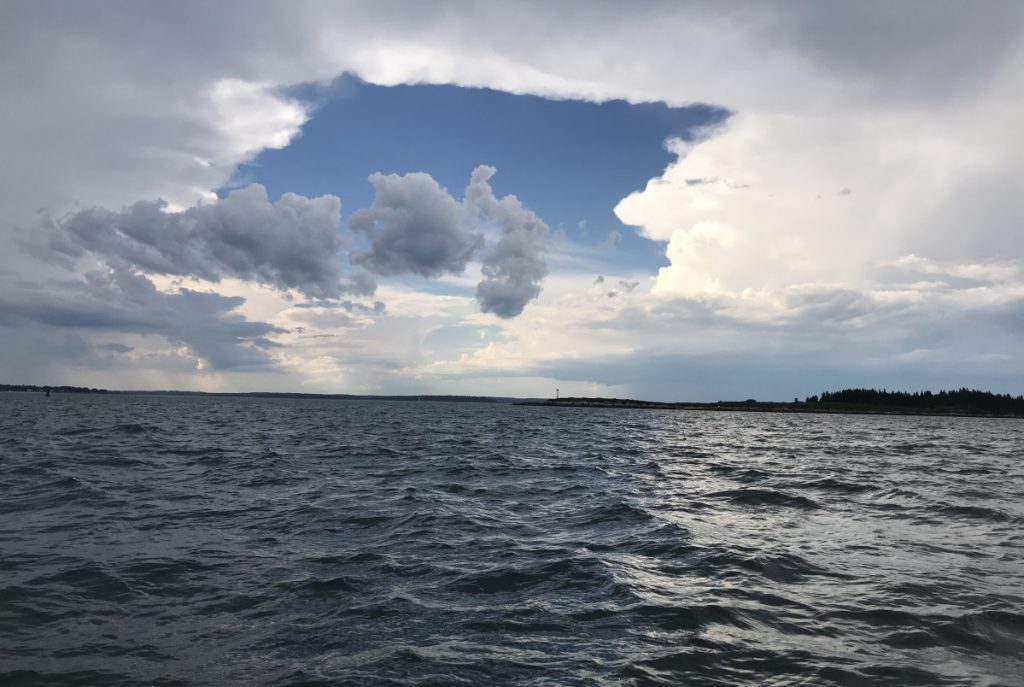
By midafternoon, a strong onshore wind was kicking up a wicked chop in Harpswell Sound, pounding my little boat as we motored south along Orrs Island. After nearly eight hours at the helm, the last thing I wanted to do was head into the open, eastern side of Casco Bay, where we would be exposed to the brunt of a falling tide and building seas.
But we had one more island to knock off, or we’d be one short.
To celebrate its 30th anniversary, the Maine Island Trail Association is encouraging members to explore the 375-mile water trail this summer by creating the 30-in-30 Challenge. The goal is to set foot on at least 30 of the trail’s 226 wild islands and mainland sites before Oct. 8 and document each visit.
That sounded like fun. But to my friend and fellow island-hopper, Chuck Radis, it didn’t seem like enough of a challenge. We wondered: Could we hit 30 trail sites in one day?
The answer is yes. And according to MITA, we were the first to do it.
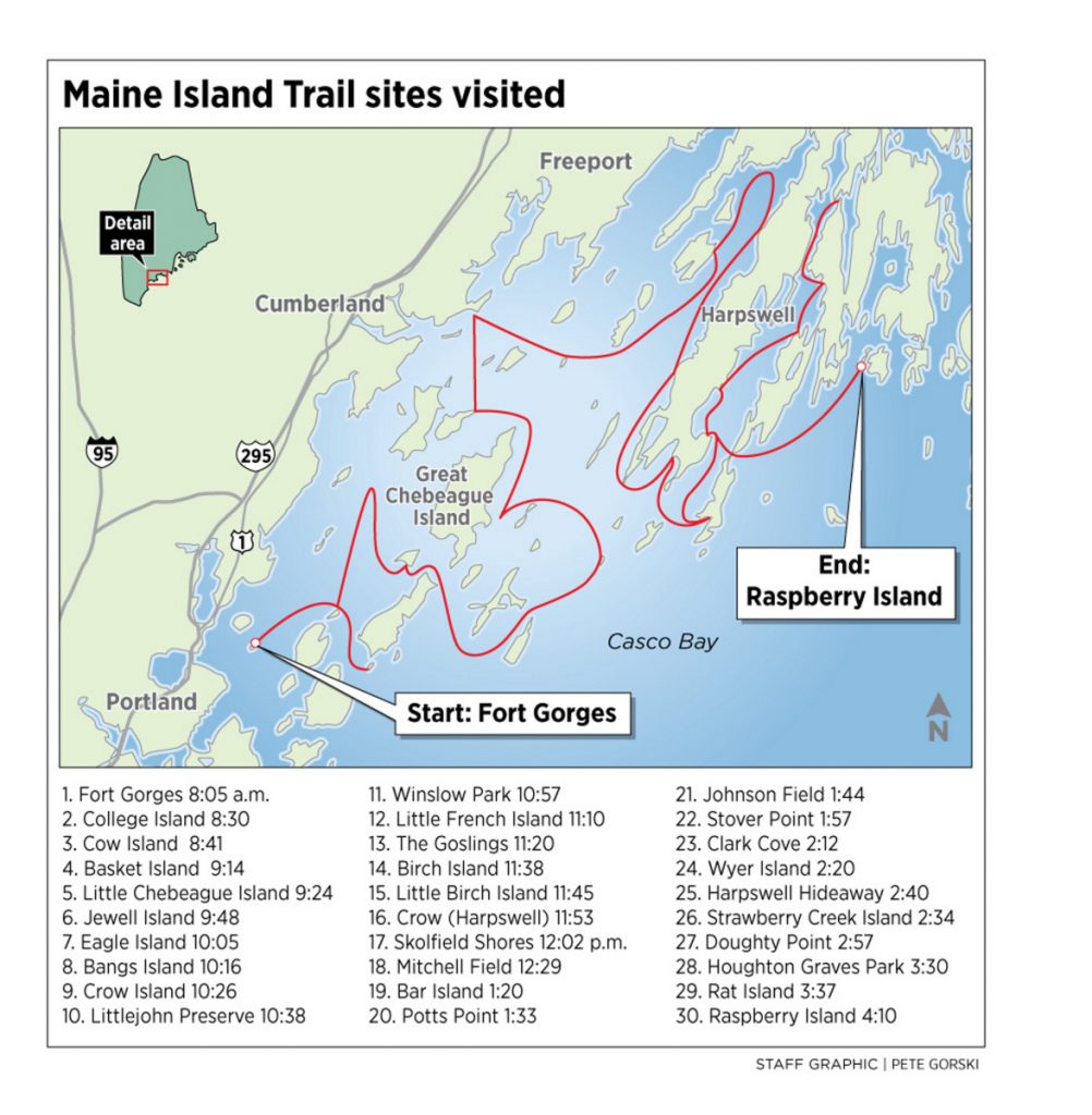
During a day in late June that started foggy and ended with thunderstorms, we touched 30 trail sites from Portland Harbor to Harpswell’s Quahog Bay. We covered 102 miles in roughly eight hours, in my 17-foot aluminum fishing boat.
But our little 30-in-24 accomplishment soon could be blown out of the water by an audacious undertaking.
 MITA leadership is planning to use a former Coast Guard response boat to hit 30 sites, beginning at the trail’s start point in Kittery and ending near the Canadian border in Eastport, in under 24 hours. The trip is planned for a day this week, weather permitting.
Meanwhile, one MITA member has used his kayak to complete 30 trail visits over six weeks, and several others are chipping away at the challenge at a more measured pace.
“The goal is to have fun with different styles and approaches,” said Doug Welch, MITA’s executive director, “and to celebrate the islands.”
As of late June, Welch had done eight islands in Casco Bay, using a rowing boat he built last winter. He plans to continue along the coast.
“You can do it very slowly over the course of the summer,” he said.
The Maine Island Trail spun off from an effort in the 1980s to inventory some of the state’s offshore islands for recreational use. In the process, Camden native and boating editor David Getchell floated the idea of a coastal water route similar to the Appalachian Trail. His suggestion led to America’s first water trail.
Today, the Maine Island Trail runs the entire coast from the New Hampshire border to Cobscook Bay. The trail features a mix of public lands and private properties, with most of the islands reached by kayak, sailboat and small motor boat. More than 25,000 people have become MITA members.
As a longtime MITA member and small-boat enthusiast, I’ve explored various sections of the trail from Casco Bay to the Down East coast. My boat is based in Freeport, so I’m most familiar with Casco Bay. But to visit 30 sites in a day, I knew a lot of things would have to line up correctly.
SMALL TIDAL RANGE
My first concern was the tides.
I needed a day with a small tidal range, because some sites are flanked by mudflats and not accessible at low water. I also needed an early morning low tide, so we could reach some of those muddy sites as the water rose.
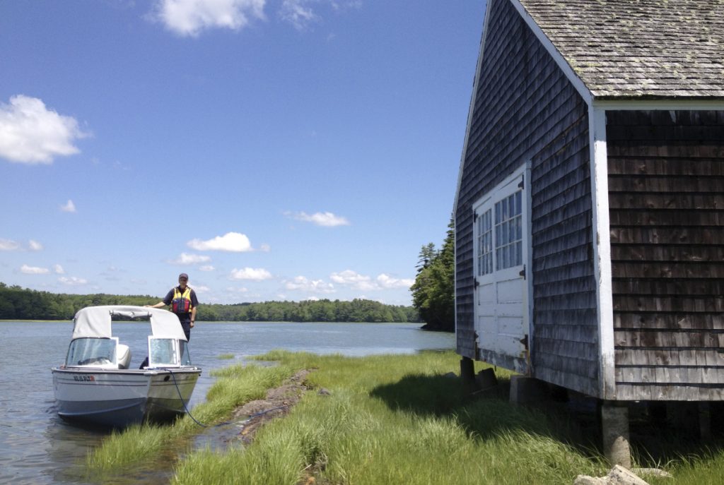
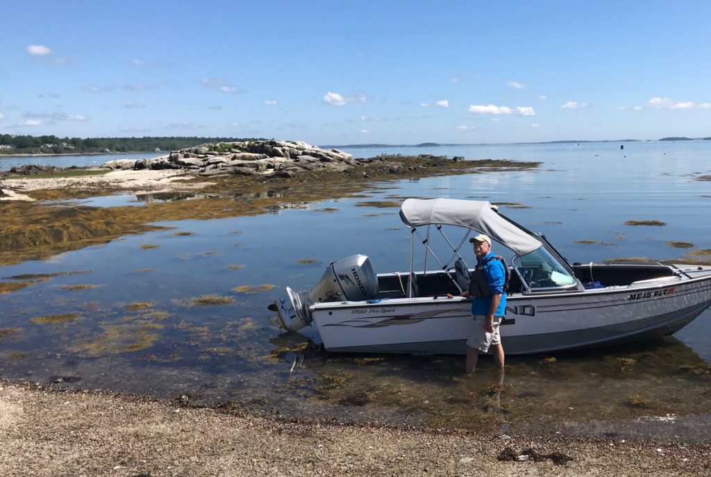
Weather, most notably wind and wave conditions, was an overriding factor. My Lund 1700 ProSport is a stout aluminum boat and its 90-horsepower Honda outboard inspires confidence. But a 17-foot boat is always a cautious visitor in the ocean, especially when it’s calling on islands in the outer bay.
My first-choice day got washed out by rain and fog. The weather also kept me from motoring the prior evening from Freeport to my friend’s house on Peaks Island, so we’d be near our starting point.
Instead, I woke early on trip day and motored from Harraseeket Harbor to Peaks. The sky had cleared in Freeport. But halfway to Peaks, the fog was hanging on. I navigate mostly with chart and compass. But now I had to slow to headway speed, turn on my hand-held GPS, and avoid threatening ledges and lobster boats that would suddenly appear out of the mist.
By the time I got to Peaks, I had missed the 7 a.m. low tide by an hour.
First stop was Fort Gorges, the Civil War-era fort on Hog Island Ledge in the middle of Portland Harbor. The fog was lifting. We landed at the small beach on the southwest side, and I looked back to a sweeping view of the city. It was 8:05 a.m. We were finally on the trail.
Next was College Island, a 1-acre rock on the tip of Long Island. We scrambled onto seaweed-covered ledges. It was 8:30. Then across to the west side of Cow Island and repeat. It was 8:41. North to Basket Island, a woodsy picnic island off Cumberland. It was 9:14.
MITA is asking participants in the 30-in-30 Challenge to document their visits. Photos and paper records will do. But MITA also has a new mobile app that allows members to click on each site and verify the time and day. We used the app, and took a quick photo at each landing for visual reference.
FOG RETREATS
Now we had to get strategic. Winslow Park in Freeport was on our list, but there’s not enough water at a low tide to reach the launch ramp. So we headed east, toward the edge of the bay and Jewell Island.
Swells rolling in from Luckse Sound made me nervous, but at least the fog had retreated offshore. With its multiple campsites and World War II spotting towers, Jewell Island is a fantastic destination. But we only had time to touch the beach by the old stone wharf. It was 9:48.
Next stop was Eagle Island State Park, the former summer home of Arctic explorer Robert Peary. The inner route from Jewell to Eagle is pinched between Cliff and Bates islands and Mink Rocks, a no-go area of jagged ledges. That passage always scares me, and I was relieved when we pulled up to the dock at Eagle Island. We crossed No. 7 off the list. Now we could head back to the inner bay and calmer water.
My friend and I have done hundreds of island landings over the years in his boats and mine, and as we moved through the bay, we settled into a familiar routine.
Study the chart and the MITA guidebook for the best landing spots. Identify hidden rocks and mudflats. Put a spotter on the bow with a paddle. Judge wind and water depth, announce when to turn off and trim up the engine. Glide in smoothly at the perfect place and hop off the bow onto the island. Well, not all landings happen like that, but it’s an aspiration.
By 10:57, we were at the launch ramp at Winslow Park. As Radis tied the bowline to the dock, I stepped away from the helm to get a sandwich out of the cooler. We really don’t have time to stop and eat, he told me. I’m not stopping, I replied. I just can’t reach my cooler while driving the boat.
My friend was right to worry about every minute. High tide was in two hours, and we were still in the western bay, with 19 more sites to visit.
A MISCALCULATION
Leaving Freeport, I made a decision I’d later regret. MITA has a mainland site at the Recompence Shore Campground at Wolfe’s Neck Farm. It was on our list. There’s enough water at half tide, but I figured I’d tag it last, on the way back to my marina. That was a miscalculation.
A resident osprey screeched his displeasure as we briefly came ashore on Little French Island, on the way to Harpswell. It was nearly noon when we touched Crow Island, which is flanked by mudflats at low tide and would have been inaccessible two hours earlier.
We tagged a few sites along Harpswell Neck and rounded the tip into Potts Harbor. Despite the time crunch, I knew we needed to stop at the Dolphin Marina for gas. We also fueled up with two Klondike bars.
We headed north, deep into Harpswell Sound, knocking off a couple of adjacent trail sites in shallow water around Strawberry Creek Island. It was after 2:30 p.m. and we were up to No. 26.
The tide was falling now. While trying to skirt a family of baby eider ducks, I strayed too close to submerged ledges. We heard the sickening sound of metal striking granite.
I quickly raised the motor. Thankfully, the prop was fine. But we were stuck on the ledge and the bay was draining. Seconds count when this happens. We pried and pushed with our paddles until we were floating again, then limped out of the danger zone. Groundings are an avocational hazard of island-hopping on the Maine coast. We strive to keep them – and their consequences – to a minimum.
Wind and waves were building as we passed under the bridge at Ewin Narrows, heading back toward the ocean. It was hard to go fast enough to put the Lund onto plane, without enduring a pounding. We got a respite around 3:30 p.m., when we ducked into Beals Cove to check off Rat Island and Houghton Graves Park, No. 28 and 29.
ONE SHORT OF 30
Now we faced a choice. We had run out of trail sites west of Orrs and Bailey islands. We were one short of 30. The next closest site was several miles away, through Wills Gut and under the Cribstone Bridge, in a part of the bay that I don’t know well and that’s open to the blowing Atlantic.
Why didn’t I detour in Freeport and hit Recompence Shore Campground?
I had listed a handful of optional trail sites, just in case, and drew a bearing on my chart to Raspberry Island, a 2-acre wooded rock at the entrance to Quahog Bay. Either go for it, or go home with 29.
The ebbing tide was colliding with the onshore breeze and churning the water, as we motored under the bridge and headed for Raspberry. It was a slow, bumpy ride. As we approached Raspberry, Radis spotted a bald eagle standing on a ledge. A good omen.
We found the landing on the northwest side, near a small campsite. It was 4:10 p.m.
The water was draining fast now and thunderstorms were building on the western horizon. We didn’t linger. Touch and go. No. 30. Not even time for a selfie.
Tux Turkel can be contacted at 791-6462 or at:
Twitter: TuxTurkel
Comments are no longer available on this story