No need to pore over forecasts and weather models to determine how bad this weekend’s storm is likely to be.
The Snow Valley Sno-Goers snowmobile club in East Andover has canceled its annual ride, which was to be held Sunday morning, followed by lunch at the clubhouse.
“If the snowmobile club doesn’t go, it has to be bad,” conceded George Thew, a club member from Andover. “After all, we are called the Sno-Goers.”
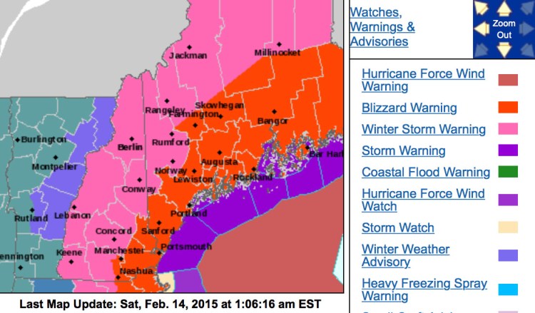
The list of cancellations is likely to grow pretty long by Sunday. Forecasters say another in a train of major snowstorms will roll up the Maine coast Saturday night and Sunday, leaving as much as 2 feet of snow in its wake to be whipped around by strong winds.
Meteorologist Mike Cempa of the National Weather Service office in Gray – which has issued a blizzard warning for the entire coast of Maine from noon Saturday until 7 a.m. Monday – said the snow may start with some ocean-effect flurries Saturday morning. The main event will begin in late afternoon, he said, with the storm picking up in intensity Saturday night into Sunday. By the time the storm departs late Sunday, Cempa said, coastal Maine will have a foot to 20 inches of snow, Down East Maine about 2 feet, and the foothills and mountains 8 to 10 inches.
Strong winds, with gusts expected to be up to 50 mph, will pick up around sunrise Sunday, Cempa said. They will start to die down early Monday, he said, but will still be strong enough during the day to cause more blowing and drifting.
And it will be cold, with temperatures unlikely to top 20 degrees during the storm Sunday and a high on Monday of only about 15 in southern Maine.
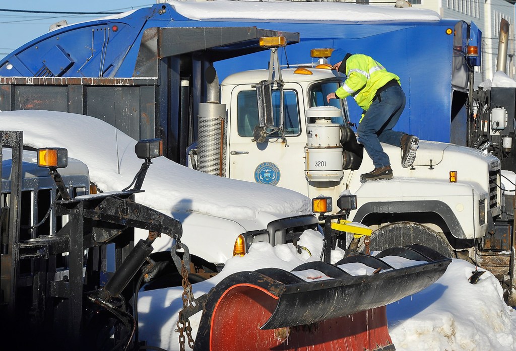
Most towns and cities have already issued parking bans for Saturday night into Sunday morning, and Portland said its parking ban will run from 10 p.m. Saturday until 6 a.m. Monday because of the amount of snow still clogging city streets ahead of the next storm.
Other towns called for extended parking bans as well – Old Orchard Beach’s runs from noon Saturday until 6 a.m. Tuesday.
Gov. Paul LePage put out a statement Friday afternoon reminding Mainers that his declaration of a state of emergency, initially issued Jan. 27, remains in effect. The order allows fuel oil truck drivers to work extra hours and provides expedited entry for any Canadian utility crews that come to Maine to help restore power.
LePage also said that the 50 Maine National Guard members who went to Massachusetts to help clear snow in the Bay State won’t deplete resources in Maine.
“We have a robust force still here in the state,” LePage said, adding that the National Guard has only rarely been called in to help with snow removal in the state.
The Downeaster train service canceled its last runs of the day on Saturday and all but two runs in each direction on Sunday. Public officials are asking residents to avoid driving Sunday, although the state has never issued an outright ban on nonemergency driving.
This year’s heavy snow is raising concerns that it may lead to problems even after the weather finally begins to warm up.
Geologists said this week that the snowpack is unusually deep across most of Maine and warned that all that snow has to melt sometime, possibly leading to spring floods, particularly if the stormy pattern continues and there are heavy rains in March and April.
“There’s been a big buildup in the snowpack with very little melting,” said Bob Johnston, senior geologist with the Maine Geological Survey.
The survey’s first snowpack report in early January found very little snow in much of Maine, Johnston said, but the early February survey revealed up to 5 inches of water in the snowpack in most of the state. Five sites had more than 30 inches of snowpack.
Johnston said he’s most concerned about the Kennebec and Penobscot rivers, especially if there are heavy spring rains. That will accelerate the melting of the snowpack, he said, and release a lot of water into Maine rivers in a short period of time.
The Maine Geological Survey will check conditions again in early March, he said, and then meet with officials from the National Weather Service, the Maine Emergency Management Agency and the Coast Guard to forecast the potential for river flooding.
Send questions/comments to the editors.


Success. Please wait for the page to reload. If the page does not reload within 5 seconds, please refresh the page.
Enter your email and password to access comments.
Hi, to comment on stories you must . This profile is in addition to your subscription and website login.
Already have a commenting profile? .
Invalid username/password.
Please check your email to confirm and complete your registration.
Only subscribers are eligible to post comments. Please subscribe or login first for digital access. Here’s why.
Use the form below to reset your password. When you've submitted your account email, we will send an email with a reset code.