
Humidity levels are increasing and setting the stage for showers and thunderstorms for the rest of this evening and into the early morning hours of Wednesday.
The Storm Prediction Center has put southern Maine under a slim risk of severe weather. This means some storms could reach severe levels if they occur, but there are still a lot of questions about whether storms will even form in the first place.
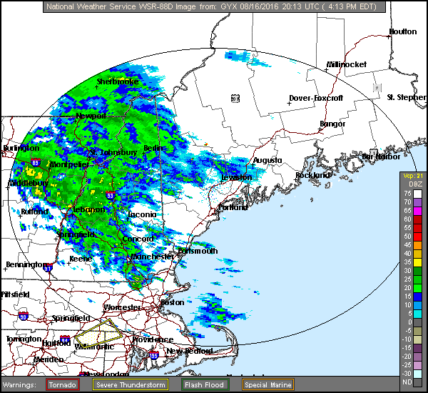
Late afternoon radar loop
The lack of much sunshine today has inhibited temperatures from increasing dramatically, a key ingredient before any thunderstorms. Warm air serves to heat the atmosphere to a level to produce big cumulonimbus clouds and we haven’t seen the sun to fuel the storms. However, even without the sunshine, there’s a lot of moisture in the air and the possibility of heavy rain does exist.
There is a warm front to our south which is trying to progress northward. It likely won’t pass through the region before a cold front cuts it off later this evening.
There are already storms developing back through New York and points south. Some of these storms are showing signs of rotation and could bring a small tornado to those areas. The atmosphere is primed for that type of activity and it is moving east so some forecasters are mentioning strong storms, but this activity should remain to our south.
The models don’t always handle short-term severe weather well but they do give Maine some heavier downpours and possible strong storms after sunset up through the mid to late evening. The loop below shows how most of the activity (greens, yellows and reds) is expected to pass over the region. The red areas are possible thunderstorms.
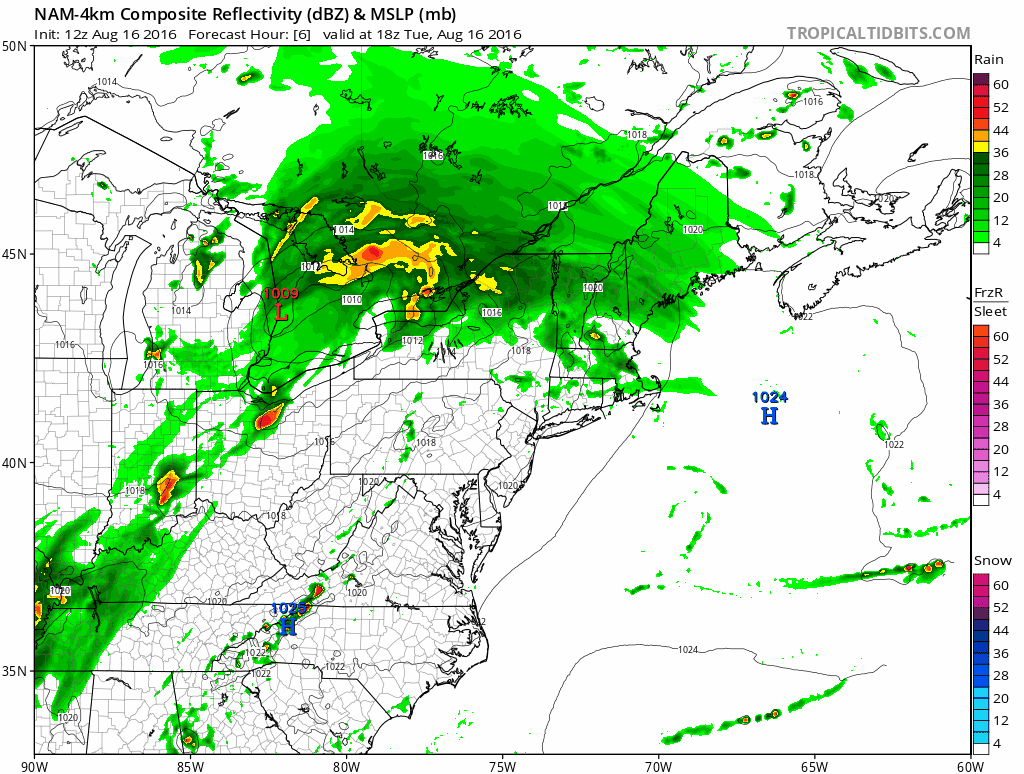
I expect many areas to receive between half an inch to 2 inches of rain. Some places could see enough rain in a short period of time to briefly create some street flooding this evening.
Tomorrow skies will be partly sunny and it will be less humid, especially in the afternoon. The rest of the week and even the weekend looks wonderful for outdoor activity and heading to the beach or lake. Temperatures inland will easily reach the 80s through Sunday with cooler sea breezes at times along the coast.
Comments are no longer available on this story