
Long range forecasts, beyond the 4th or 5th day are much less reliable than the short-term ones predicting the weather 24 or 48 hours in advance. I am leading with that statement as I explore how Matthew may impact our weather this weekend and into Columbus day.
Before any influence from Matthew arrives in northern New England, we will see high pressure building into the area from Canada. This will clear the skies and bring several days of sunny pleasant October weather. The lack of rain is of course concerning, but while certainly horrible for agriculture and some homes who use well water, it’s not as if Maine is suddenly going to turn into the Mohave desert. The drought will end and the water table will return to normal. Even during the big drought of the mid-1960s, eventually the rains return.
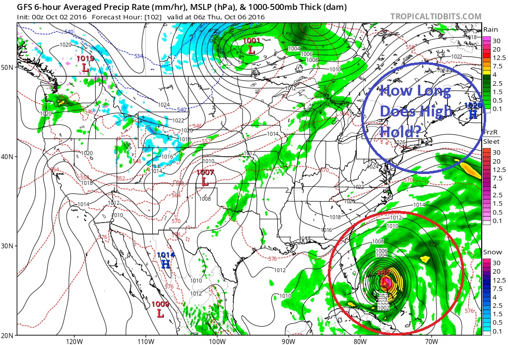
The same high pressure system which will bring some fabulous October weather this week plays into our weekend forecast.
The projected path of hurricanes can be difficult to forecast because the currents in the atmosphere, if weak, allow these storms to behave more erratically. Additionally, other weather systems moving through the atmosphere interplay with each other and then create new steering currents which impact the tropical system.
The “no name storm” or “perfect storm” back in October 1991 was a good example of how a hurricane, Grace, a cold front and an upper level system can all interact with each other and have major impacts to Maine.
It’s too early to know how Matthew, high pressure to the north of Maine and a trough in the upper levels of the atmosphere will interact. The models themselves provide very little in the way of concrete guidance with the American Model or GFS bringning the storm north into New England this weekend. This would mean a wet and windy period for Columbus Day weekend.

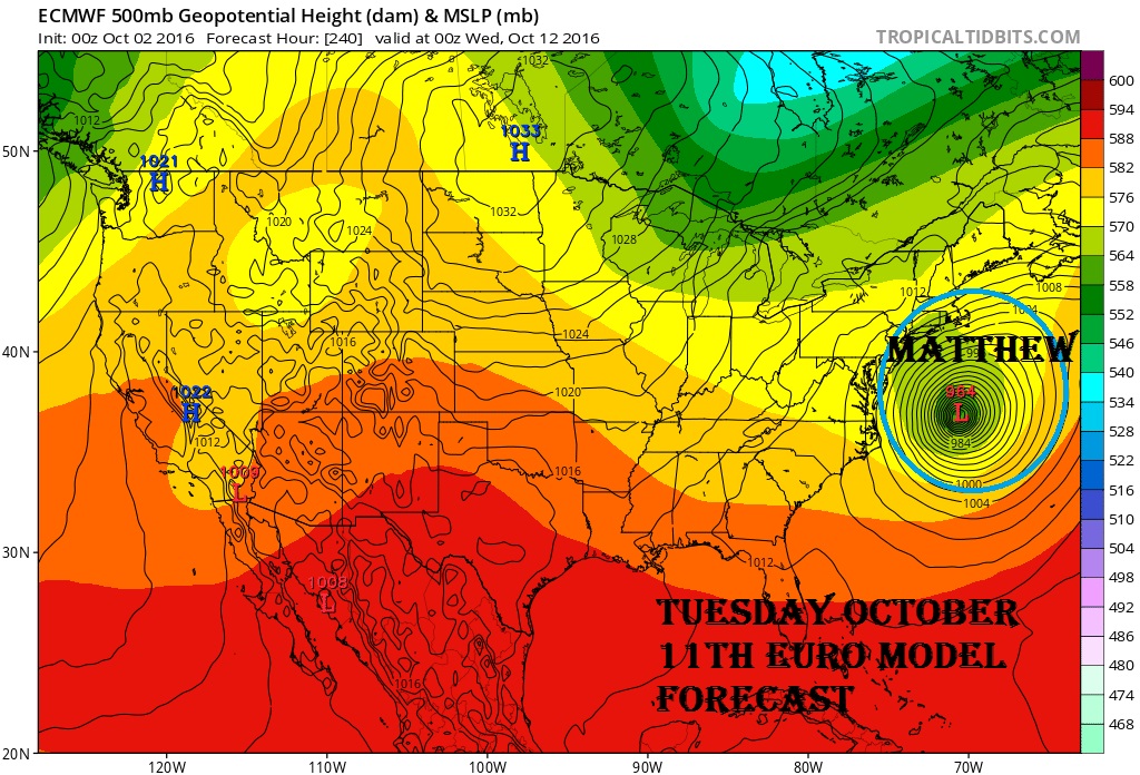
The European model is much different and keeps the storm further south much longer. When it does eventually move north the steering currents keeps it out to see with nothing more than rough seas along the Maine coast.
Over the next two days, after the storm has passed Jamaica, Haiti and Cuba information gathered about Matthew and the surrounding atmosphere will coalesce giving us a better idea of what the future of Matthew will bring.
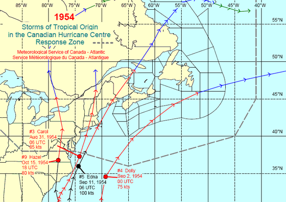
Of note, the last time a hurricane reached the shores, north of Florida in October was during the active hurricane season of 1954. In mid-October of that year Hazel brought damaging wind and flooding rains to areas from the Carolina’s all the way to Canada.
Comments are no longer available on this story