
Here we go again. Another couple of very cool days, along with clouds and some rain. Interestingly, June 2015 also started on a very cool note, with the first couple of days barely reaching 50 at the Portland International Jetport. That was also a wet month, with around half a foot of rain. For those who like sun and warm weather, June can often disappoint.
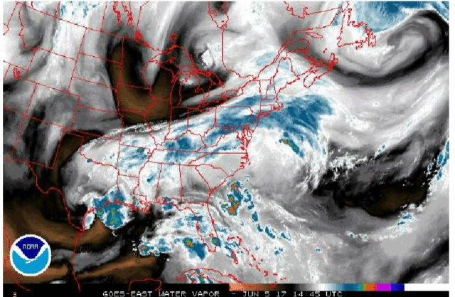
You can thank or curse the jet stream for this wet and cool pattern. This flow of air at about 30,000 feet continues to take a big dip over New England and when this happens the weather turns foul.
Storms rotate counter-clockwise and often bring clouds and showers. Watch the loop below a couple of times. Notice that swirl in the atmosphere heading for the Great Lakes? That is a piece of upper-level energy that will help to keep that dip in the jet stream in place over the Northeast. These energy packets also ignite additional rainfall areas as they move through the upper-level flow.
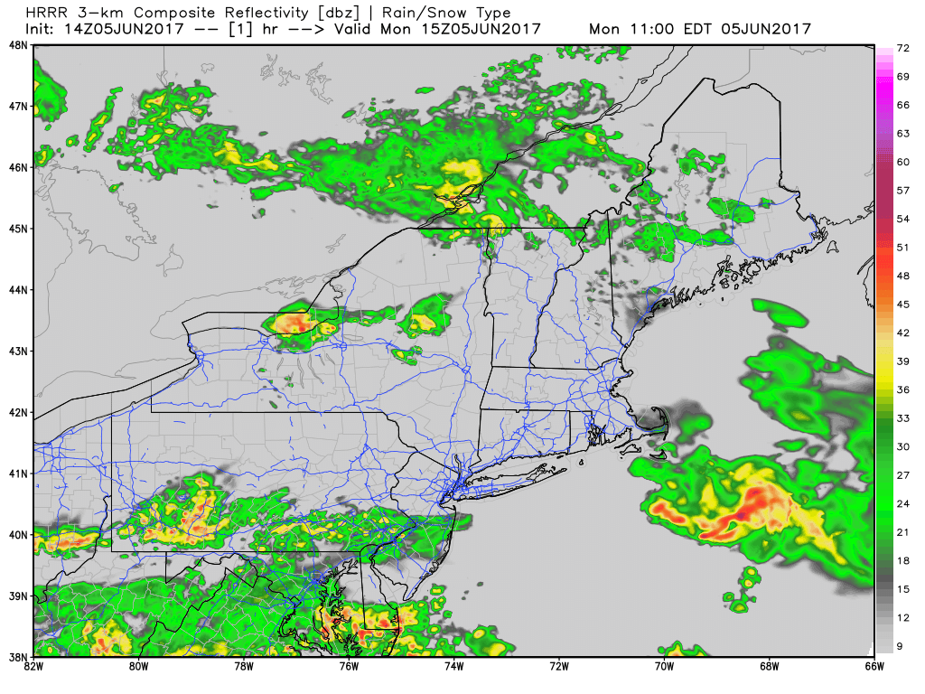
On Monday morning, one area of showers brought about a tenth to a quarter-inch of rain to the area. More rain will fall overnight and early Tuesday. The predicted radar loop below has some areas of red and orange, indicating possible thunderstorms embedded within the heavier showers. This means at least another half-inch of rain, perhaps even more in some of the embedded heavier elements.
As this next system becomes stronger, it will allow winds to increase off the ocean. It won’t be windy enough for tree damage or coastal issues, but the wind will keep the marine air in place. This means highs tomorrow will stay under 60 degrees, very cool for the 6th of June.
When does it end?
Focus on the radar loop one more time. See how in the beginning (date is on top) the rain is rotating over southern New England? Notice how by the end of the loop the rain is moving south. This is the beginning of the end of this pattern. As high pressure comes in from Canada, it will push the clouds and showers south and east. The clearing will be slow at first, improving during Wednesday from north to south and along the coast. By Thursday and into the weekend, temperatures will recover closer to seasonal averages. I can’t rule out a shower sometime early in the weekend as the air becomes warmer, but after Wednesday morning, the trend is much drier.
Much warmer next week
Less rain will make many of you happy, and I know a bit of warmth would also be appreciated. All the models agree next week is going to be significantly warmer. Some models have 80s arriving here, but even the coolest of the models has upper 70s and lower 80s. This will occur with mainly sunny skies. Temperatures for Flag Day, June 14, may be significantly above average.

Temperatures next week look much higher than average.
Comments are no longer available on this story