
Every 6 to 12 hours we get new information about upcoming weather, including storms. Wednesday afternoon, the models continued the trend of keeping the nor’easter that threatens us Friday from having a major impact. The odds of a significant June nor’easter have diminished in the past 24 hours, and while we are not out of the woods totally, you can rest a bit easier. If this storm did hit, it would mean another 1 to 3 inches of rain, and that would be quite the spoiler to start the weekend.
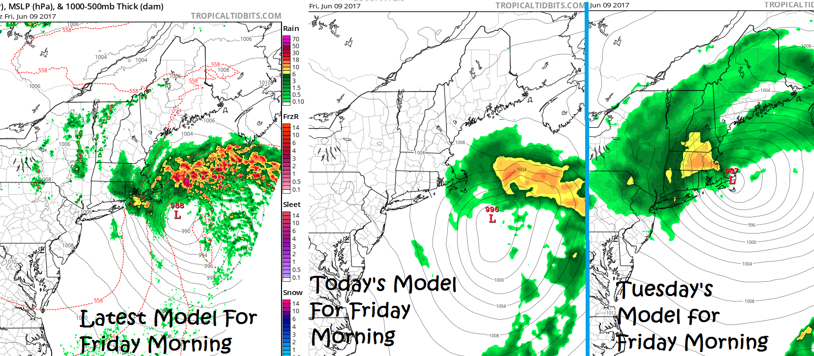
Check out the change to one of the models since Tuesday. Notice how much farther east the storm is on the image to the left – the most recent model forecast. The one on the right from Tuesday was closer to the coast. Other models started this trend Tuesday. If things change I will let you know, but for now plan on a rather cloudy Friday with a couple of showers possible Then get ready for the heat this weekend.
One of the reasons I have always loved the weather is its ability to surprise me. When the calendar says winter it can be warm, and when June arrives it can be cold. I suppose that’s why athletic competitions are so much fun to watch. You can put together two teams or several individuals in the same type of competition, but the results can often be a shocker. I am not planning on being surprised Friday with this storm, but will be keeping a close eye on the model trends.
No matter what happens Friday, it will warm up significantly next week. It might seem odd to have more confidence in the warm weather a week from now than in the forecast for a few days from now, but that’s the case. There is very strong agreement on the jet stream flipping next week and bringing the warm air to New England, which gives high confidence to that part of the forecast. It’s still too early to say just how warm it will get Monday and Tuesday next week, but inland areas are looking at near 90 degrees and even some coastal towns will reach that mark.
Beyond the heat, we will need to keep an eye on any back door cold fronts coming in from eastern Canada. A frontal passage in the middle of the week would quickly break the heat. Notice the model trend below. This is a model, so don’t get hung up on the exact numbers, rather focus on the trend. I find this model often too cool anyway. But the point is to see the three warm days Sunday, Monday and Tuesday and then the cooler air Wednesday and Thursday.

Comments are no longer available on this story