
As we all enjoy more fantastic weather here in New England, it’s probably difficult to see the devastating weather happening in Texas as even remotely related. The gaseous envelope surrounding the planet doesn’t know borders or care about them, and the fact that Harvey is more than 1,800 miles from Portland doesn’t mean the weather locally isn’t atmospherically connected. Society may be dealing with globalization of human endeavors, but meteorological and climatological globalization are simply truths.
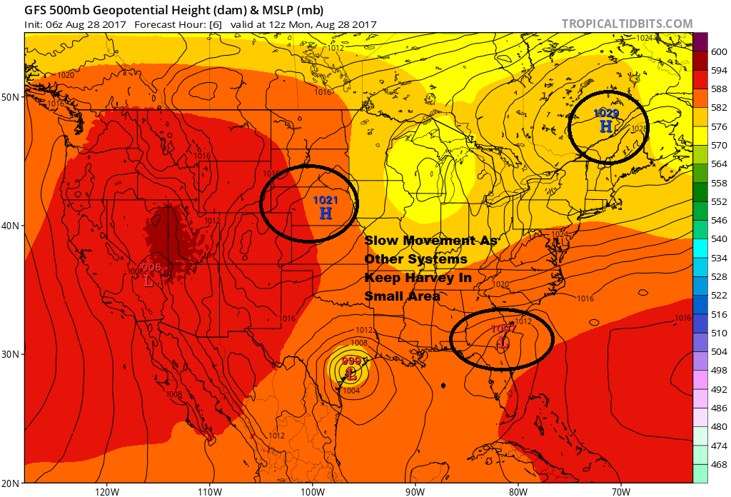
Several weather systems, including the one giving us all the great weather here, are interacting to prevent the tropical system in Texas from making much progress north.
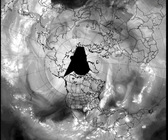
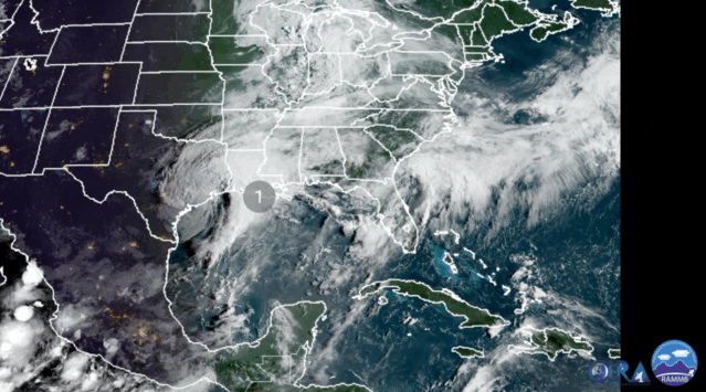
As Monday dawned across the U.S., the satellite image of Harvey, the longest a Texas hurricane that made landfall has ever remained a named tropical system, continued to dump copious rainfall across a region utterly overwhelmed by trillions of gallons of water since the storm began.
The massive flooding in Texas is something the entire country – and even the world – is aware of. The UK’s Telegraph tweeted this image Monday:

The human impact in these situations is immeasurable and life-altering. The scientific piece of the storm is fascinating and the infrastructure element untested.
EXTREME EVENT REALIZED
Forecasters often use the term “worse case scenario” because we want people to be aware of what might happen. Whether it’s a day with severe weather, an icing event or simply a snowstorm, there’s often the possibility of something extreme happening, but most often it never does. In the case of the system in Texas, the worse case scenario is occurring and subsequently all the impacts of such an event are being realized.
The coming months and even years will provide an opportunity for everyone from FEMA to local planning boards to ask themselves if they are ready for these extreme events and if the costs of making changes for these exceptional meteorological outliers is too great or worth any price.
A lot of what will happen in the coming days is unknown. There’s no real world way to test letting millions of gallons of water flow out of overflowed bayous and reservoirs into neighborhoods.
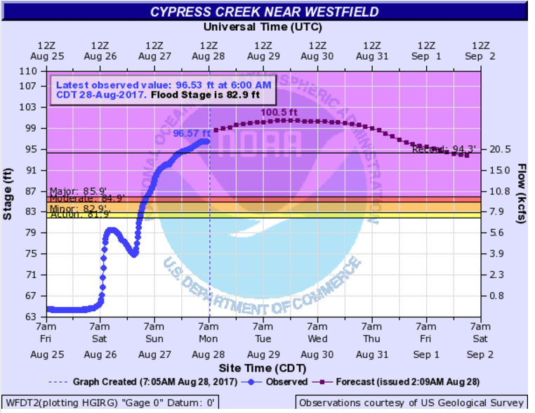
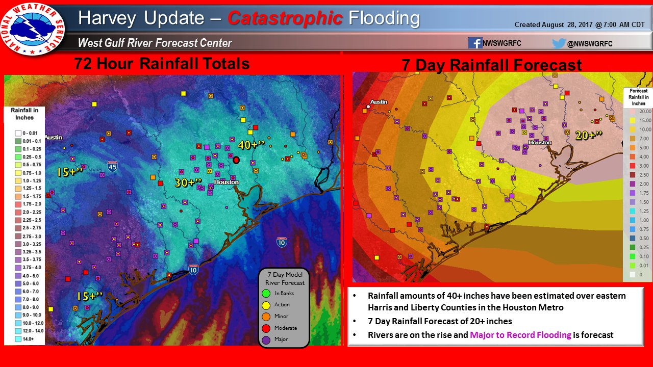
It’s hard to understand how fast the water rises, but the chart below from just one of the many creeks around Houston can give you an idea. Late Saturday evening the water in Cypress Creek hadn’t even reached flood stage, yet by early Monday the creek was into record territory and was forecast to stay in the “major flood” category for the rest of the week.
Imagine this type of situation replaying itself across much of greater Houston and, depending on how the rainfall materializes over the next 48 hours, the situation could get worse and spread into other communities east toward Louisiana.
YEARLY RECORD IN JEOPARDY
Imagine breaking the record for longest baseball game ever by the sixth inning. I took at look at Houston’s wettest year ever recorded to see if the city was close to that record this early in the year. As of today, the city is about 8 inches away from it’s yearly record and with more downpours in the forecast it’s not out of the question that Houston get’s close to this watershed number over the next couple of days.
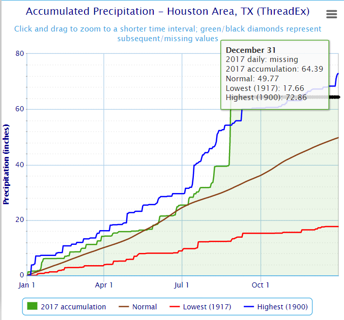
50 INCHES OF RAIN?
We love superlatives and there’s never been a tropical storm in the United States – at least from accurate records – when 50 inches of rainfall has occurred.
In order to reach 50 inches, one of the towns that has received 30 to 40 inches of rain would need to see another 10 to 20 inches fall. It’s possible. At this point, hitting a round number like 50 inches versus 47 won’t really matter and just makes for a noteworthy headline, but it’s amazing to even consider.
The models generally agree the heaviest of the rainfall will stay east of Houston, but there may still be significant downpours coming. The situation will not get better until the rain stops and rivers have finally crested, which won’t happen in some areas until the weekend.
ACTIVE 10 DAYS AHEAD
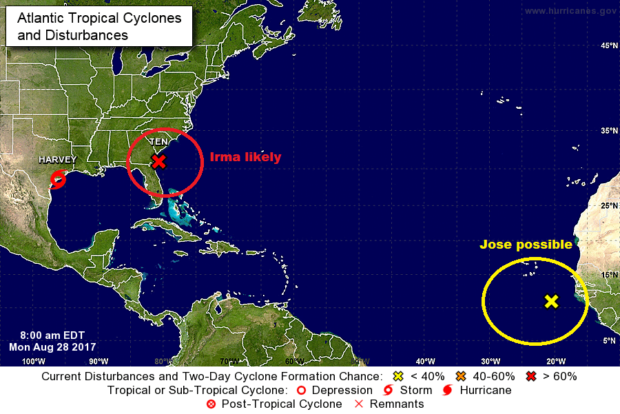
In addition to Harvey, there are two weather systems forecasters will be watching.
The first, likely to become Irma off the southeast coast, should have little impact on New England beyond some clouds and rough seas. (Stay tuned to forecasts, however, as things could change).
The second, which could become Jose, will travel across the Atlantic and whether it ever reaches the U.S. is still a bit of a “what if” scenario. This is the the most active time of the year for tropical weather, so if something is ever going to get to New England, the next few weeks brings our highest risk.
Follow Dave Epstein on Twitter @growingwisdom
Comments are no longer available on this story