
Christmas 2017 is more than likely going to have snow on the ground in nearly all of Maine, but along the southern coast it’s a bit of a race against a few mild days beforehand. We are in the middle of a very active pattern with a lot of rapid changes. There will be days ahead that are in the 40s while others will stay below freezing. This rollercoaster ride will make it seem like Mother Nature just can’t decide exactly how to end 2017.
Monday’s snow is now over
A light to moderate snowfall Monday brought more slick travel to the region and a few more inches of very fluffy snow. The reason for the snow was warm air trying to move north running into the cold air over Maine. As the battle ensued, snow fell for much of the day and into the evening, resulting in over 3 inches in some places.
This snow fell on top of the existing snow pack which is slowly growing. Skiing and other snow sports have gotten off to a great start this year, with a nice base of snow in the mountains.
Mild Tuesday
Tuesday’s temperatures will reach just into the 40s ahead of a colder air to the west. This is certainly warm enough for some melting and a good chance to clear walkways and driveways.
The atmosphere turns colder on Wednesday and Thursday with high Wednesday only a few degrees above freezing and staying well under freezing in the mid 20s the following day. Both days are great for skiing without any extreme cold. As we reach the weekend, more changes are ahead.
Weekend mess
The scenario heading into this weekend is that a cold front will be slicing through the center of the country. Ahead of this front, unseasonably mild air will be thrust northward along the eastern seaboard. While it’s difficult to erode cold air in December, it can be done with enough of a southerly flow. The warm air will be accompanied by eventual rainfall as well. Clouds move in Friday, and it’s raw and damp and snow or a mix begins sometime late in the day or at night. As warmer air flows north, any snow will change to all rain. Saturday is wet, but mild. The timing of the change to rain will determine how bad travel might become Friday and early Saturday. By Saturday afternoon, temperatures will reach well into the 40s and there’s a chance some areas reach 50 degrees. The mountains should remain in the 30s – so although there will be some rain, the loss of snow should be minimal.

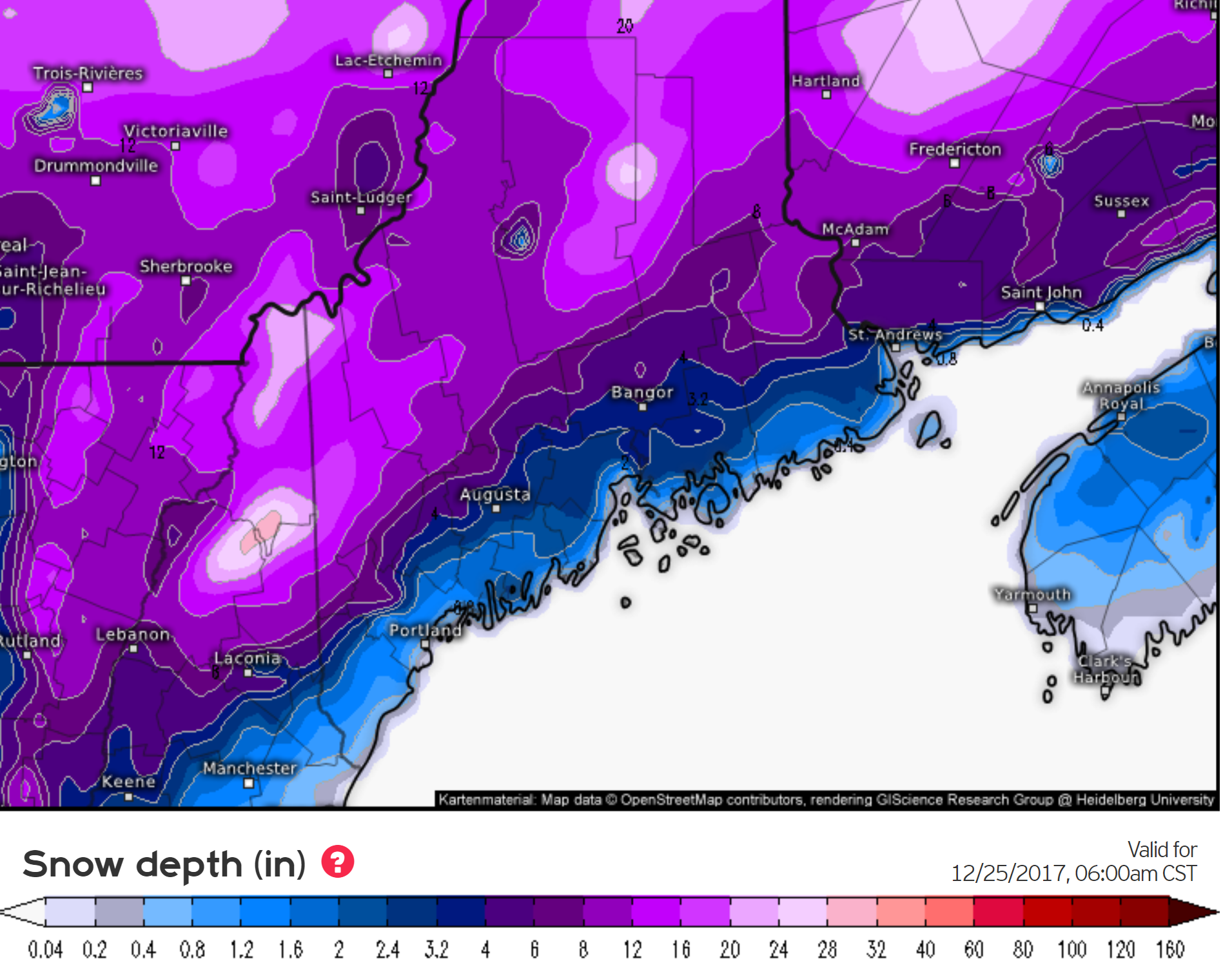
Christmas storm possible
Another weather system moves into Maine for Christmas. Since this storm is a week away any forecast is subject to change, but there is a chance of more messy weather. This system could even bring ice to the area, one of the worst kinds of storms we see. More on this later in the week. The bottom line, weather will likely continue to make headlines as we close out 2017 and start 2018.
Comments are no longer available on this story