
It’s the middle of winter, nearing the supposed peak of the season for winter sports. But it’s been nearly two weeks since our last widespread snowfall, which dropped 6 inches in Portland and Bangor on Jan 17.
The brief thaw put a large dent in the snow pack. Yes, there is still a some snow on the ground inland and in the mountains, but a fresh snowfall would go a long way. The only part of the state still doing well is northern Maine. Most areas have very limited snow and some spots even have bare ground.
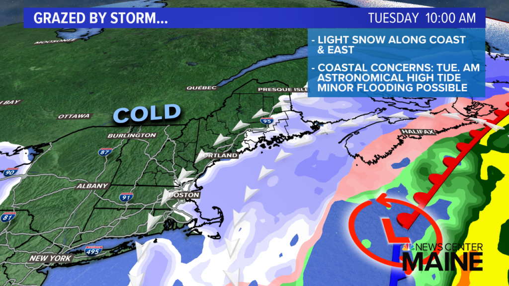
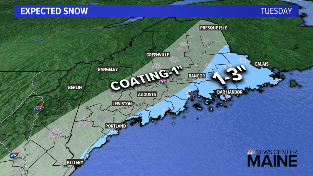
Later Monday and into Tuesday, the western flank of a very large ocean storm will graze the New England coast. The storm will be very far out there so we miss out on the mesoscale banding. Periods of light snow will be draped over the coastline and roads might be slick in the morning.
Accumulations will be minor, generally an inch or less. However, Downeast locals will see a bit more; perhaps a few inches in parts of Hancock and Washington counties.
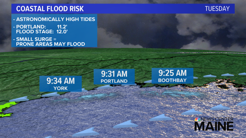
A second concern is coastal flooding. Tides are astronomically high this week. In Portland, Tuesday’s 9:31 a.m. high tide will be 11.2′. Flood stage is 12.0′. It won’t take much of a surge on top of the already high tide to cause flooding of vulnerable, low-lying areas near the coastline.
The high tides Wednesday and Thursday are a bit higher, so those need to be watched as well.
If you crave more snow than just an inch or so, the evolving pattern will excite you. An East Coast trough will become reestablished for the next couple of weeks. This will keep temps at or below normal, and energy rounding the trough will attempt to spawn storms too. More snow is in our future, it’s just a question of how much.
Comments are no longer available on this story