
The weekend’s storm is moving out. The rain and snow has ended, but watch your step this morning.
There may be a few icy spots, especially inland. Driveways and sidewalks are most susceptible, but some of the side streets and back roads may be icy too.
Fortunately, there is no “flash freeze” behind this storm. Cold air will gradually move in today.
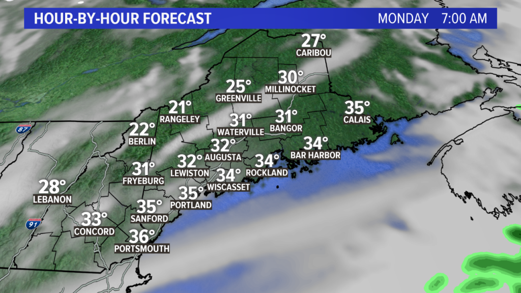
Highs will be in the mid to upper 30s inland; near 40 degrees along the coast.
Colder air will start to move in during the day as a northwesterly wind develops. The wind may be a bit gusty at times.
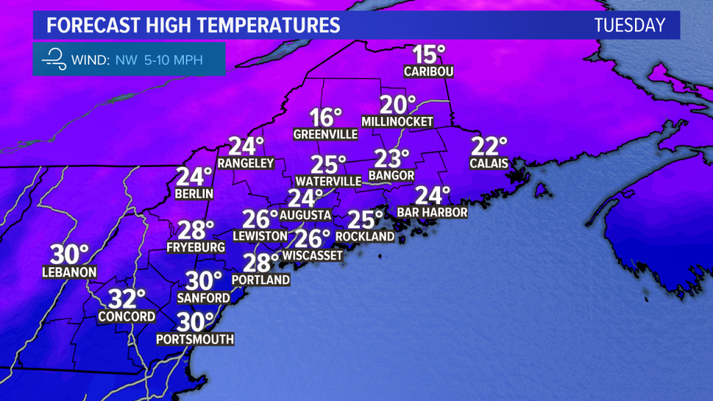
Monday night into Tuesday morning will be very cold again with lows in the single digits inland, teens along the coast. Highs on Tuesday will be in the 20s despite lots of sunshine.
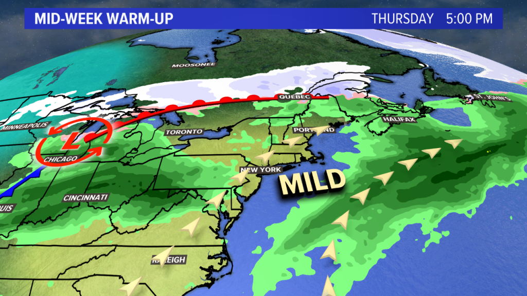
This cold shot is short-lived, however.
A warm front passes through on Wednesday. With it will be a few extra clouds and perhaps a flurry. As a southwesterly flow develops, highs should top 40 degrees in most towns Wednesday.
Thursday will be the mildest day with highs in the 40s to near 50 degrees in parts of southern Maine. We’ll have more clouds around and occasional rain showers.
Colder air tries to snap back at the end of the week. If it arrives soon enough, rain may change over to a mix or snow in the mountains on Friday. Saturday looks cold and blustery, before warmth tries to return late in the weekend.
The bottom line: The temperature ups and downs continue, but no big snowstorms are expected in the next seven to ten days.
Comments are no longer available on this story