
It will continue to feel like early spring over the next few days. Temperatures will flirt with 50 degrees in southern Maine.
All eyes are on the end of the week. A large storm will form off the East Coast.
Right now, the odds of a big snowstorm are low. There’s a lack of cold air ahead of and behind the storm, meaning the precipitation could fall in the form of rain or wet snow.
It’s also possible the bulk of the precipitation misses Maine to the south.
The most concerning threat is erosion and flooding during high astronomical tides.
The NAO (North Atlantic Oscillation) is going negative. This means large, blocking high pressure is forming over Greenland, stalling the weather pattern and slowing the speed of the storm as it forms off the Mid-Atlantic.
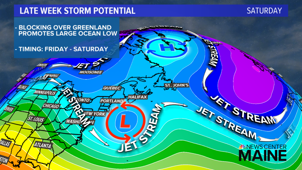
The blocking may be so intense that the track gets suppressed to our south, and northern New England only gets grazed by the storm. Historically, stronger blocking favors a track farther south of New England. This is a storm track that targets the Mid-Atlantic.
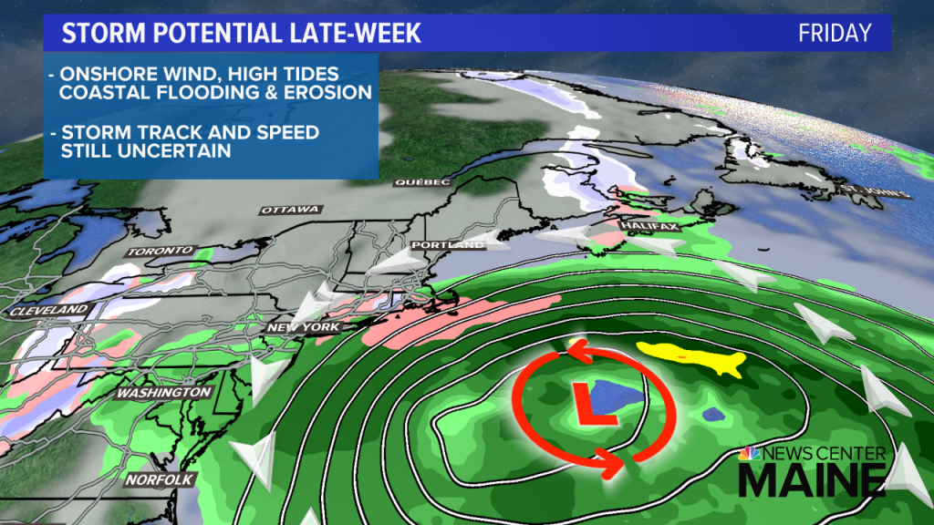
Despite all of this, the storm is forming at a poor time. The highest astronomical tides of the month occur late this week. Friday’s midday high tide is 11.2 feet in Portland. Combined with an onshore wind and large waves from the storm positioned south of New England, coastal flooding and erosion will be a problem, possibly for a few high tide cycles. This may end up being the main impact in our state.
Follow our updates over the next few days as the storm track comes into focus.
Comments are no longer available on this story