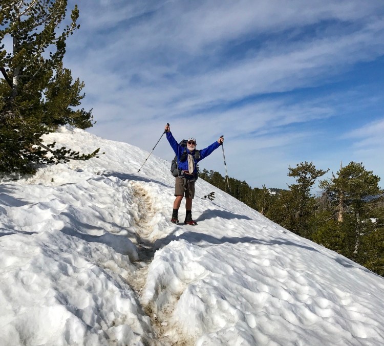
INYOKERN, Calif. — Kennedy Meadows at mile 702 of the Pacific Crest Trail marks the end of the southern California desert and the start of the Sierra Nevada mountain range. Mt. Whitney, the tallest peak in the contiguous United States at 14,505 feet, is just 65 miles distant, and 13,124-foot Forester Pass, the highest point on the entire PCT, is a dozen miles beyond.
At this point, more than a quarter of the journey is complete. A million or so footsteps have led me across diverse landscapes to spectacular vistas and comfortable waysides amid the pleasurable company of great people on and off the trail. Such is the true magic of a long walk and my raison d’etre for being here.
Atop Mt. Baden-Powell, named for the founder of world Boy Scouting, I reveled in the extraordinary panorama of the San Gabriel Mountains from the 9,406-foot peak. I’d camped at the snow line the evening before, then donned micro-spikes at first light for the icy climb that switchbacked over the trail route until it became impossible, necessitating a steep straight-up scramble to achieve the summit.

Kish’s tent got partly buried in the snow as he camped between Tehachapi Pass and Walker Pass. Photo by Carey Kish
On the 86-mile stretch from Tehachapi Pass to Walker Pass, the scenery was awesome but it came at a price, as Mother Nature presented one gnarly weather scenario after another. West winds blowing at 35-50 mph and gusting to 60 and 70 mph made forward progress difficult at times. A day of cold rain eventually morphed into snow, soaking my gear and sagging the tent with six heavy, wet inches. But on the one good day of sun I managed 22 wonderful miles, my best day yet.
I’ve shared the way with a tight-knit trail family who I love dearly. We look out for each other and try to camp together in the evenings. Mostly I walk alone, but on one particularly special segment, a small group of us struck off together in late afternoon and walked into the sunset, following the Los Angeles Aqueduct across the Mojave Desert. We yipped with the coyotes, howled at the waxing moon and sang Hakuna Matata for 17 miles before – exhausted – we cowboy camped trailside well after midnight.
From cold beers and belly laughs around the hot tub at the Acton KOA Campground and camping in the mystical manzanita forest and getting our nails painted crazy colors at Casa de Luna to lodging at what amounts to a western movie set at Hiker Town and ordering $150 of pizza and soda from a picnic area 40 miles from the nearest town because we could, I’ve had the time of my life.
Sadly though, I lost my hiking partner, Iron Lady, to a bum knee at Wrightwood. We rendezvoused a week later at Agua Dulce, but the news was grim. An MRI confirmed a stress fracture, effectively ending my pal’s journey and forcing me to carry on solo.

Members of Kish’s beloved trail family enjoy dinner and drinks at the Mexican restaurant in Agua Dulce. Photo by Carey Kish
Tucked into the piney woods at 6,000 feet in the Sequoia National Forest, Kennedy Meadows is a veritable hub of activity. There’s a general store, two outfitters, a restaurant and campground, Wi-Fi, and a hoard of crusty hikers milling about, some gearing up to enter the snowy Sierra while others consider alternate plans.
Last winter was a real whopper in the Sierra – one of the five snowiest in the last 40 years – depositing enough of the white stuff for an average snowpack 165 percent of normal. This spring has been a lot cooler than usual, which has inhibited melting and brought even more snowstorms. The result is that 600 continuous miles of high elevation snow cover lie ahead, a situation that poses significant difficulties for hundreds of concerned foot travelers, me included.
I’ve decided that rather than just get through the Sierra now, I’d much prefer to enjoy the mountains later, so I am jumping up to Ashland in southern Oregon, just over the California line, at mile 1,700. From there, I’ll hike 1,000 miles south back to Kennedy Meadows.
There are long stretches of snow-free trail in northern California right now, and what snow I will encounter is at a lower elevation and will disappear sooner. Through June and into July, the heavy Sierra snows should also reduce to a more reasonable depth, which will make negotiating the high passes much less of a struggle.
Come early August, if all goes well, I’ll return to Ashland and merrily resume the northbound hike through Oregon and Washington, the Canadian border at Monument 78 ever in my mind’s eye.
Carey Kish of Mount Desert Island thru-hiked the Appalachian Trail in 1977 and 2015, and completed the 1,100-mile Florida Trail in 2017. Follow Carey’s PCT adventures on Facebook @CareyKish.
Send questions/comments to the editors.


Success. Please wait for the page to reload. If the page does not reload within 5 seconds, please refresh the page.
Enter your email and password to access comments.
Hi, to comment on stories you must . This profile is in addition to your subscription and website login.
Already have a commenting profile? .
Invalid username/password.
Please check your email to confirm and complete your registration.
Only subscribers are eligible to post comments. Please subscribe or login first for digital access. Here’s why.
Use the form below to reset your password. When you've submitted your account email, we will send an email with a reset code.