
The first humid weekend is in the books for 2021.
Big changes are on the way behind the cold front, though.
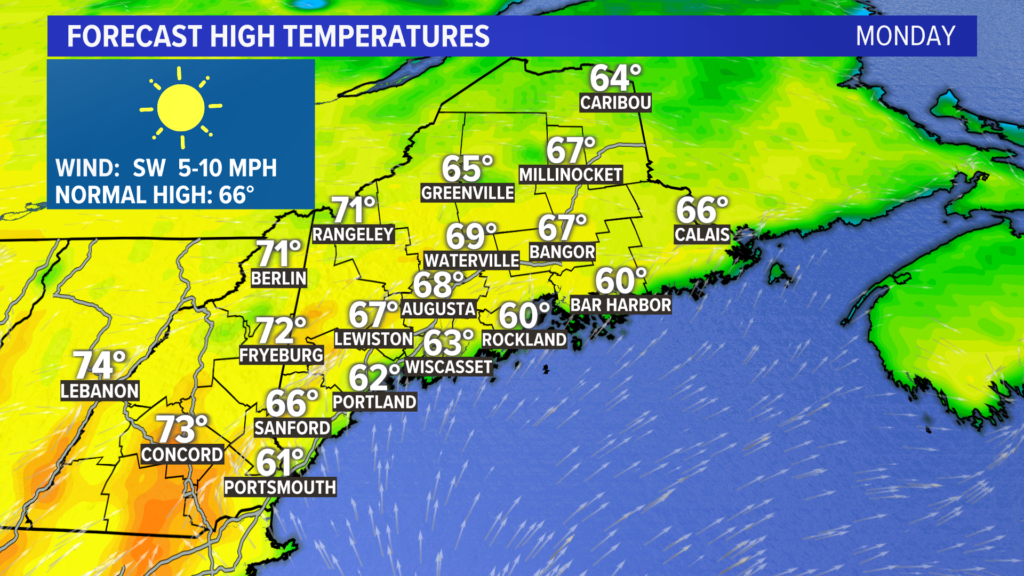
Cool high pressure is in control for Monday afternoon. This is going to be a stark difference compared to the weekend. High temperatures stay in the 60s, and an afternoon sea breeze could keep coastal spots below 65 degrees the entire day.
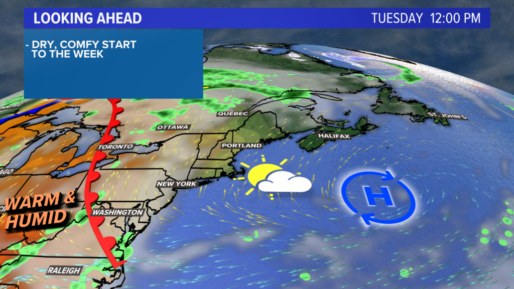
As high pressure shifts east, winds will switch to be out of the southwest.
Warmer air begins to build in, bringing a warmer day. Expect coastal temperatures to top out in the low 70s, while mid to upper 70s are likely inland.
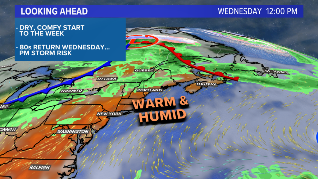
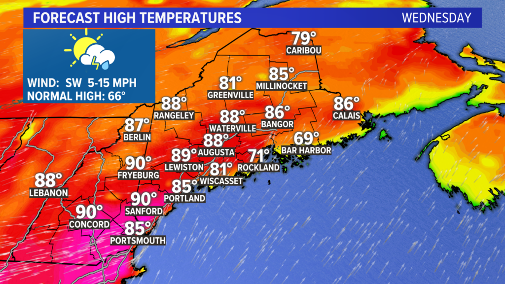
Heat and humidity are back on Wednesday.
Temperatures soar, with the forecast calling for highs in the mid or even upper 80s.
An approaching cold front will pass through in the evening, bringing some showers or thunderstorms with it.
Rain chances do not look overly impressive with this front.
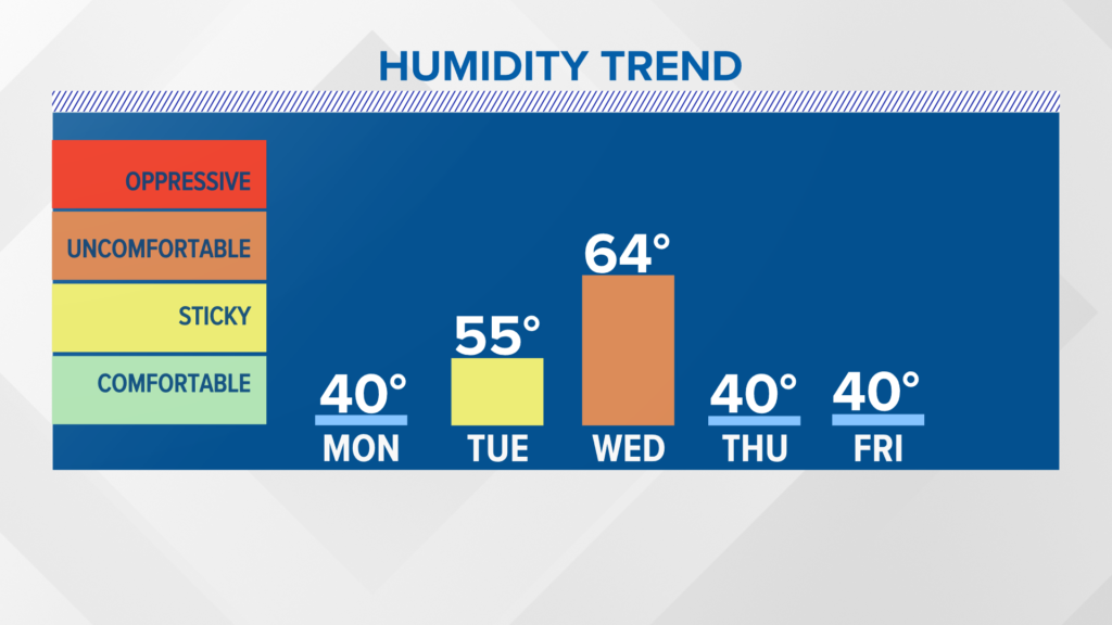
Drier and cooler air returns on Thursday, with temperatures likely sitting in the 70s under sunny skies.
On Friday, highs will be stuck in the 60s instead.
The start of Memorial Day weekend is looking cooler and sunny from this far out. Be sure to check back and see if anything changes.
You can always get more forecast information from me on my Twitter account, @MikeSliferWX.
Comments are no longer available on this story