
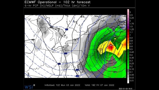
Energy for a developing storm expected here Friday is entering the Pacific Northwest right now and is getting better sampled. This is providing improved data for models to work with, and any new trends become very important.
The latest trend has been a shift east, a bit farther offshore.
Here’s the model run from Monday:
And from last night:
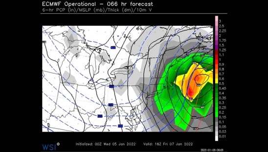
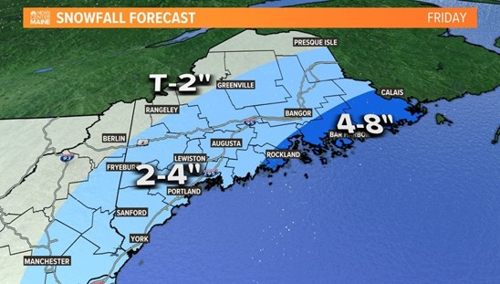
It’s not a huge adjustment east, but that 75 miles or so keeps most of Maine out of the heaviest snow bands. While it’s looking like we’ll miss out on the big amounts, we still get plowable snow on Friday.
The storm is still 48 hours away, and shifts and wobbles can occur. Keep checking back for any adjustments to the snow amounts.

The Times Record Sustaining Sponsor
We believe a community must be informed to thrive. bowdoin.edu
Comments are no longer available on this story