
Here we go again … two days go by and another storm sets its sights on Maine.
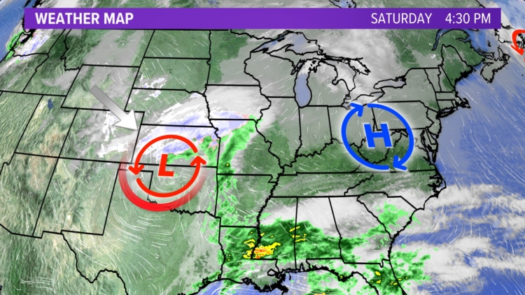
Right now, low pressure is over the four corners and will be transferring its energy to the East Coast soon. High pressure will slide east of Maine tomorrow. Not an ideal setup for a big winter storm. You want the high to be to our north and in a “blocking” pattern.
This storm will not be pure snow like Friday’s, which dumped up to 9 inches on parts of Maine.
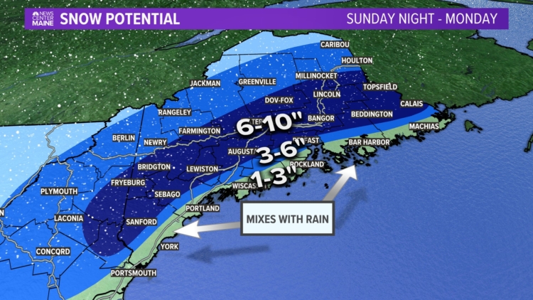
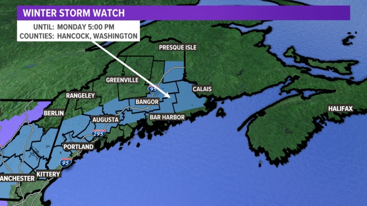
However, winter storm watches are up for the interior through 5 p.m. Monday as an area of low pressure will take shape Sunday and move into the Northeast during the day.
Don’t get me wrong: I’m not complaining. We are below the averages for snowfall so far this season for nearly the entire state, except Caribou.
Total storm accumulations will range from a messy 1 to 3 inches along the coast, including some ice to much heavier amounts inland. Without some warm air mixing in, I do not expect totals to be all that impressive for most locations up the I-95 corridor.
The storm ends Monday before the rush hour commute is over, but the morning commute will be a hassle.
Another storm will get ready to move into Maine by mid- to late-week with a mix of rain and snow likely at this time.
Comments are no longer available on this story