
Did you put away your winter coat yet? Or think about taking the snow tires off your vehicle? With the record breaking temps we’ve been having recently, no one could blame you for thinking winter was only hanging on by a thread and would soon break. But that’s all about to change in the next 24 hours.
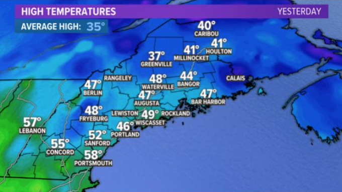
Southern Maine made a run for 60 degrees Wednesday but fell a couple of degrees short in the afternoon. Today we got to 60 in the southwest interior of Maine, and Portland has already broken the record set back in 1981 of 51 degrees. The same can be said for Bangor, which broke the record of 52 set back in 2006 with a forecast high in the mid-50s today.
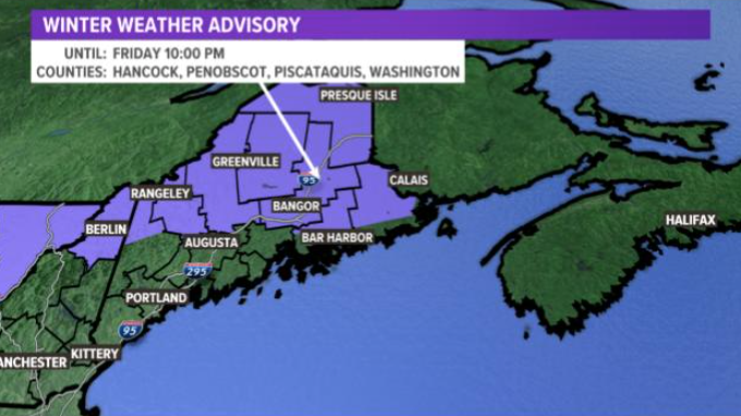
However, winter weather advisories are up away from the coast for the next storm churning in the Ohio Valley.
An area of low pressure will intensify as it moves into New England tonight.
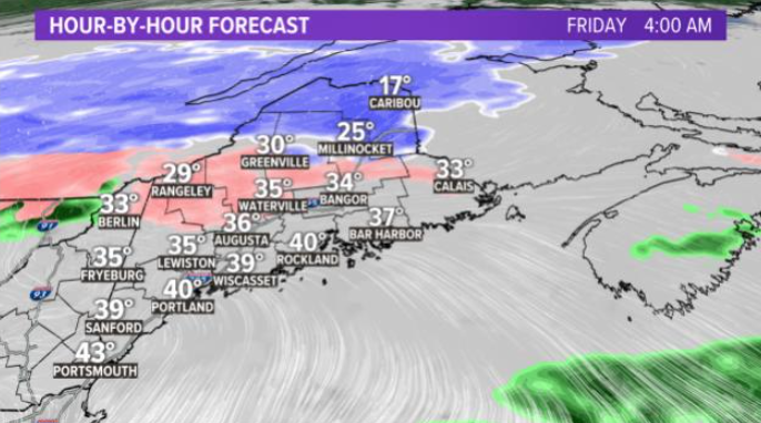
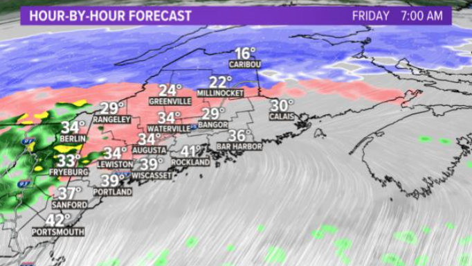
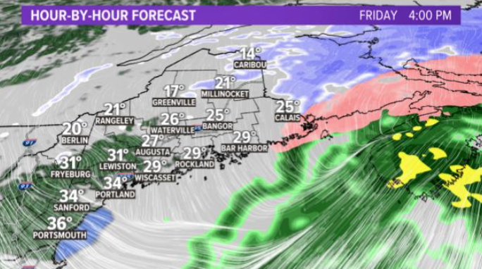
We will go from sun and clouds with record highs to 20s and 30s with a wintry mix of precipitation in 24 hours.
Here’s the hour by hour forecast to plan your day:
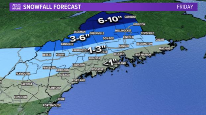
When it’s all over tomorrow night less than 1 inch of snow will accumulate along the coastline. However, 1 to 3 inches is expected on a line from Fryburg to Waterville and Bangor up to Calais. You can expect 3 to 6 inches from Rangeley, Rumford, Greenville, Dov-Fox, up to Houlton. I expect 6 to 12 inches for northern Maine with a mostly all snow solution.
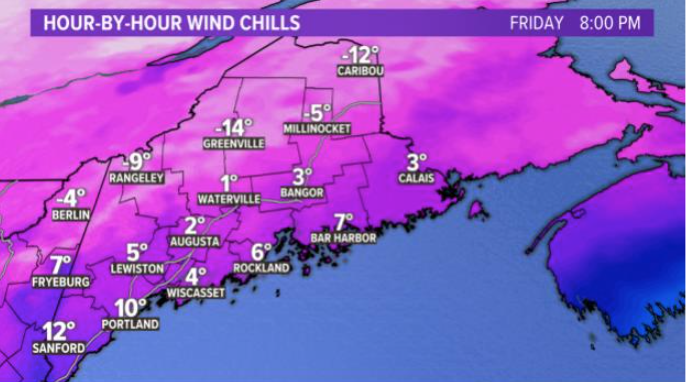
The wind will go from the spring-like westerlies we are having today to out of the cold North. That means wind chills tomorrow evening if you go out for dinner will be in the single digits to subzero for parts north.
Comments are not available on this story. Read more about why we allow commenting on some stories and not on others.
We believe it's important to offer commenting on certain stories as a benefit to our readers. At its best, our comments sections can be a productive platform for readers to engage with our journalism, offer thoughts on coverage and issues, and drive conversation in a respectful, solutions-based way. It's a form of open discourse that can be useful to our community, public officials, journalists and others.
We do not enable comments on everything — exceptions include most crime stories, and coverage involving personal tragedy or sensitive issues that invite personal attacks instead of thoughtful discussion.
You can read more here about our commenting policy and terms of use. More information is also found on our FAQs.
Show less