

The headwaters of the Carrabassett River originate on the slopes of Sugarloaf Mountain, the Crocker Mountains and the Bigelow Mountain Range that form Carrabassett Valley. Beginning as a mountain stream, the winding river flows south through Franklin and Somerset counties before joining the Kennebec River in North Anson.
There are three sections of the Carrabassett River that are popular paddling destinations and are appropriately called Upper, Middle and Lower. The Upper consists of 2 miles of very steep, continuous whitewater in a boulder garden that begins near the entrance to Sugarloaf Mountain Ski Resort and tumbles precipitously to a bridge next to the Carrabassett Valley Town Office. Possessing the character of a classic mountain stream with a moderately steep gradient and lacking any substantial pitches, the Middle begins at the town office and ends a little north of Kingfield. The Lower starts in Kingfield and flows circuitously to Wire Bridge in New Portland.
Subject to the whims of snowmelt and rain, finding an adequate water level to paddle the Middle is a challenge. As a result, it has been a few years since my outdoor club, the Penobscot Paddle & Chowder Society (PPCS), has been able to organize a spring trip there.
This spring, I began studying the U.S. Geological Survey online Carrabassett River gauge and watching the weather in the valley in hopes of coordinating a Middle Carrabassett whitewater trip. As usual, we needed rain and enhanced snowmelt. A mid-April rainstorm coupled with warm weather delivered what we needed, and I announced a PPCS trip for the next day. One has to be ready to go to paddle the Middle.
Four PPCS kayakers met in Kingfield on an unusually warm, sunny spring morning to take on the Carrabassett River challenge. The water level was ideal.
We dropped a shuttle vehicle off next to the river on Route 27 about 2 miles north of Kingfield and drove another 5 miles upriver to a location called Packard Pool where there is a complicated rapid we wanted to scout in advance of beginning our trip. After planning a preferred route, we continued a short distance upriver and launched at a camp owned by friends.
The moderately steep gradient of the icy mountain stream resulted in an unusually high rate of boat speed from the outset. Typical of the entire day, we swiftly navigated through narrow channels between rocks to Packard Pool Rapid. We entered the complex descent far right and then moved hard left to a must-catch eddy. The advance scouting failed to reveal how pushy the rapid was and everyone had difficulty reaching the eddy. From there, we ferried far left and powered through an attenuated passage that breached two wide holes.
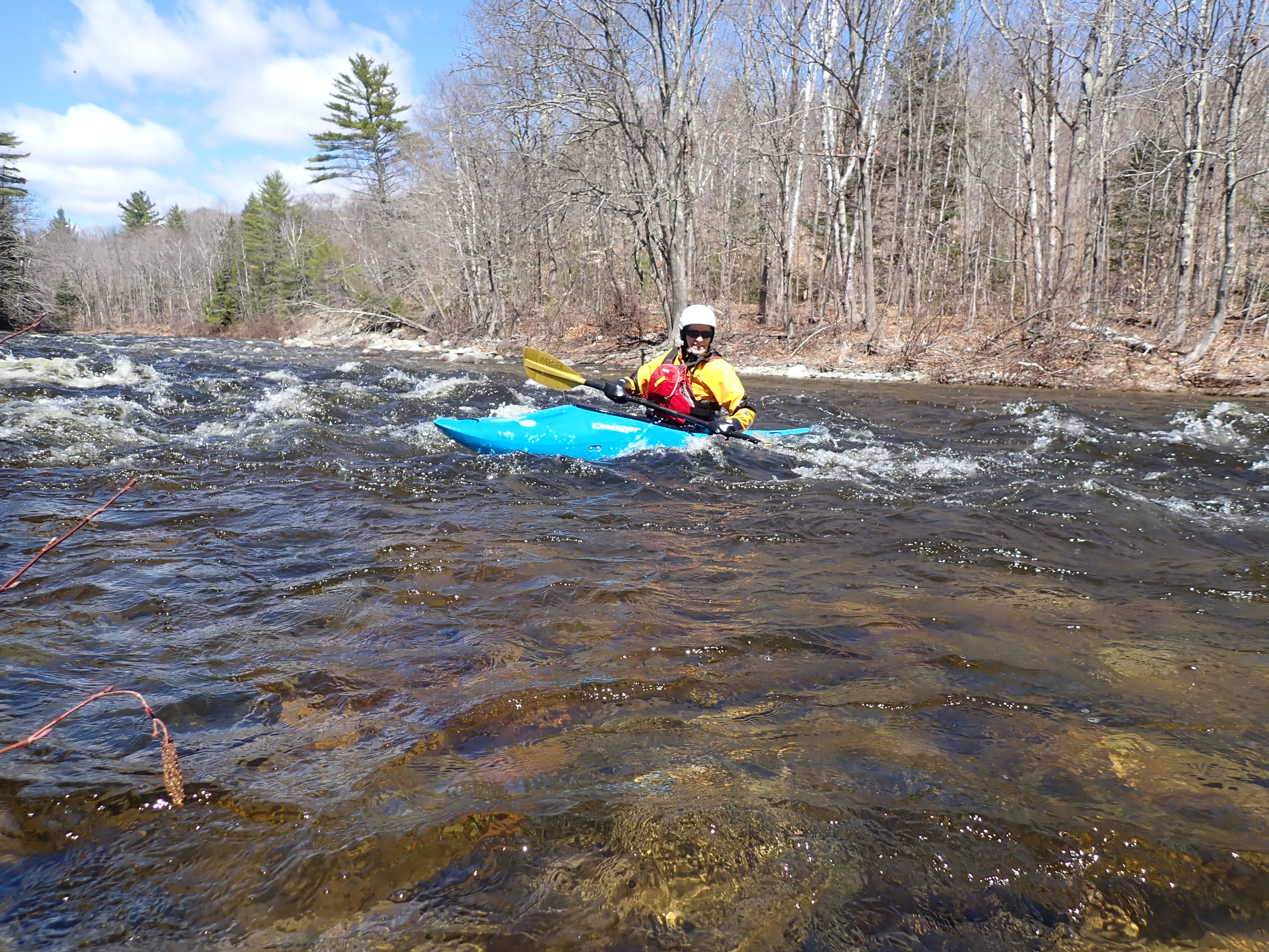
Continuing downriver, we paddled through several Class II/III rapids. The middle of the outing is predominantly quick water and easy whitewater. Shortly after, we entered a long, feisty rapid with substantial waves tumbling over hidden rocks. From that point on, we enjoyed almost continuous Class III whitewater to the takeout. We navigated down rolling wave trains, caught eddies, ferried away from hazards and surfed waves or tried. For a moment in time, our sole focus was reading the river and maneuvering around dangerous boulders and threatening holes.
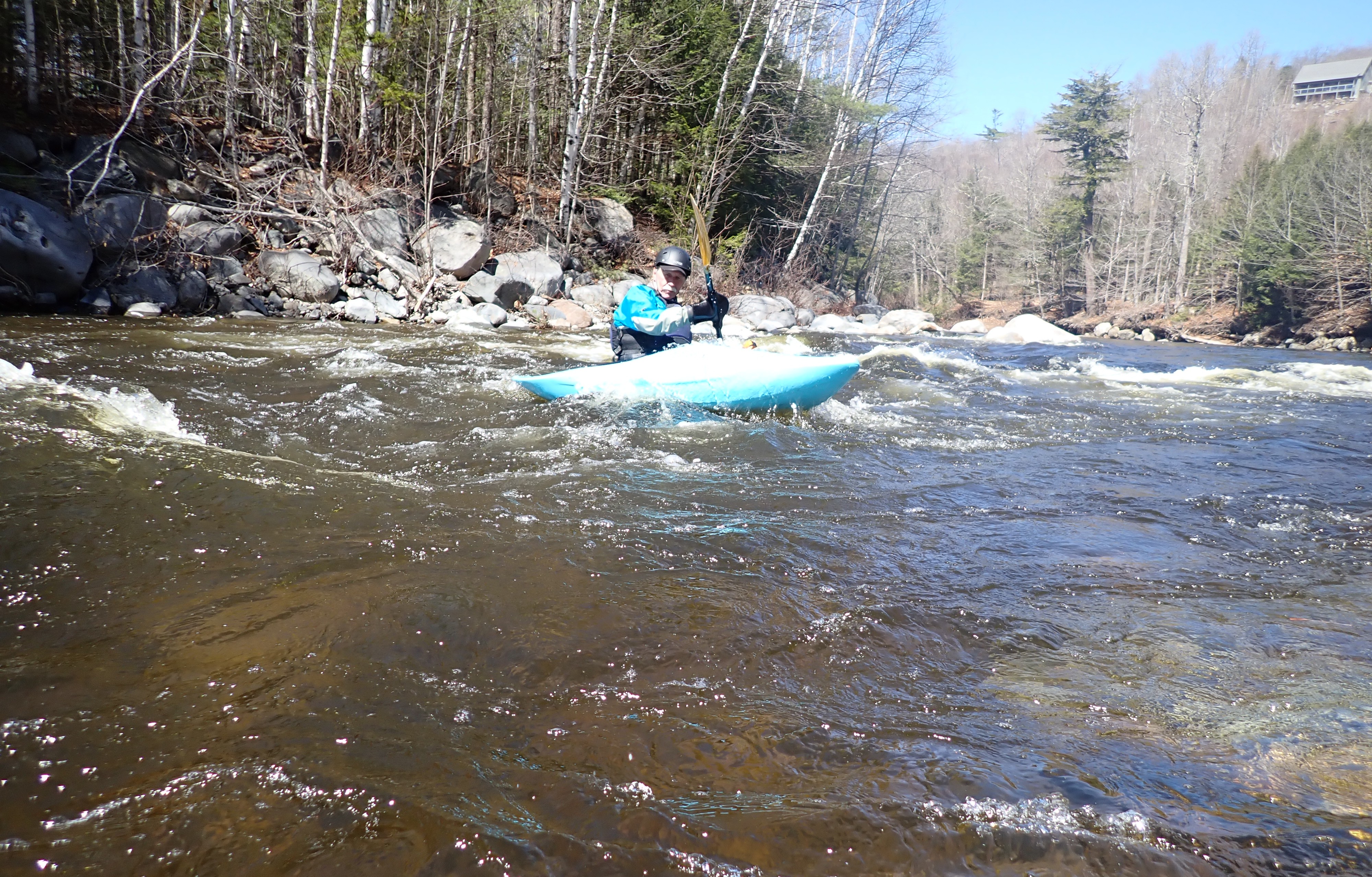
Always watching for surfing opportunities, we spotted a potential surfing wave on the right shore. After catching an eddy next to the seemingly smooth, inviting wave, two kayakers were able to complete successful surfs. My attempt failed as an unseen wrinkle in the wave pushed me off, nearly flipping me. The remaining kayaker had a similar experience except he fell halfway over forcing him to execute an emergency low brace to avoid capsizing in the frigid, shallow river.
More exhilarating whitewater followed to the takeout where we carried kayaks up a twisting path on a steep embankment to the waiting shuttle vehicle. It’s impossible to kayak the Middle Carrabassett on a sunny day without enjoying the spectacular scenery. Looking back, exceptional views of the majestic Bigelow Mountain Range were almost constant.
Ours had been an exceptional voyage on the elusive Middle Carrabassett.
My book, “Maine Al Fresco: The Fifty Finest Outdoor Adventures in Maine,” narrates many more Maine whitewater exploits, including a descent of Orbeton Stream, a precipitous mountain stream that flows off the eastern slopes of the Saddleback Mountain Range.
The author of “The Great Mars Hill Bank Robbery” and “Mountains for Mortals – New England,” Ron Chase resides in Topsham. His latest book, “Maine Al Fresco: The Fifty Finest Outdoor Adventures in Maine,” is available at North Country Press and through online retailers. Visit his website at ronchaseoutdoors.com or he can be reached at [email protected].

The Times Record Sustaining Sponsor
We believe a community must be informed to thrive. bowdoin.edu
Comments are not available on this story. Read more about why we allow commenting on some stories and not on others.
We believe it's important to offer commenting on certain stories as a benefit to our readers. At its best, our comments sections can be a productive platform for readers to engage with our journalism, offer thoughts on coverage and issues, and drive conversation in a respectful, solutions-based way. It's a form of open discourse that can be useful to our community, public officials, journalists and others.
We do not enable comments on everything — exceptions include most crime stories, and coverage involving personal tragedy or sensitive issues that invite personal attacks instead of thoughtful discussion.
You can read more here about our commenting policy and terms of use. More information is also found on our FAQs.
Show less