
I’ve had the good fortune to paddle the Machias River about 35 times over the past 50 years. During the last two decades, I’ve coordinated Penobscot Paddle & Chowder Society multiday Machias River trips almost every spring. Normally, I select late April or early May for the excursions because that’s when the water levels tend to be highest and it’s before the blackflies arrive. If you experience the Machias during peak blackfly season, you’ll understand why I consider that an important factor.
In recent years, I’ve attempted to add some variety to the Machias River trip by paddling its major tributaries and then finishing on the Machias. Last spring, the club paddled Mopang Stream, the second-largest tributary to enter the Machias from the west. This year, I hoped to paddle Old Stream, a comparable body of water that joins from the east.
Based on my experience and information available on the American Whitewater Association website, I concluded at least 120 cubic feet per second (CFS) was needed on the U.S. Geological Survey (USGS) Old Stream gauge to descend the remote stream. I also use that gauge as an indicator of the Machias River water level because, for some inexplicable reason, the USGS stopped operating the gauge on the Machias River about 20 years ago, even though it’s the largest watershed in the region.
The week before my planned trip, I participated in the Machias River Canoe Race. At the time, the river was running at about a medium level but Old Stream was 85 CFS. Since a significant rainstorm was predicted in the interim, I was guardedly optimistic that we’d have adequate water for Old Stream.
During the days before the scheduled trip, all of my usual Machias River companions had to drop out because of unanticipated conflicts. However, there was good news: club member, David Baird, was able to join me. Since he had never paddled the Machias, I would have the welcome opportunity of introducing him to arguably the best canoe trip in Maine.
When David and I met at the Airline Campground next to the Machias River the night before our planned trip, the Old Stream gauge was still too low. We opted to do a section of the Machias from below First Machias Lake to Smith Landing in Marshfield, a three-day trip.
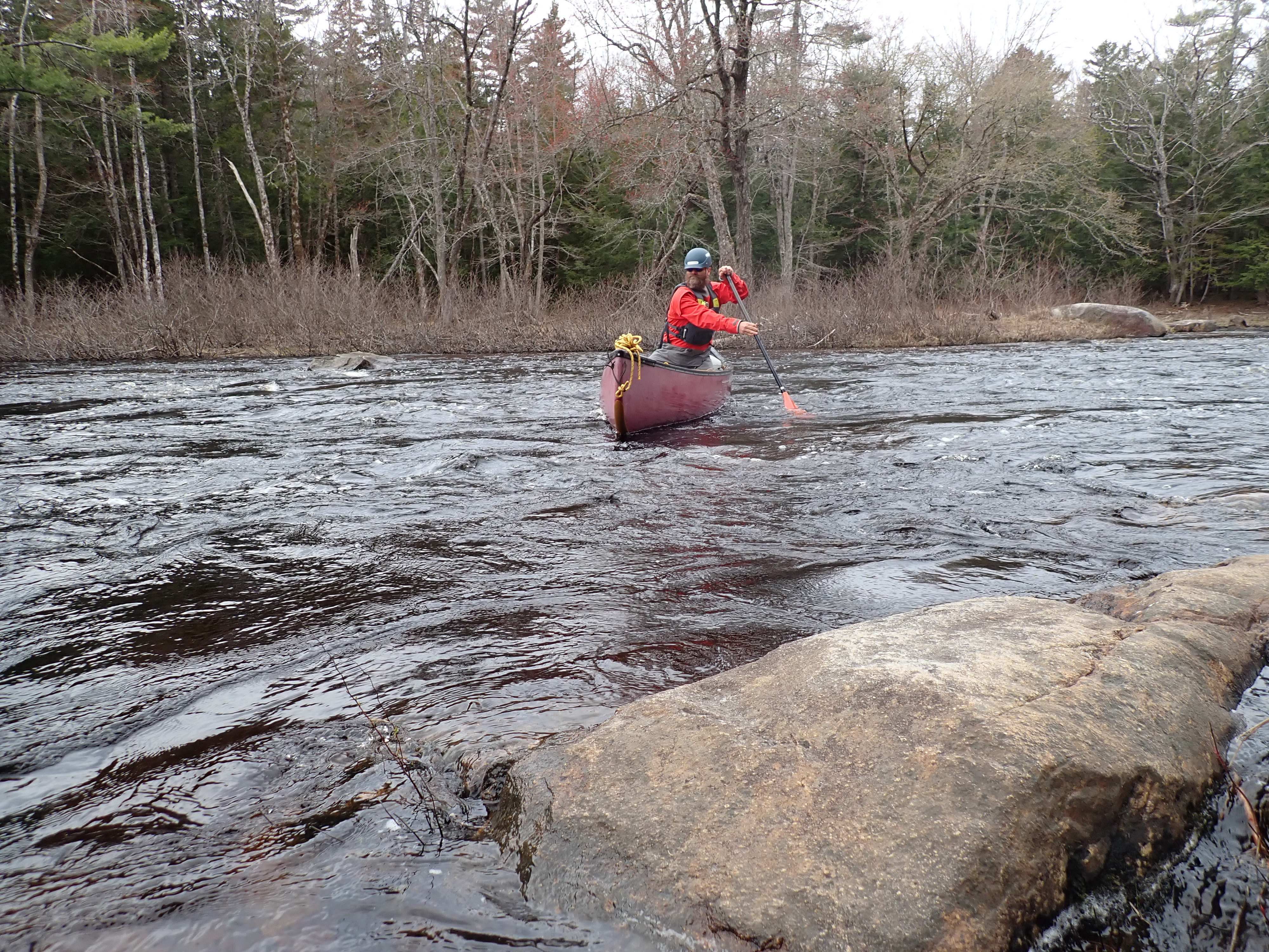
We began on May 2 at a location about two miles downriver of First Machias Lake. It was a seasonably warm, partly sunny day with moderate winds, and the water level was a little above medium — in other words, ideal.
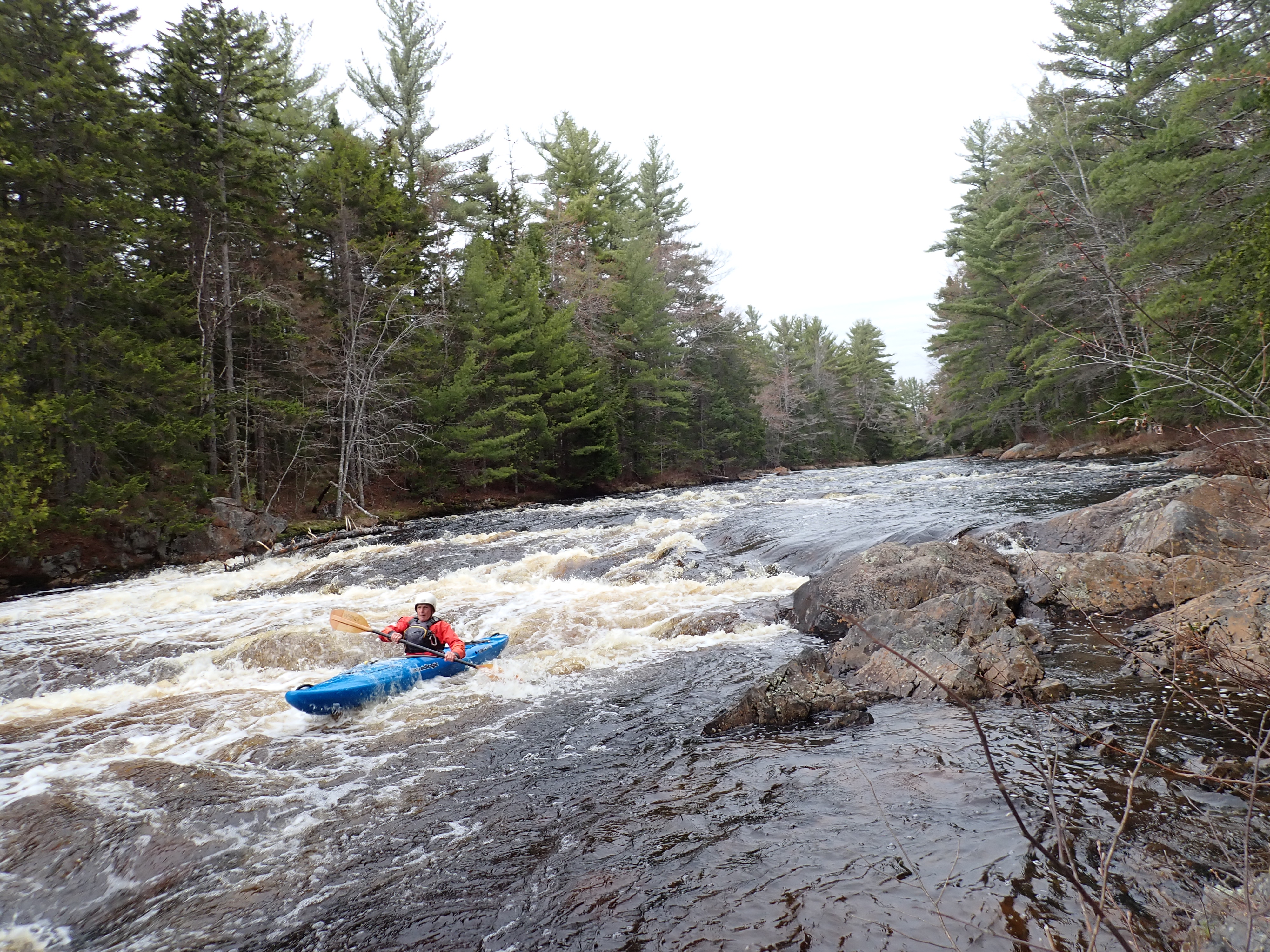
After about 2 miles of quick water, we encountered the first of six Class III rapids on our trip, Carrick Rips. Following a careful scout, we completed the tricky descent without incident.
Shortly after, we passed the West Branch of the Machias, which enters on the right. More rapids, including Class II Boot Rips, ensued on our way to Airline Rapids, which begin just below Route 9. Since we had scouted the extended, complex Class III falls during out shuttle earlier in the day, we cautiously maneuvered down the right side in the upper portion and ferried to river left at the bottom.
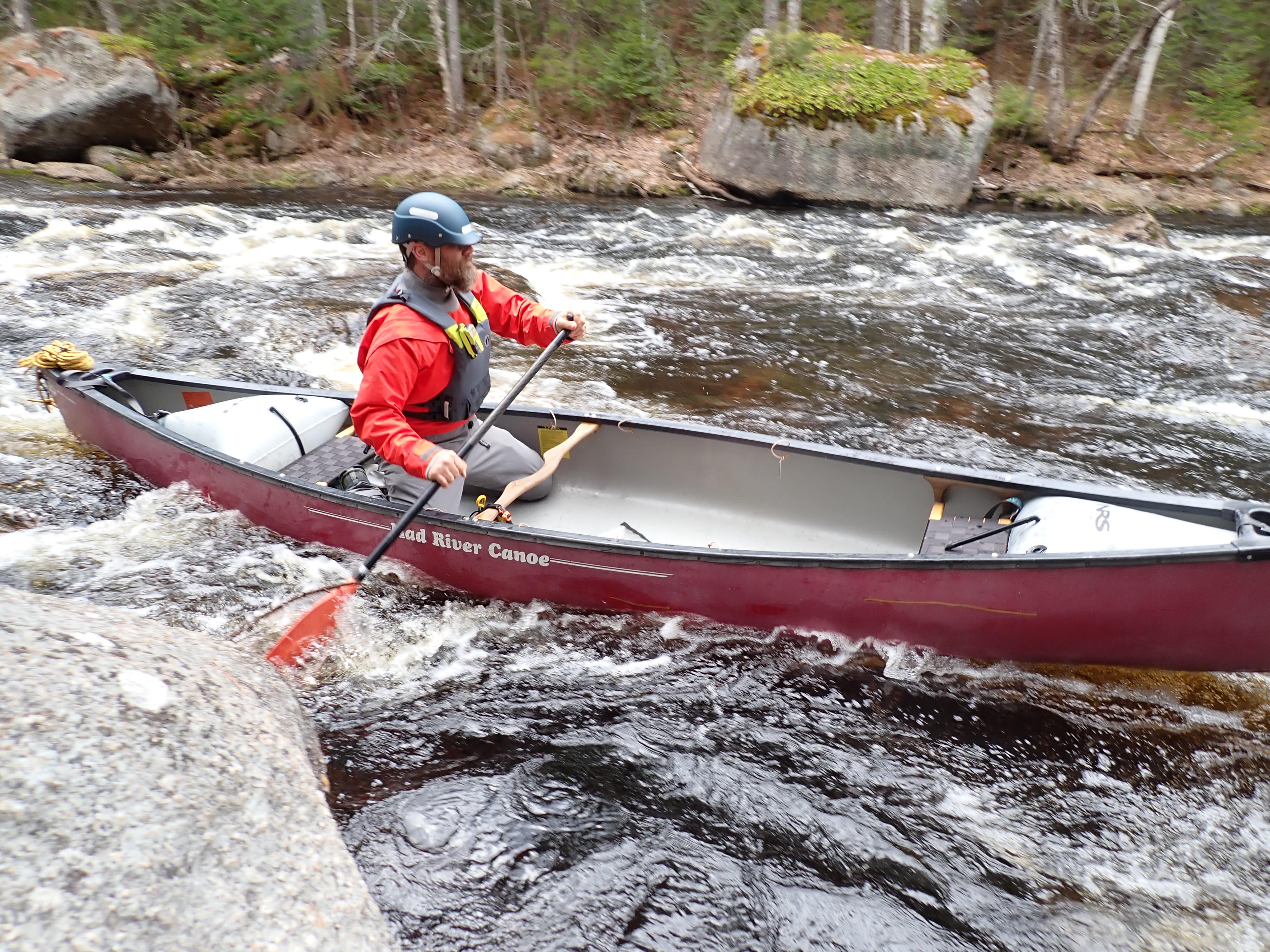
A combination of easy rapids and quick water followed to Little Falls, a lengthy, steep and difficult Class III-plus descent. We inspected the challenging pitch while carrying our gear to an exceptional campsite at the end. I paddled down the left side in my expedition kayak while David provided safety with a throw bag at the bottom. He opted to portage his canoe.
Once finished, we established camp. Since rain was predicted in the night and all of the next day, we erected tarps over a communal area next to the fire ring and above our tents.
With our tents and gear protected from the elements, we settled in while contemplating the remainder of our trip. The next day required negotiating through four demanding rapids called the Wigwams followed by a long portage around unnavigable Holmes Falls. The final day would begin with a narrow, technical descent of Little Holmes Falls and end with a long, flatwater paddle to Smith Landing.
Heavy rain began during the night.
My book, “Maine Al Fresco: The Fifty Finest Outdoor Adventures in Maine,” relates the six best extended canoe trips in Maine including a descent of historic Webster Stream and East Branch of the Penobscot.
The author of “The Great Mars Hill Bank Robbery” and “Mountains for Mortals – New England,” Ron Chase resides in Topsham. His latest book, “Maine Al Fresco: The Fifty Finest Outdoor Adventures in Maine,” is available at North Country Press and through online retailers. Visit his website at ronchaseoutdoors.com or he can be reached at [email protected].

The Times Record Sustaining Sponsor
We believe a community must be informed to thrive. bowdoin.edu
Comments are not available on this story. Read more about why we allow commenting on some stories and not on others.
We believe it's important to offer commenting on certain stories as a benefit to our readers. At its best, our comments sections can be a productive platform for readers to engage with our journalism, offer thoughts on coverage and issues, and drive conversation in a respectful, solutions-based way. It's a form of open discourse that can be useful to our community, public officials, journalists and others.
We do not enable comments on everything — exceptions include most crime stories, and coverage involving personal tragedy or sensitive issues that invite personal attacks instead of thoughtful discussion.
You can read more here about our commenting policy and terms of use. More information is also found on our FAQs.
Show less