

On the second day of our three-day trip on the Machias River in Washington County, David Baird and I awoke to rain. We were at a campsite at the foot of Little Falls in a remote area about 5 miles downriver from Route 9.
The rain was expected and we had erected a tarp next to a fire ring to keep gear dry and provide shelter while cooking breakfast. After carefully packing to keep sleeping bags and clothing as dry as possible, we loaded gear into our boats and set off downriver. I was paddling an expedition kayak and David a solo canoe.
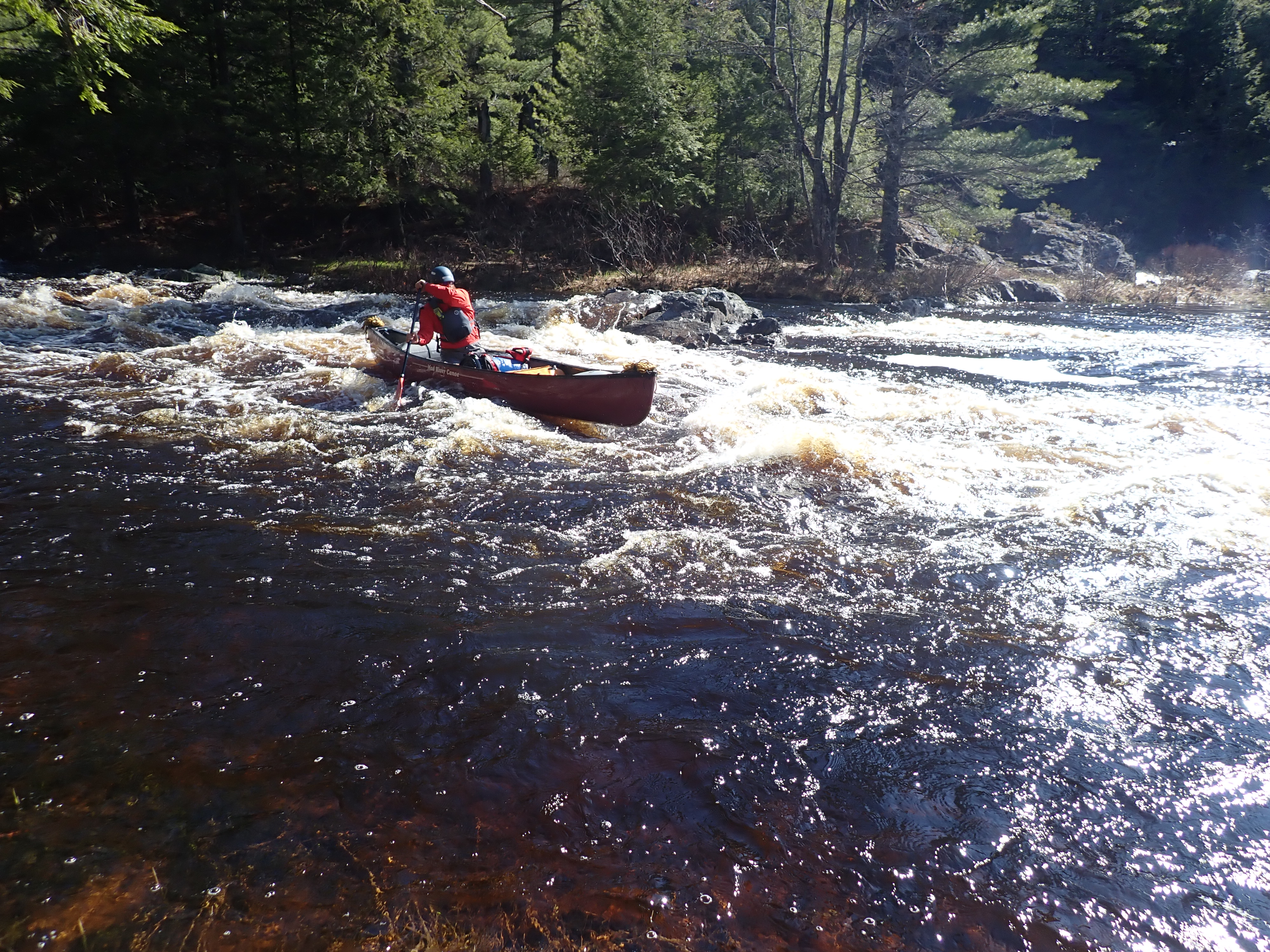
We started with about 4 miles of flatwater in route to a challenging 2-mile section of whitewater called the Wigwams. After passing Mopang Stream on the right, we approached First Wigwam, a long Class III rapid. The rain temporarily subsided while we scouted the falls from the portage trail on the right. After careful inspection, we decided to negotiate through large waves far left at the top to avoid powerful holes and then move center through a long wave train to the bottom.
Our descents went according to plan and we met up in a large eddy next to a Downeast Salmon Federation Cabin on river right. One of the occupants walked down to the shore to greet us. He was part of a team of canoeists that had ended their trip at the cabin the night before. Except by river, access to the cabin requires driving about 30 miles on rough dirt roads that begin at Route 1 in Columbia Falls.
Easy rapids continued for about a mile to Second Wigwam, a long, twisting Class II falls. We entered center, moved left around a wide hole on the right and then right to avoid another substantial hole on the left. After, we rode standing waves to a pool at the terminus.
Beyond the pool, breaking waves could be seen at the top of Third Wigwam. We caught an eddy on the left above the falls to scout from the portage trail. Feisty waves pockmarked with intimidating holes inundate the upper portion of the lengthy rapid finishing with a river-wide ledge drop. We identified a route on the left that led to a channel through a narrow opening in the ledge at the end. Our choice was a good one — the complex maneuvers were completed without incident.
The rain increased in intensity as we turned left around the next bend and entered Fourth Wigwam. We navigated through a circuitous wave train in the center to avoid rocks and holes on both sides.
About 3 miles of flatwater ensued to Upper Holmes Falls, a 15-foot unnavigable cataract. We caught a micro-eddy just above the beginning of the falls where there is a clearing ideally suited to start the portage.
Steady rain continued as we portaged our boats and gear around the falls. Most of the portage trail is wide and in good shape, but a steep pitch must be descended at the end.
Shortly after, we located a quality campsite in a densely forested area that partially shielded us from the rain. Our first mission was to erect a tarp for shelter. The rain turned to drizzle and finally concluded early evening.
The skies cleared and it turned cold during the night. We awoke to welcome sunshine and temperatures soon climbed. The water level had risen substantially due to the rain.
First on the agenda was the final Class III rapid on our trip, Little Holmes Falls. We skirted the left side of an entrance rapid and then ferried right to an eddy just above the falls. A large log partially blocked the top, so we pulled our boats a few feet around the obstruction. Instead of the expected shallow technical descent, we successfully navigated through large breaking waves to the bottom while avoiding another log on the right.
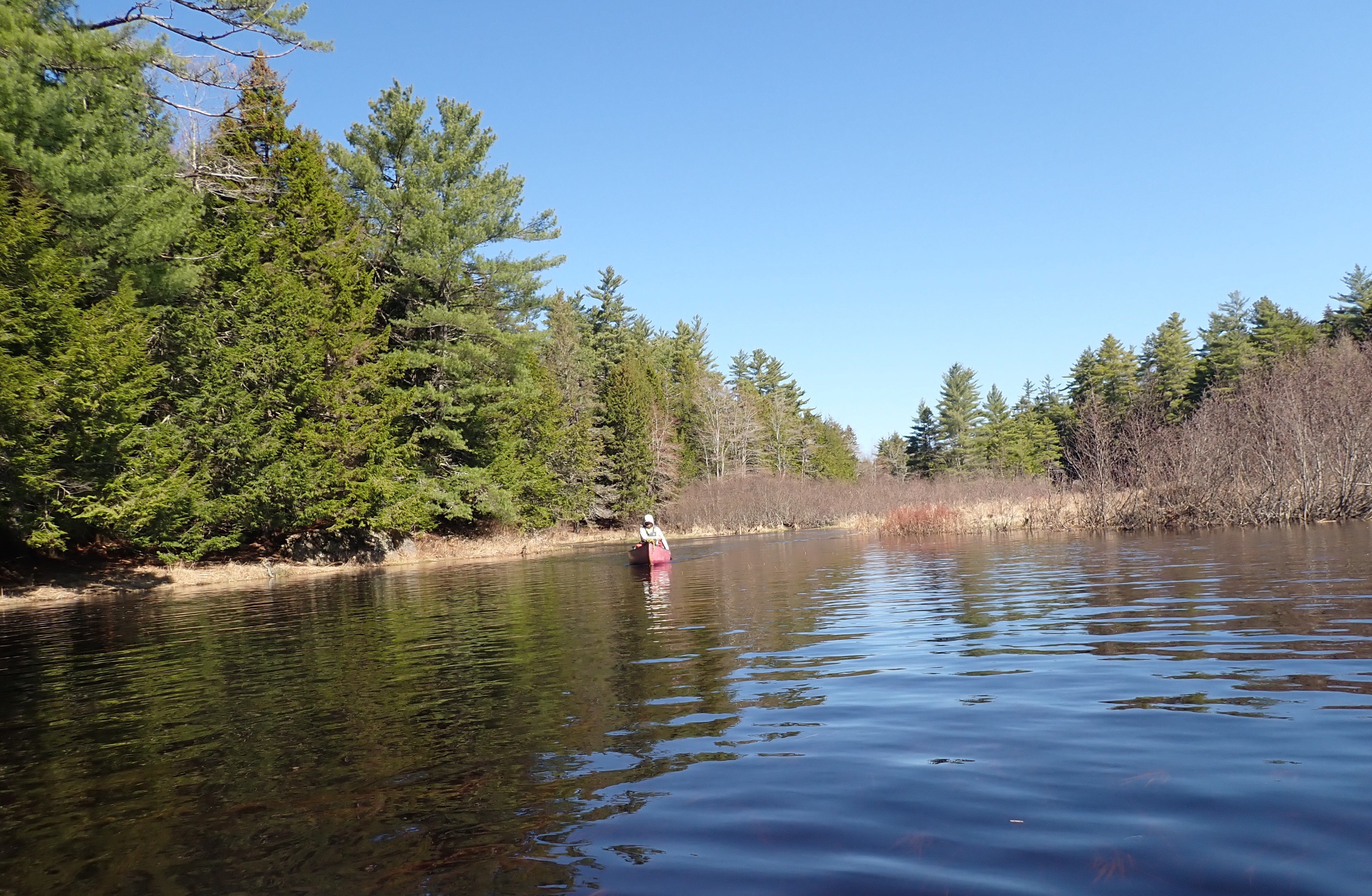
The remainder of our journey consisted of idyllic paddling in warm, sunny weather with light winds for about 10 miles to the planned takeout at Smith Landing in Marshfield. No surprise, it rained during the shuttle.
My book, “Maine Al Fresco: The Fifty Finest Outdoor Adventures in Maine,” narrates five more exceptional Maine river trips, including a spring descent of the St. John River in Aroostook County.
The author of “The Great Mars Hill Bank Robbery” and “Mountains for Mortals – New England,” Ron Chase resides in Topsham. His latest book, “Maine Al Fresco: The Fifty Finest Outdoor Adventures in Maine,” is available at North Country Press and through online retailers. Visit his website at ronchaseoutdoors.com or he can be reached at [email protected].

The Times Record Sustaining Sponsor
We believe a community must be informed to thrive. bowdoin.edu
Comments are not available on this story. Read more about why we allow commenting on some stories and not on others.
We believe it's important to offer commenting on certain stories as a benefit to our readers. At its best, our comments sections can be a productive platform for readers to engage with our journalism, offer thoughts on coverage and issues, and drive conversation in a respectful, solutions-based way. It's a form of open discourse that can be useful to our community, public officials, journalists and others.
We do not enable comments on everything — exceptions include most crime stories, and coverage involving personal tragedy or sensitive issues that invite personal attacks instead of thoughtful discussion.
You can read more here about our commenting policy and terms of use. More information is also found on our FAQs.
Show less