
We’re at the midpoint of February. If last year is any proof, a thaw this time of year does not mean winter is over. Although the major headline in the next 10 days is the milder weather, there is still plenty of time for winter to snap back.
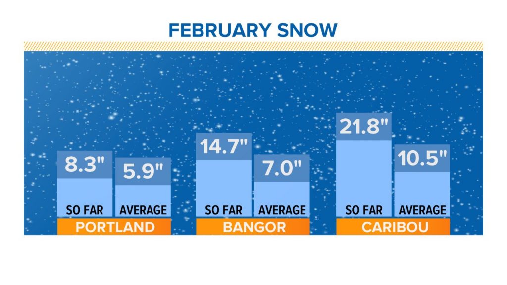
So far this month, 8 inches of snow have fallen in Portland, which is a tick above average through the date. Average for the month is a foot.
There is one sneaky chance for snow, and it comes this weekend.
Cold high pressure builds on Saturday, bringing sunshine and dry weather. Highs will be in the 20s. It should be a very nice winter day.
This high retreats Saturday night, with warmer air to follow for the second half of the weekend. As it does, a system will develop off the East Coast.
It doesn’t look like a very strong storm, but it will have a decent precipitation shield.
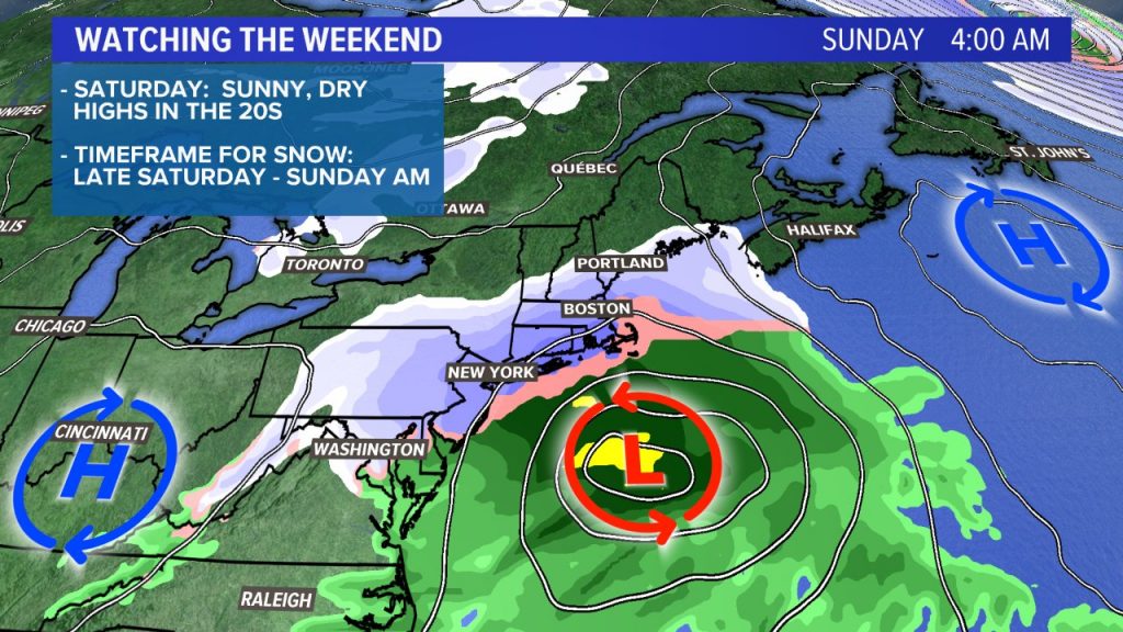
Southern New England has a higher chance of seeing snow at this point. But the northern extent of the snow may reach into central and southern Maine as well.
The timeframe would be late Saturday night into Sunday morning. It’s quick-moving, so if we do see any snow, it should move out Sunday afternoon.
The exact track of the storm is important. If it shifts any farther south, only flurries and snow showers would make it into Maine. If it comes any farther north, most of the state would see an accumulating snow.
By Thursday evening we should have a much better idea on the possible snow totals.
Comments are no longer available on this story