
Cyclogenesis is underway south of us off the East Coast, creating a formidable nor’easter that will move into the Gulf of Maine overnight. The center of the storm will move over eastern Maine tomorrow where it will eventually decay and die off late in the day.
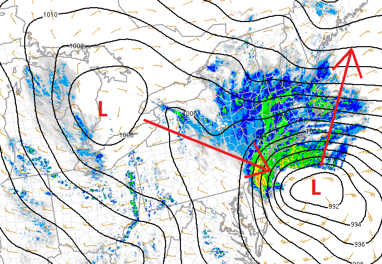
The worst of the storm will come overnight. Snow rates may top 1″ per hour and there may even be some thundersnow. The wind will be whipping, perhaps over 40 mph creating blizzard-like conditions. Travel is not recommended.
Expect a lot of delays and cancellations, both schools and businesses, tomorrow morning. Heavy snow bands are hanging on, but beginning to shift north.
Snow will lessen in intensity from south to north from late morning to early afternoon, with improving conditions during the second half of the day.
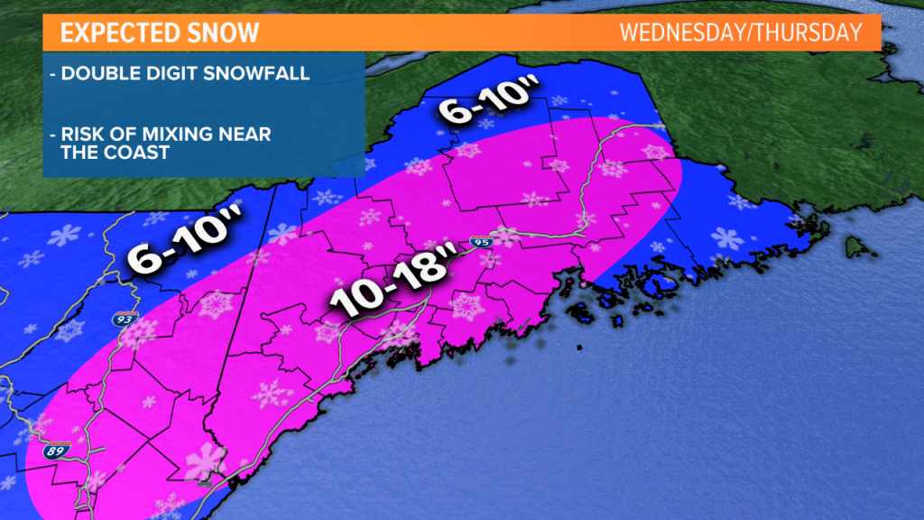
This will be a double digit snowfall for most. The highest chance for up to 18 inches will be in western Maine; totals should be closer to a foot in central and eastern Maine. Totals may be held below 10 inches if mixing with rain occurs in coastal Downeast Maine.
Comments are no longer available on this story