

8:14 p.m.
MIAMI — Forecasters say Hurricane Earl has weakened to a Category 2 storm though they warn it is still powerful as it heads toward North Carolina and the Eastern Seaboard.
Additional Photos

The National Hurricane Center says Earl’s winds are now at about 110 mph and could weaken further.
Still, the coast is expected to be lashed by winds of hurricane strength — more than 74 mph — for a couple of hours.
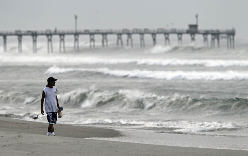
The first bands of heavy rain hit the long ribbon of the Outer Banks tonight. The downpours started in several bursts.
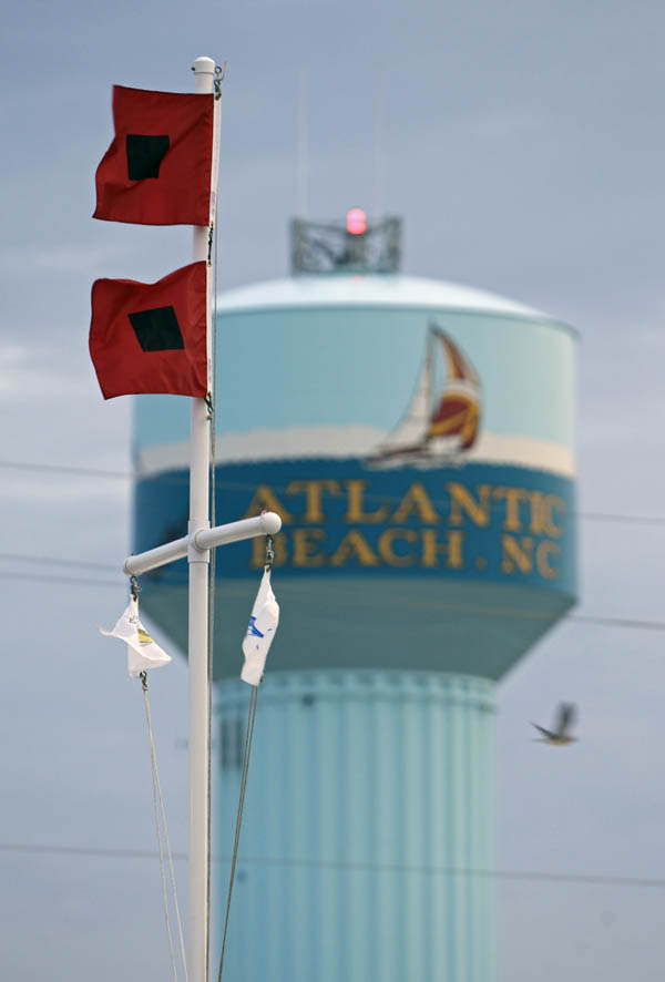
North Carolina is the first and potentially most destructive stop on the storm’s projected journey up the Eastern Seaboard.
Hurricane force winds are extending out 70 miles from the center of the storm that is 160 miles south-southeast of Cape Hatteras.
5:32 p.m.
BUXTON, N.C. — The last ferries pulled away from North Carolina’s vulnerable barrier islands today as Hurricane Earl spun closer with winds near 125 mph, putting the East Coast all the way to Canada on alert for what could be a blustery Labor Day weekend.
A hurricane warning was issued for the tip of Massachusetts, including Nantucket and Martha’s Vineyard. New hurricane and tropical storm warnings and watches were issued for parts of Canada, adding to those already in effect from North Carolina to near the Canadian border.
With winds expected to whip up in North Carolina’s Outer Banks by this evening, Federal Emergency Management Agency Administrator Craig Fugate said residents and tourists could no longer afford to wait on the next forecast to see how close the eye of the storm might get.
“People should not be lulled into a false sense that this will steer away from them,” Fugate said. “Time will be running out for people who have not gotten ready.”
The final state-operated ferry was leaving Ocracoke Island in North Carolina at 3 p.m. for its 40-minute route to neighboring Hatteras Island. Other ferries had already stopped running earlier in the day.
Earl weakened slightly as it moved toward the coast about 245 miles south of Cape Hatteras today, but it was still a dangerous Category 3 storm. Hurricane force winds were beginning to spread farther from the eye, the National Hurricane Center in Miami said.
The center’s director, Bill Read, said hurricane force winds were spread 90 miles out and widening. The eye of the storm will likely remain about 30 to 75 miles east of the Outer Banks, meaning at the closest point of approach, the western edge of the eyewall could impact Cape Hatteras with huge waves, beach erosion and maybe some property damage.
“They’re going to have a full impact of a major hurricane,” Read said.
There will be a similar close approach later this week for the eastern tip of Long Island, Rhode Island, Martha’s Vineyard, and Nantucket.
That will mean strong, gusty winds much like a nor’easter, and possibly fallen trees and power lines.
“This is the strongest hurricane to threaten the northeast and New England since Hurricane Bob in 1991,” said Dennis Feltgen, a meteorologist and spokesman for the National Hurricane Center. “They don’t get storms this powerful very often.”
Forecasters said Earl could pass within 30 miles of Nantucket Island, Mass., bringing wind gusts up to 100 mph.
“We’re preparing for the worst,” assistant town manager Gregg Tivnan said today.
North Carolina Gov. Beverly Perdue told reporters at a morning news conference that her state is prepared for Earl and it’s now up to coastal citizens to get to a safe place as the storm passes by.
“We’re very ready, as ready as anybody can be,” Perdue said. “It’s a serious storm and we all need to treat it like a serious storm.”
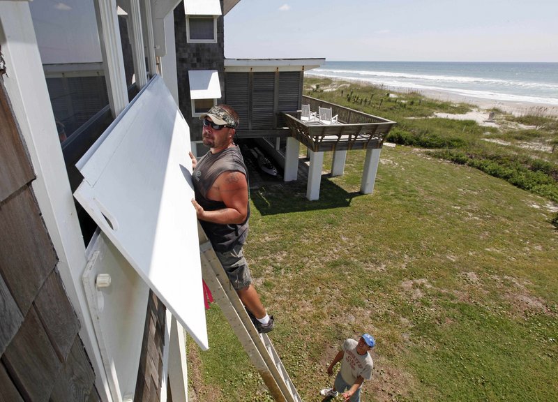
Tourists were largely gone from the Outer Banks, but residents who stayed behind said they were prepared to face down the powerful hurricane.
Three counties have issued evacuation orders, but Perdue said emergency officials can’t make residents leave their homes. She warned emergency crews often can’t immediately reach stranded coastal homeowners after a storm.
Evacuations continued early today on the coast, with residents and visitors told to leave a barrier island in Carteret County and another in Dare County where the Wright Brothers National Memorial marks their first successful airplane flights at Kitty Hawk in 1903.
Residents like Nancy Scarborough, who manages the Hatteras Cabanas, said Outer Banks residents have a tight-knit community that takes care of its own.
“I worry about not being able to get back here,” she said. “I’d rather be stuck on this side than that side.”
Along with the 30,000 residents and visitors asked to leave Hatteras Island, 5,000 more tourists were ordered to leave Ocracoke Island, which is only accessible by ferry and airplane.
The North Carolina National Guard is deploying 80 troops to help and President Barack Obama declared an emergency in the state. The declaration authorizes the Department of Homeland Security and Federal Emergency Management Agency (FEMA) to coordinate all disaster relief efforts.
Preparations were going on all the way up the East Coast. In Maine, lobstermen took the storm in stride, putting their traps into deeper water to ride out the hurricane instead of pulling them in. Pat White said people who make their living on the water know weather can be fickle and storms like Earl can change their paths quickly.
“You never know,” White said. “You can’t trust them.”
Copy the Story LinkSend questions/comments to the editors.

Success. Please wait for the page to reload. If the page does not reload within 5 seconds, please refresh the page.
Enter your email and password to access comments.
Hi, to comment on stories you must . This profile is in addition to your subscription and website login.
Already have a commenting profile? .
Invalid username/password.
Please check your email to confirm and complete your registration.
Only subscribers are eligible to post comments. Please subscribe or login first for digital access. Here’s why.
Use the form below to reset your password. When you've submitted your account email, we will send an email with a reset code.