

AUGUSTA — River ice and snowpacks have yet to melt significantly in much of Maine and aren’t expected to melt anytime soon, which could leave the state vulnerable to April flooding, experts say.
Members of the Maine River Flow Advisory Commission, a group of state, federal, local and other officials monitoring spring flood risk, said at a meeting Thursday that the threat will likely be above normal in many areas, because lingering cold temperatures have left ice and snow conditions virtually unchanged over the past two weeks.
Tom Hawley, a hydrologist for the National Weather Service in Gray, said temperatures are expected to remain cold into early April, although there is no forecast for rain that could lead to flooding in the next two weeks.
“Right now, every week that goes by, I think our flood threat will be increasing,” he said. “By the time we get into April, I think we’re still going to have quite a bit of snow on the ground, and that’s kind of worrisome to me.”
Much of Maine has 5 to 8 eight inches of water in its snowpack, with the largest totals in the western mountains, rural Penobscot and Piscataquis counties and Down East.
From the Augusta area to Calais, water content in the snow is among the highest levels measured in the past decade at this time of year, but that isn’t the case in other areas. Water content is somewhat higher than usual in most of York County, but normal around Portland and in parts of western Maine.
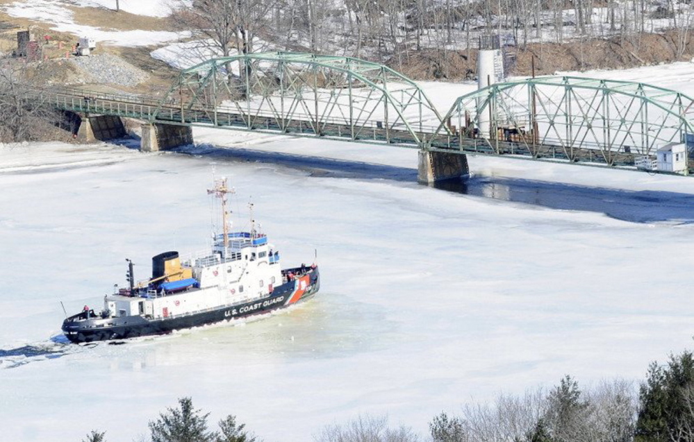
Coast Guard Lt. Dan Bourbeau said current plans call for breaking up ice on the Kennebec River from Bath to Gardiner during the week of March 30. They were delayed a week because crews have had trouble breaking up ice on the Penobscot River.
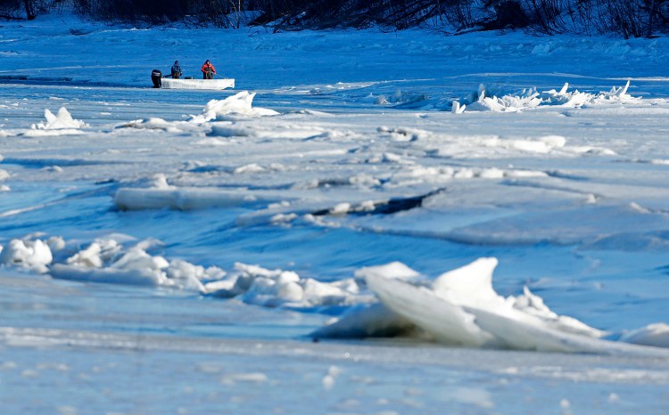
Gregory Stewart, data section chief for the U.S. Geological Survey in Augusta, said ice is still nearly two feet thick in some places on the Penobscot, with more than a foot of snow on top of that. He said the state is seeing “mid-winter ice conditions,” with little slush, which has elevated the risk that ice jams will form and cause flooding.
Stewart said ice was still more than a foot thick when measured recently on the Kennebec River in Sidney, which usually has open water at this time of year.
State officials are watching two areas that pose flooding risks on the Kennebec River: an ice jam that formed in January at the confluence with the Carrabassett River in Madison; and at the new Richmond-Dresden bridge, an area that has experienced some of the worst ice jam floods in the river’s history, including a massive flood of Augusta and Richmond in 1936.
Michael Smith, director of the Somerset County Emergency Management Agency, said the Madison jam is obscured by snow, but he believes there’s little water flow around it and that little has changed “considering the way the weather has been.”
In Richmond, the new Maine Kennebec Bridge linking Richmond and Dresden could pose a risk of jams later on. The bridge is 115 feet upstream of the old Richmond-Dresden bridge. Stewart said the added piers could increase the risk of ice jams.
“We’re just closely monitoring things,” said Richmond Police Chief Scott MacMaster, the town’s emergency management director, “and I don’t think anyone really knows what spring’s going to bring with the new bridge because it’s a new bridge.”
Copy the Story LinkSend questions/comments to the editors.

Success. Please wait for the page to reload. If the page does not reload within 5 seconds, please refresh the page.
Enter your email and password to access comments.
Hi, to comment on stories you must . This profile is in addition to your subscription and website login.
Already have a commenting profile? .
Invalid username/password.
Please check your email to confirm and complete your registration.
Only subscribers are eligible to post comments. Please subscribe or login first for digital access. Here’s why.
Use the form below to reset your password. When you've submitted your account email, we will send an email with a reset code.