

Not far from the Canadian border on Route 27, just below Sarampus Falls on the Dead River in Alder Stream Township, and south of the beautiful Chain of Ponds, there’s a road to the west leading into a part of the Penobscot Indian Territory.
The road, identified by a sign explaining the rules that apply in the area, is about 17 miles north of the intersection of Routes 16 and 27 in Stratton. It leads to a favorite hike of mine, with an added bonus if you happen to like to cast a fly.
Additional Photos
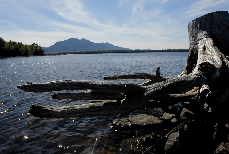
Snow Mountain, only 52 feet shy of joining Maine’s 14 elite 4,000-footers, at 3,948, is a hike overlooked by many. But it’s a must if you want to see an extended sweep of the western mountains, many miles of Benedict Arnold’s route to Quebec in 1775 along the headwaters of the Dead River, and views of Canada all the way to Lac Megantic.
There’s a chance that the gate at Route 27 may be locked, which will extend your round-trip hike by about 10 miles, but over the many years I’ve been there, the gate has always been open. If that’s the case, you’ll follow a well maintained gravel road for 3.9 miles, take a right at the fork and proceed 1.1 miles to a parking lot and the Snow Mountain trail head.
If you want to camp, you must obtain a permit from the Penobscot Indian Nation Department of Trust Responsibilities.
The trail is over old logging roads, and was recently relocated in spots to protect wildlife and fish habitat. After about two miles, a spur leads left to Snow Mountain Pond and the former fire warden’s camp which is now private property. Leaving the pond, the trail climbs steeply north, past a welcome spring. Near the summit, it connects with a trail to the left to Big Island Pond. After that there’s a great viewpoint back to the south.
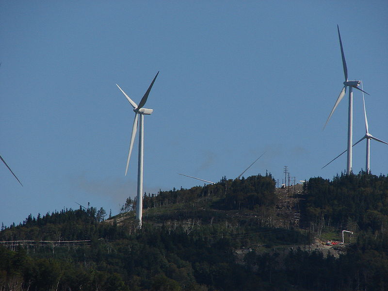
At the summit, after a climb of 1.3 miles from the pond, the remains of the old fire tower still stand, and a clamoring up it will give you fabulous 360-degree views of the wild surroundings. Whether you’re a supporter or not, you’ll get a great look at the parade of wind-power turbines on the flanks of neighboring Kibby Mountain.
The bonus of a trip up Snow, for me, is the chance on the way back to cast a fly in little Snow Mountain Pond on the way down. And I hasten to admit that on a recent trip, I had such fun fishing there on the way up I never did continue on up to the summit.
And speaking of that recent trip, I owe a special debt of gratitude to two benefactors. The first one is the owner of the old overturned aluminum skiff on the shore that I commandeered for my fishing excursion, as there’s barely a spot to fish from the shore on the entire perimeter of the pond. Thank you, whoever you are, and I promise I left it in the same condition I found it.
The second is my old skiing buddy Rik Dow, now a wintertime instructor at Bretton Woods in New Hampshire and a long-time coach driver, guide and general fount of knowledge on the Mount Washington Auto Road in the summer.
It happens that Dow drove a few of us to the summit on May 27 for our last day of skiing for the season in the east snow fields, and waited for us for several hours as we played in the late spring corn. An accomplished fly-tier and knowledgeable fisherman, Rik whiled away the time that day tying flies that he generously gave to all six of us as a remembrance of a very special day. It was, in fact, the 70th birthday of one of our party.
My fly, his own Lizzie B., landed for me a 10-inch brookie on about my third cast on the recent trip to Snow Mountain Pond, the best fish I’ve found there, as they tend to run pretty small. I’d be interested to hear from anyone who’s had better luck — and how.
You can complete a great day in Franklin County if you bring along your kayak and pop it into Flagstaff Lake on your way home at the public boat launch just north of Stratton on Route 27, where the South Branch of the Dead River passes under a bridge.
You can paddle out into the lake and explore the North Branch up toward Cathedral Pines in Eustis, or down toward the village of Stratton. One of your rewards is a spectacular view of the Bigelow Range.
I like to head up the South Branch, and in the early summer you can go upstream a couple of miles — past some sand bars that are perfect lunch spots — and at least three sets of rapids that you can work your way up through before turning around to scoot down for a bit of an easy whitewater thrill.
On my August trip, however, the river was so low I had to stop at less than a mile up the river. Nonetheless, still a great paddle.
Fall and its inviting cooler weather are just around the corner, so now’s the time to start planning your autumn outings.
John Christie is an author and a year-round explorer of the Maine outdoors. He and his son, Josh, will share this space this summer to highlight places to enjoy the beauty only Maine has to offer. He can be contacted at:
jchristie@fairpoint.net
Copy the Story Link
Send questions/comments to the editors.

Success. Please wait for the page to reload. If the page does not reload within 5 seconds, please refresh the page.
Enter your email and password to access comments.
Hi, to comment on stories you must . This profile is in addition to your subscription and website login.
Already have a commenting profile? .
Invalid username/password.
Please check your email to confirm and complete your registration.
Only subscribers are eligible to post comments. Please subscribe or login first for digital access. Here’s why.
Use the form below to reset your password. When you've submitted your account email, we will send an email with a reset code.