
At an historic site on River Road, state archaeologists have pieced together a theory of how the Province Fort, constructed in the mid-18th century to protect early settlers, was laid out.
The dig is a continuation of work from November 2015, when archaeologists from the Maine Historic Preservation Committee determined the site was in good shape and worthy of listing on the national registry of historic sites, according to historical archaeologist Leith Smith.
The fort was a respite for the seven families who were the early settlers in Windham (then known as New Marblehead), who built their homes along the banks of the Presumpscot River in the late 1730s. In 1744, the fort was built at the top of the hill, giving a better view of the surroundings, and serving as protection from attacks by Native Americans.
A contingent of soldiers were assigned to the site to protect the settlers from attacks by Native Americans, especially when the settlers were working out in the fields.
In phase three of the excavation, the six-person crew is digging a grid of one-by-one meter squares, which allows them to map out the location of artifacts and significant changes in the soil.
In early June, the crew began by digging on the south side of River Road, opposite the Parson Smith house. They uncovered a loose line of stones, approximately 8 feet from the shoulder, which they believe is the remainder of a rock wall that was the interior of two barriers.
From early documents, the crew knows the wall of the fort was 50-by-50-feet. When they traced out 50 feet from the wall, to the opposite side of River Road, they found similar remnants on the north-side wall.
Farther outside the walls of the fort, the crew is still looking for a fence line, evidence left from a trench dug for a stockade, the external of the two protective barriers.
Inside the rock wall, archaeologists said, there was two-story block house. Within the confines of the rock wall, Smith suspects the settlers kept livestock, gardens, sheds and open space activities.
The team uses a combination of sharp shovels and a heavy trowel to unearth artifacts, depending “on what we’re digging around and through,” archaeologist John Mosher said. “It’s quicker to go by shovel, but when you hit a change in the soil you change to a trowel.”
The archaeologists get a glimpse into the lives of these early settlers with artifacts dug up at the site, including ceramics, pottery, animal bone and brick (which was made locally).
While Hollywood tends to glamorize archaeology as all about artifacts and digging up treasures, “the truth is we spend 95 percent of our time looking at soils,” Smith said, which can signify disturbances left by humans or animals after they’ve occupied an area for a significant length of time.
On the morning of June 30, the crew had been “flooded out a bit” by a massive rainstorm the day prior. The crew was working primarily in the area between the rock wall and the stockade.
The crew was digging in an area where there was likely another out-building, Smith said, evidenced by the presence of hard clay, which was used as a mortar.
Annie Mitchell, an archaeologist with the historic preservation committee, said she was working on an area that was likely a hearth or chimney.
The soil disturbances that gave evidence for the hearth are like “discrete time capsules,” Mitchell said. “At one event in time, this might have been someone’s kitchen.”
By 1760, after the threat of Native American attack had largely dissipated, the fort started to function as a town hall, school, church and meetinghouse. It was sold and taken down roughly 20 years later.
Two archaeological digs took place at the site in the 70’s and 80’s, however, this is the first major excavation to uncover the nature of the fort.
The impetus for the excavation was a Maine Department of Transportation project on River Road, set to begin in winter of 2017, according to the department. The $8.4 million construction project involves widening and flattening River Road in the oldest section of Windham.
In the historic neighborhood on River Road, which features 18th-century homes such as the Parson Smith house, the Elder house and the Anderson/Lord house, the state plans to lower a hill by Anderson Road by 4 feet and add 5-foot shoulders.
The site of the fort, which consisted of a small house and two protective barriers, was situated centrally across River Road, according to Smith.
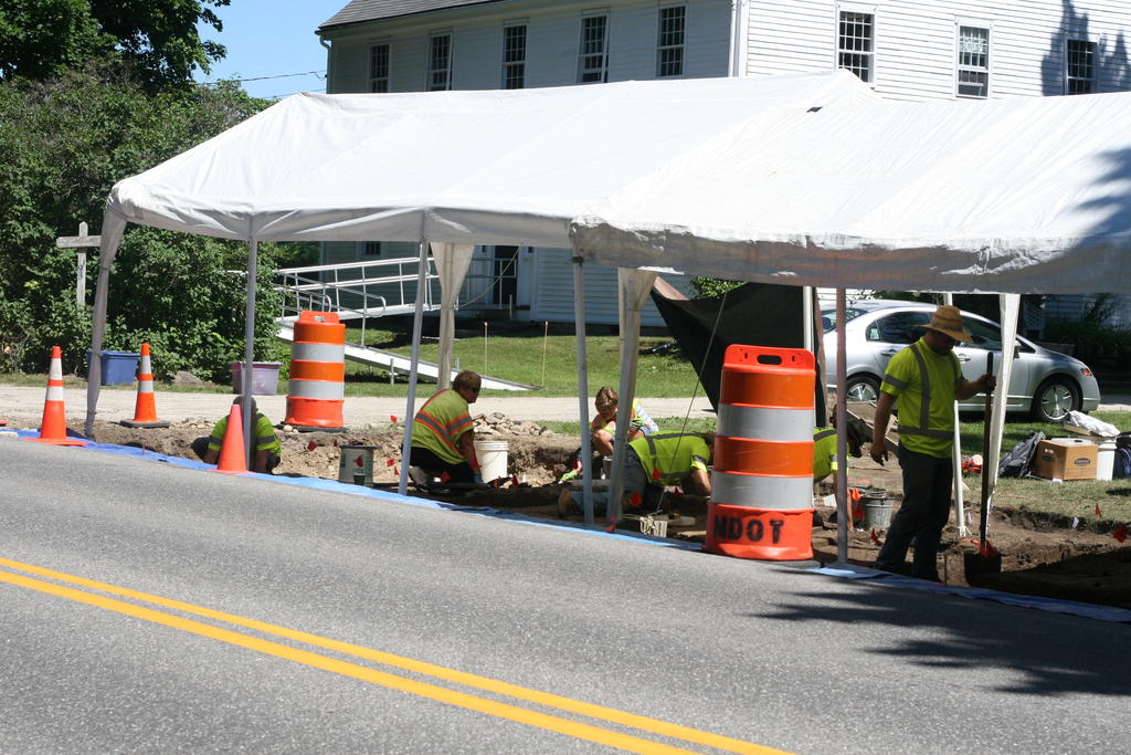
Archaeologists work at the Province Fort site on River Road in Windham.
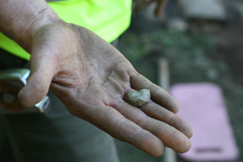
Archaeologist John Mosher holds a piece of flint he uncovered at the Province Fort site in Windham. The flint, distinguished by its sharp edges, was used in 18th-century muskets to discharge the ammunition.
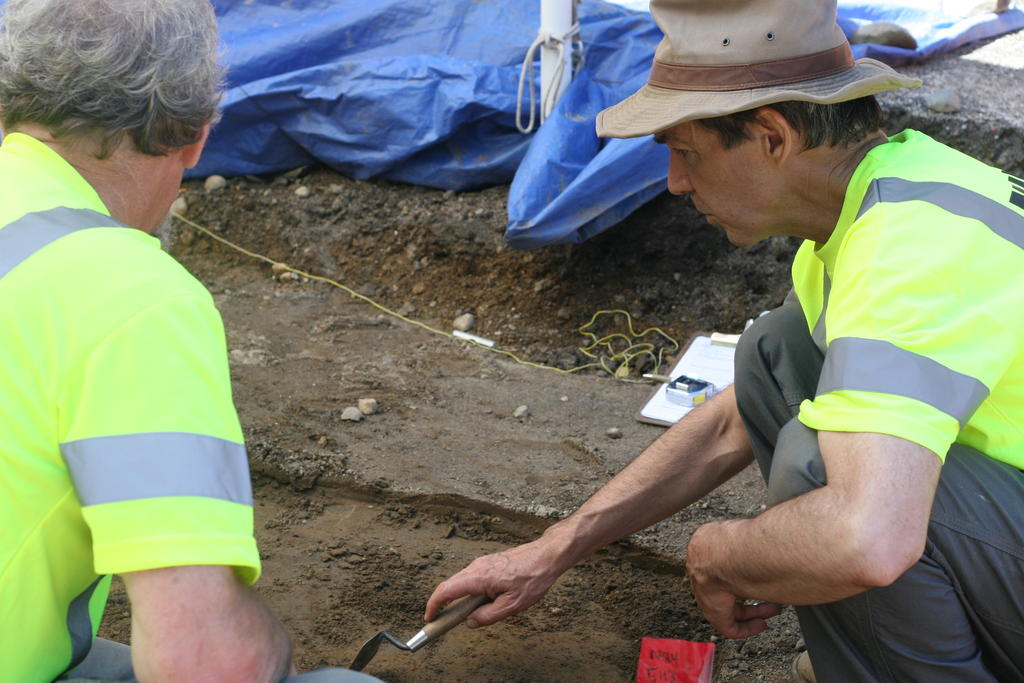
Archaeologist Leith Smith digs with a volunteer at Windham’s Province Fort site.
Comments are no longer available on this story