


This December is certainly going to go into the record books as much more typical for Maine. Portland has already seen nearly a foot of snow this month with at least a small amount more on the way for the city and larger totals expected inland.
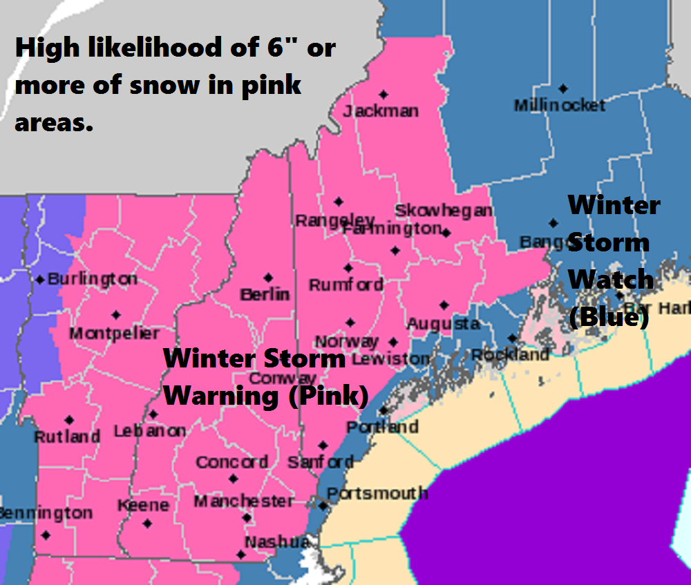
Winter storm warnings are issued when snow totals are likely going to reach or exceed 6 inches.
Any clouds this morning will quickly depart leaving us with a mostly sunny and pleasant day. Temperatures will be seasonably chilly, but certainly not very cold by winter standards.
Tonight is dry with no weather problems. Temperatures will fall to the teens and 20s – about what you’d expect for late December.
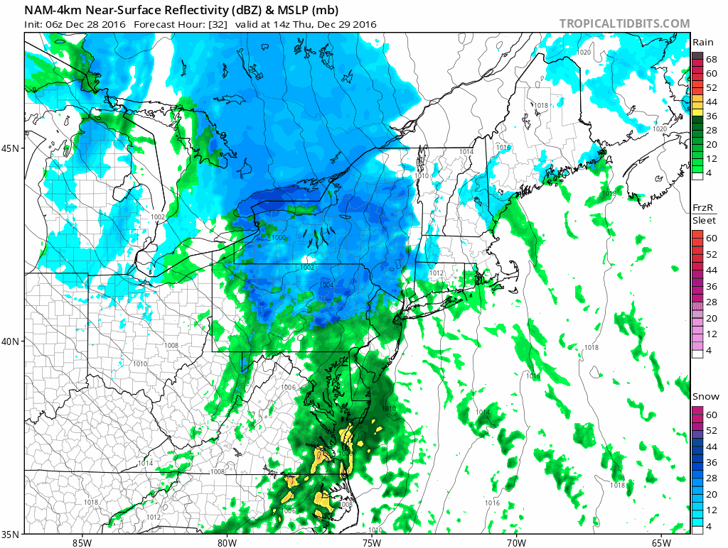
The atmosphere becomes complicated on Thursday as a storm will approach the area from the south and west. There will be enough cold air during the storm for an all snow situation in the mountains. At the coastline the snow will likely mix with and change to rain for a time before ending as snow early Friday. This fluctuation in precipitation type means much less snow for the coast from York to Bar Harbor.
A rapidly developing nor’easter will bring snow and some rain to the area Thursday into early Friday.
The challenge for me and other forecasters, is just how much cold air ends up getting back into the system as it pulls away early Friday. It’s unlikely the islands off the coast, as well as the outer peninsulas, are going to get more than a half-inch to 2 inches of snow. The areas where snowfall could be as little as that or end up with a few inches are as you approach Route 1 and points further west.
The snowfall totals you see on the map below could be off by a few inches depending on the exact evolution of the storm. If the warm air wins out, those closest to the Route 1 line will see less snow than I am forecasting right now. Of course, if the cold air holds on longer or becomes involved in the system sooner, places like Portland will see more snow than forecast.
This is what I call a high bust potential forecast for Greater Portland, Kennebunk, Brunswick and Rockland.
Ski areas will do the best out of this storm. I can easily see a 6- to 12-inch storm for skiers with more than that across the summits of Oxford, Franklin and Somerset counties.
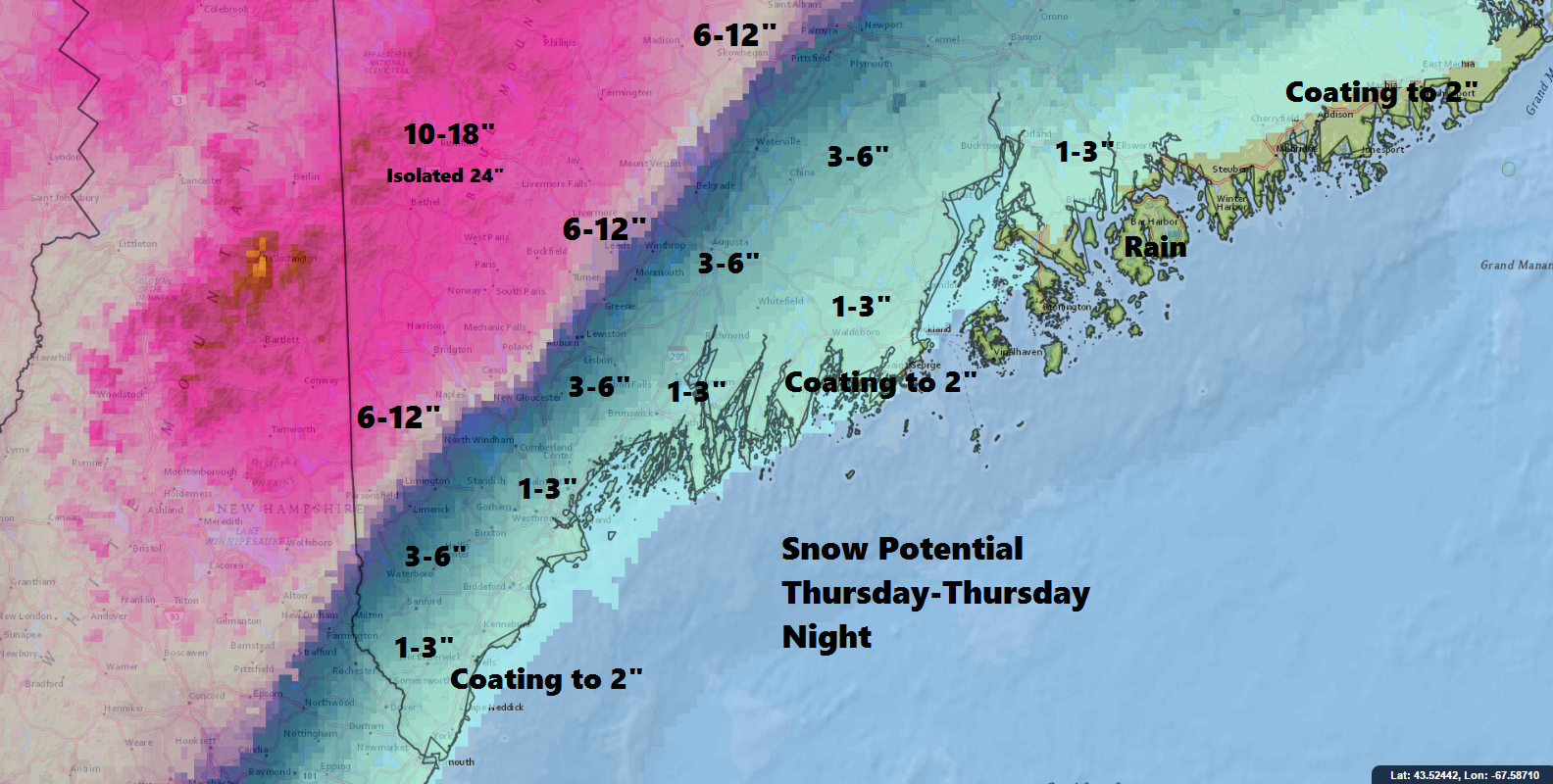
Snow will rapidly increase in depth as one moves west past the Maine Turnpike
The Thursday evening commute will be impacted the most. By Friday morning it’s generally over and improvement takes place. Those areas with 8 or more inches of snow will definitely have a slow ride to work Friday. Winds may be strong enough along with the heavy wet nature of the snow to cause some power outages in certain areas. The most likely places for this will be the foothills which will be on the line between the heaviest snow and the mix along the coast.
The system winds down on Friday with clearing skies and blustery conditions.
You can follow my weather updates on Twitter at @growingwisdom.
Copy the Story LinkSend questions/comments to the editors.

Success. Please wait for the page to reload. If the page does not reload within 5 seconds, please refresh the page.
Enter your email and password to access comments.
Hi, to comment on stories you must . This profile is in addition to your subscription and website login.
Already have a commenting profile? .
Invalid username/password.
Please check your email to confirm and complete your registration.
Only subscribers are eligible to post comments. Please subscribe or login first for digital access. Here’s why.
Use the form below to reset your password. When you've submitted your account email, we will send an email with a reset code.