

SAN FRANCISCO – Forecasters issued flash flood warnings Monday throughout the San Francisco Bay Area and elsewhere in Northern California as downpours swelled creeks and rivers in the already soggy region.
The National Weather Service said heavy rain could persist into the evening and was expected to cause flooding on the Carmel River in Monterey County and Coyote Creek in Santa Clara County.
In the San Joaquin Valley, residents were patrolling levees for signs of danger, reviewing evacuation plans and filling hundreds of sand bags as the San Joaquin River kept rising.
“Our community is pulling together like real champs,” said San Joaquin River Club resident Paula Martin, who is helping coordinate emergency plans for the private neighborhood of 800 homes.
Martin said the neighborhood has sirens in a clubhouse and church that can warn residents of impending flooding.
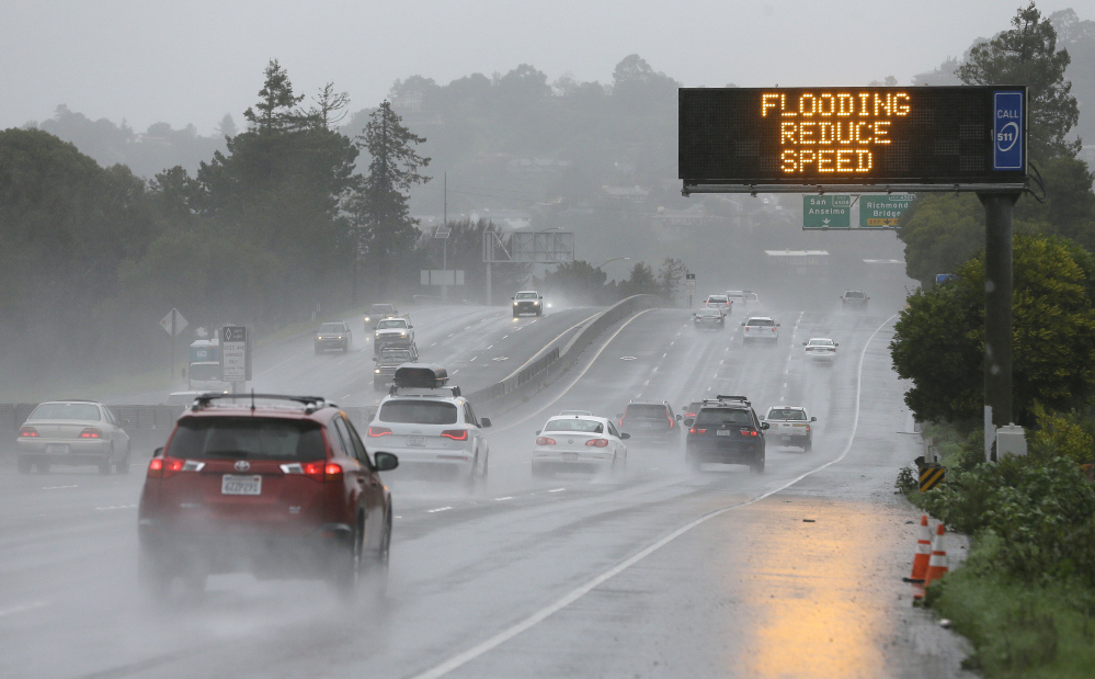
The weather service also issued snow and wind advisories, including a flash flood warning for the Soberanes burn area in Monterey County. It said winds could reach 60 mph in the San Francisco Bay Area.
Santa Cruz County had seen 2.8 inches of rain in 24 hours and could see up to 8 inches before the storm passes Tuesday. Marin County got 2.3 inches of rain while close to an inch fell in San Francisco.
Forecasters said rainfall in San Francisco has already surpassed the normal annual amount for the wet season that begins in October.
The city has logged 24.50 inches of rain since Oct. 1, said forecaster Bob Benjamin. The average rainfall for the year ending Sept. 30 is 23.65 inches.
In the mountains, the weather service forecast heavy snow in the Lake Tahoe area with a high avalanche danger until Tuesday in an area of the Sierra Nevada from Yuba Pass to Ebbetts Pass.
Forecasters say the winter storm could drop up to 5 feet of snow in areas above 7,500 feet while lower elevations could see between 8 and 24 inches of snow.
Forecasters advised motorists to avoid travel in the area through Tuesday.
Moderate to heavy rain along with snowmelt below 7,000 feet was expected to swell rivers and streams and increase the chance of flooding.
The San Joaquin River was approaching the top of levees and could remain at that level for four days, said Tim Daly, a spokesman with the San Joaquin County Office of Emergency Services.
“When the water gets that high and more water is coming, there is just too much pressure and levees can break,” Daly said. “They can be topped.”
The Don Pedro reservoir, which captures water from the Tuolumne River, a key tributary of the San Joaquin, was at 97 percent capacity.
The weather service also issued flash flood warnings for the North Bay and Monterey areas as well as south-central Alameda County and southeastern Santa Clara County.
The water level kept falling at Oroville Dam, where a damaged spillway had prompted the evacuation of 188,000 people a week ago.
Copy the Story LinkSend questions/comments to the editors.

Success. Please wait for the page to reload. If the page does not reload within 5 seconds, please refresh the page.
Enter your email and password to access comments.
Hi, to comment on stories you must . This profile is in addition to your subscription and website login.
Already have a commenting profile? .
Invalid username/password.
Please check your email to confirm and complete your registration.
Only subscribers are eligible to post comments. Please subscribe or login first for digital access. Here’s why.
Use the form below to reset your password. When you've submitted your account email, we will send an email with a reset code.