
The weather pattern has changed substantially from the beginning of the month. Cold air is no longer entrenched across the eastern seaboard, at least for now. There will be some colder days, but the cold is not as sustainable in this new pattern.
A large storm system will track through the middle of the country Monday into Tuesday, with the storm center moving over the Great Lakes on Tuesday. This places us firmly in the warm side of the storm. However, there will be just enough cold air to make things messy around here with a variety of precipitation types.
Steadier snow will develop Monday evening and Monday night from west to east. It will be cold enough for accumulation, even near the coastline, Monday night.
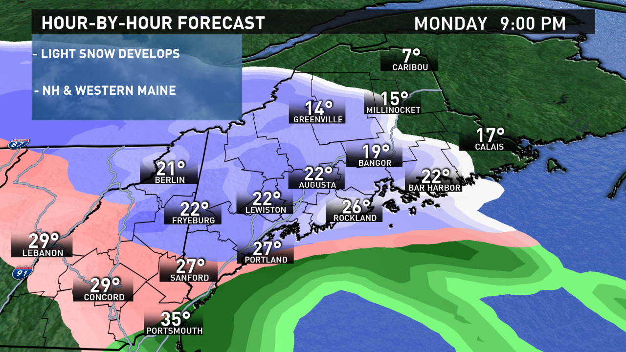
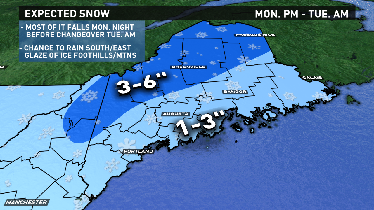
Most of the accumulating snow will occur overnight Monday night. A flip to an icy mix and even rain will occur by sunrise Tuesday.
Before the changeover, 1 up to 3 inches of snow accumulation in southern and central Maine. In the mountains, foothills and far north, 3 up to 6 inches of snow may fall.
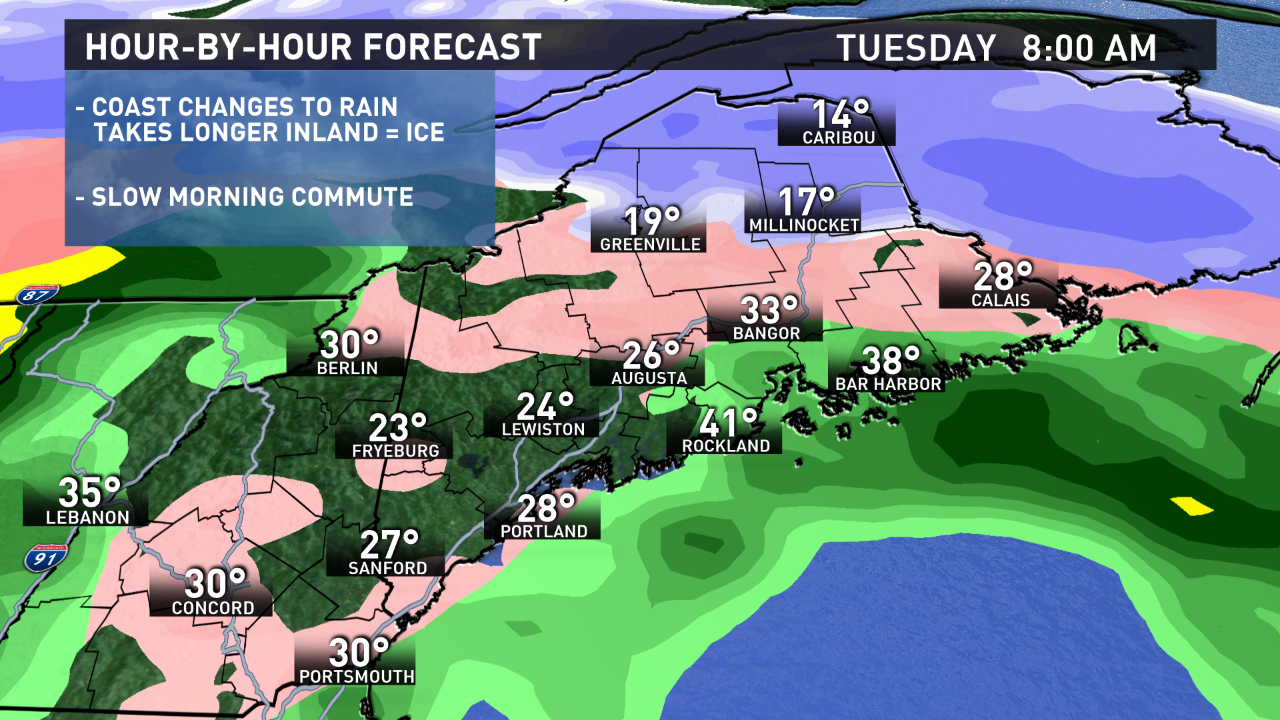
During Tuesday morning, milder air will move in aloft, changing any snow to sleet and freezing rain. Warmer air will take over at the surface, quickly transitioning the coast and eastern Maine from ice to plain rain. However, it will take longer for the temperature to rise above 32 degrees across the interior and mountains. There may be a few hours of freezing rain during the middle of the day Tuesday, that can produce a light glaze of ice. .
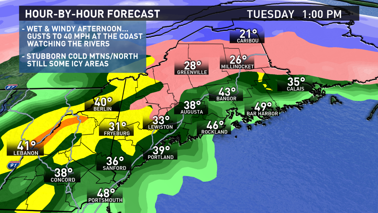
Rain will continue in southern and central Maine Tuesday afternoon, and it will fall heavily at times. Over an inch of rain is possible.
In the “warm sector” near the coast, where temperatures rise well into the 40s, wind gusts over 40 mph out of the south-southeast are possible Tuesday afternoon. The wind should not be strong enough for any substantial power outages, but it will be noticeable.
In addition, we’ll be watching the rivers for ice jams to redevelop.
The milder air, snow melt and rainfall is not a good combination. The Saco, Kennebec, and Penobscot are of particular concern. Ice jams may begin on Tuesday and may not settle until later in the week.
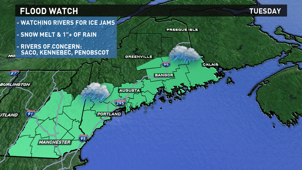
These jams can occur quickly, causing flooding in vulnerable areas along the river.
The storm moves out by Wednesday morning. It’ll clear out and cool down Wednesday. We’ll turn briefly colder for the middle of the week, then a warm-up is likely next weekend.
Comments are no longer available on this story