

I always find it fascinating when extreme temperature swings are in the forecast, especially involving record highs or lows. Unfortunately for this weekend, the record highs reinforce some warm air in the upper levels as cold drains in. In other words, ice is a big concern on Sunday.
Let’s start with Saturday. The image below shows the old records in Portland and Bangor alongside the observed high temperatures from today. Pretty impressive warmth, to say the least.
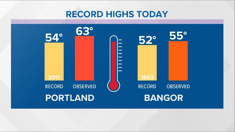
Record high temperatures on Saturday, January 11, 2020. NEWS CENTER Maine
It’s hard to believe just how quickly the cold takes over, but it wins in this situation. By Sunday morning, freezing rain and sleet will be found throughout most of Maine. Far northern Maine ends up with snow while extreme southwestern Maine sees plain rain. Here’s a model representation of what to expect through Sunday morning.
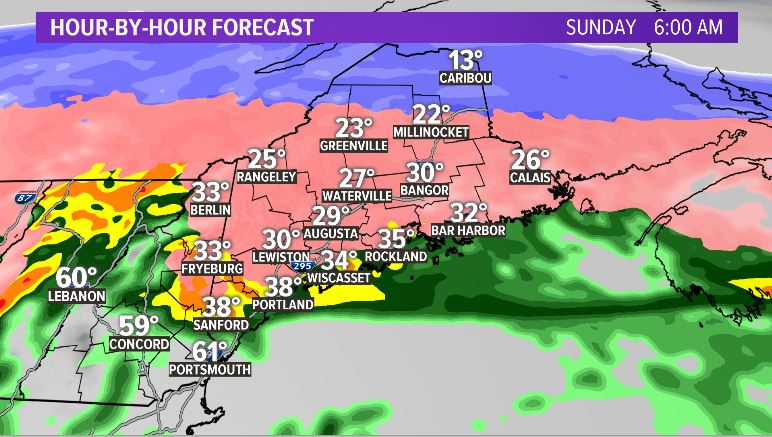
NEWS CENTER Maine
Things look active through the morning and into the early afternoon. Most will see precipitation relax heading into Sunday afternoon with completely clear conditions late in the day. For totals, take a look below.
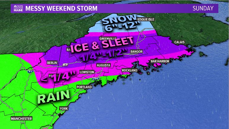
NEWS CENTER Maine
One of the biggest questions from systems like this, though, is what the numbers mean. In general, 1/4-inch to 1/2-inch tends to have some impacts, but it is not a catastrophic event. In other words, you might lose power, but this will not be like 1998.
This image helps break down what to expect out of this.

NEWS CENTER Maine
After the storm wraps up, watch out for some icy spots on the roads. Big improvements are made late Sunday and into Monday, bringing quiet conditions to start off the work week.
Get the latest on the weather by following me on Twitter and Facebook.
Send questions/comments to the editors.

Comments are no longer available on this story