

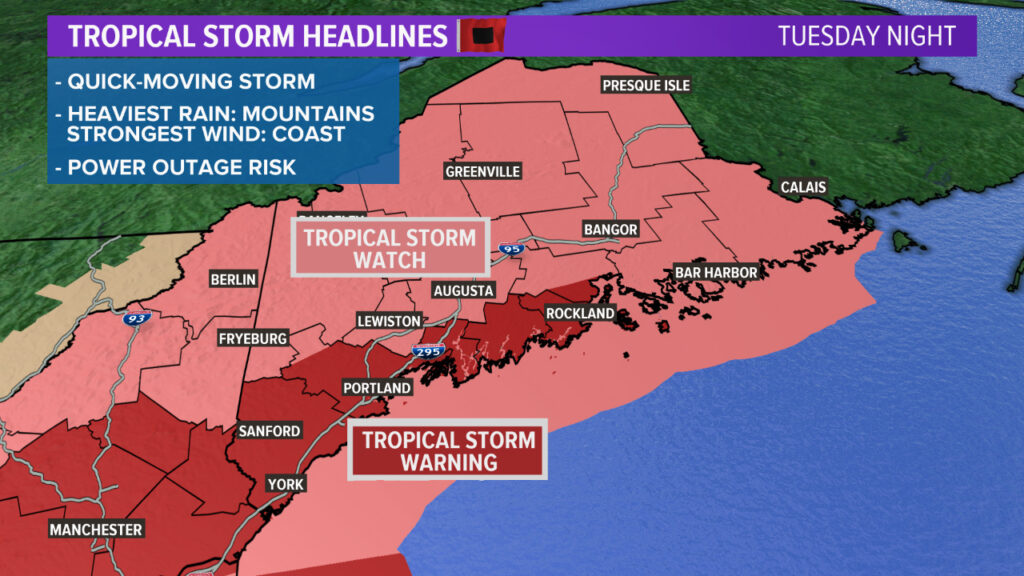
Heavy rain and some strong wind gusts are expected overnight Tuesday as a result of Isaias.
A tropical storm warning was issued by the National Weather Service for along much of the Maine coast for Tuesday night. A tropical storm watch is in effect for the rest of Maine.
Close to the coast, the winds could gust to 45-50 mph. Farther inland, expect 35-45 mph gusts.
The mountains could end up with 2 to 4 inches of rain, while inland will receive more like 1 to 2 inches, and at the coast, there will likely be under an inch.
Isaias will impact us mostly between the hours of about 9 p.m. Tuesday and 4 a.m. Wednesday.
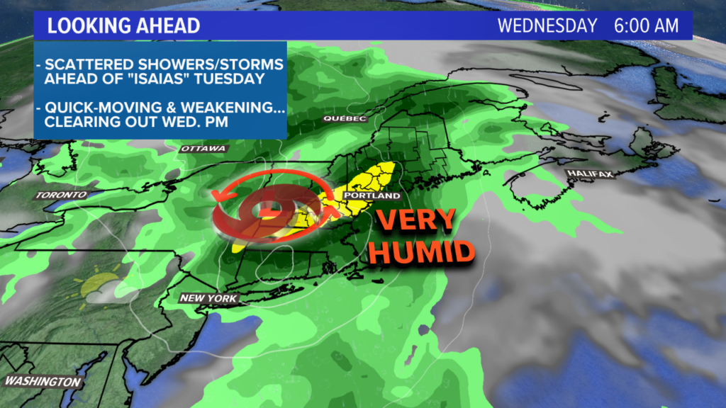
Tuesday will start off with overcast skies and a handful of showers. Moisture steadily builds in, allowing showers to continue through the afternoon. There will be some dry time mixed in between showers.
By the late afternoon, steadier rain starts to move in. This moisture is going to be pulled in ahead of Isaias.
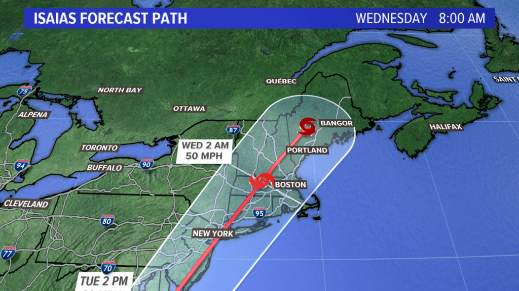
The forecast takes Isaias right over Maine. NEWS CENTER Maine
The forecast takes the storm up through New England. There are still a couple of possibilities in its track.
There are still some changes in the final track that will have an impact on what we see. NEWS CENTER Maine
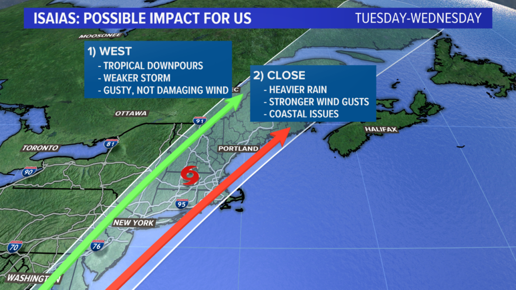
A more inland track will result in a weaker storm overall. This would mean wind gusts will be on the weaker side, though we still would see tropical downpours.
Track two, which would push the center of the storm a bit closer to us, could have bigger impacts. Wind gusts would be a bit stronger, and there would likely be some coastal issues with rough surf and strong rip currents.
The heaviest rain is likely overnight Tuesday into Wednesday. NEWS CENTER Maine
With so much moisture to work with, some localized high water is possible. Widespread flooding is unlikely due to the recent drought conditions. Scattered power outages are possible.
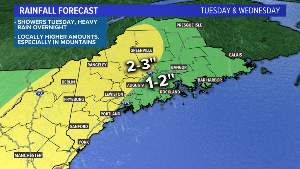
A widespread 2-3″ is expected with some locally higher amounts mixed in. NEWS CENTER Maine
My current thoughts on rain are a widespread 1-3″ with some locally higher amounts in the mountains. This map is going to change a bit as we get the exact track of the storm figured out. If it ends up swinging further west, these amounts will be lower. Further east, these amounts will climb. These are the rain totals for all of Tuesday and Wednesday, including the showers Tuesday morning.
As a quick note, any rogue thunderstorms will have to be watched. There is a very small threat for a severe thunderstorm to get mixed in Tuesday. The chances are low, but there is ample wind shear, so if a storm forms it will rotate.
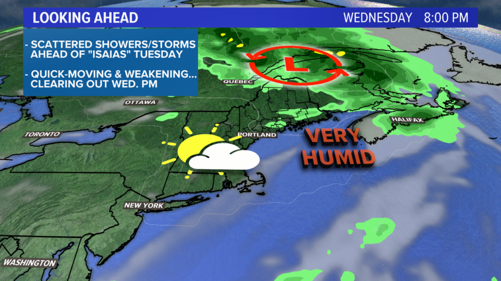
Sunshine is possible Wednesday evening. NEWS CENTER Maine
As the storm speeds up and moves away from Maine, sunshine returns. There could be a few breaks of sun as early as lunch Wednesday, though chances will increase later in the evening.
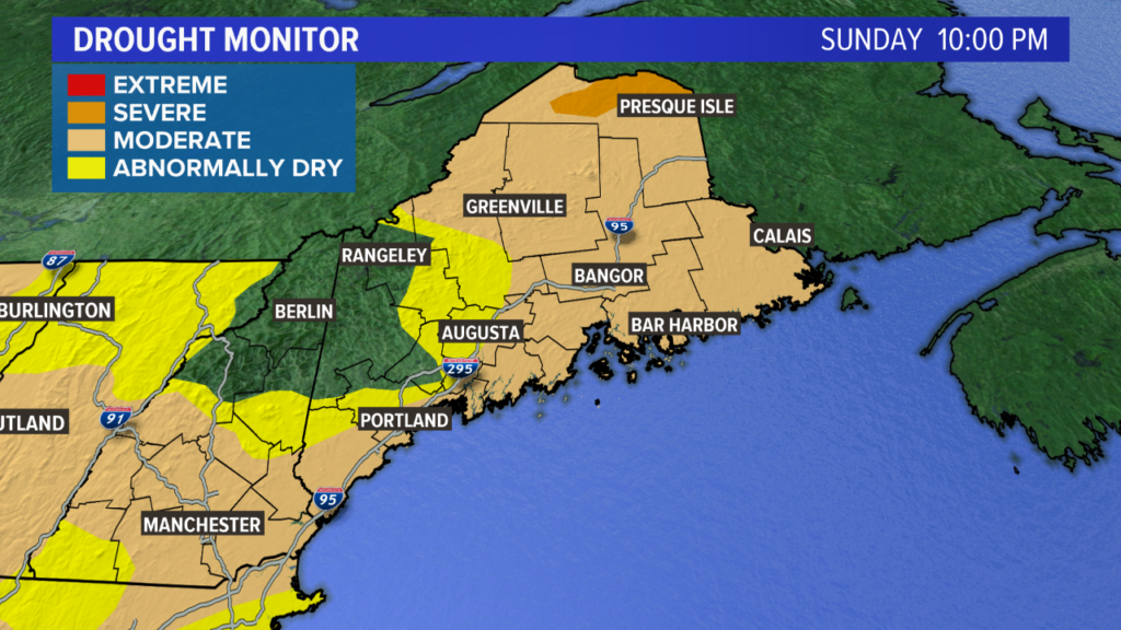
This drought monitor should look a bit different next update. NEWS CENTER Maine
The incoming soaking rain will put a decent dent in our rain deficit. Drought conditions are still found through the majority of Maine.
Beyond that, the remainder of the week looks pretty nice. Sunshine returns and there will be more and more comfortable days mixed in by the weekend.
For the latest, follow me on Twitter and Facebook.
News Center Maine meteorologist Jessica Conley contributed to this report.
Copy the Story LinkSend questions/comments to the editors.

Success. Please wait for the page to reload. If the page does not reload within 5 seconds, please refresh the page.
Enter your email and password to access comments.
Hi, to comment on stories you must . This profile is in addition to your subscription and website login.
Already have a commenting profile? .
Invalid username/password.
Please check your email to confirm and complete your registration.
Only subscribers are eligible to post comments. Please subscribe or login first for digital access. Here’s why.
Use the form below to reset your password. When you've submitted your account email, we will send an email with a reset code.