

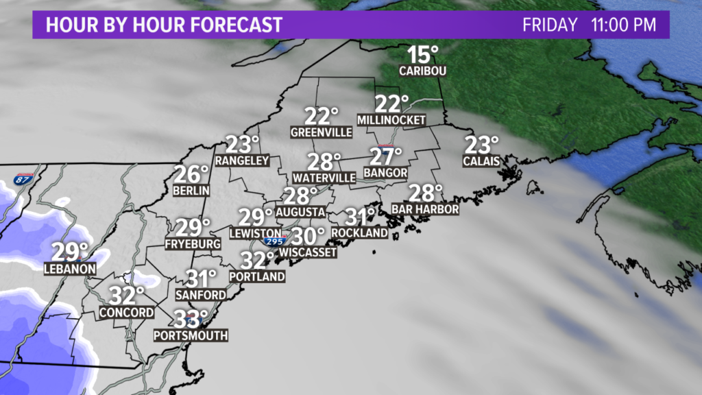
Happy New Year! The active pattern to end 2020 is continuing right into 2021. The first day of the new year actually looks pretty good, all things considered. Expect some sunshine Friday with high temperatures between 30 and 35 degrees.
NEWS CENTER Maine
Clouds move in later Friday evening. It will be a quick transition from clear skies to overcast, happening from west to east.
NEWS CENTER Maine
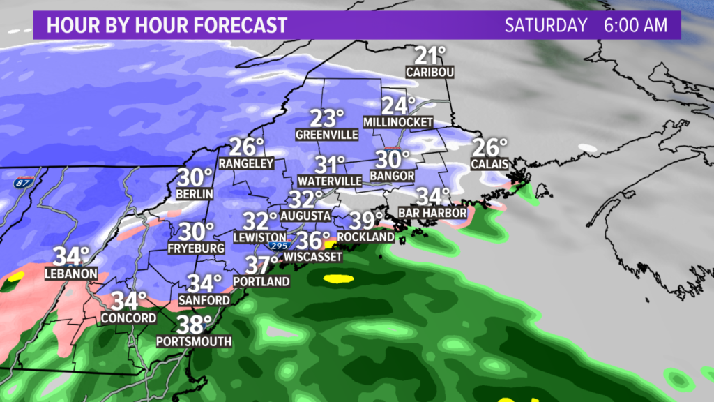
Shortly after the clouds take over, snow starts to fall. I think there will be enough cold air to support snow flakes just about everywhere on Saturday morning around sunrise.
NEWS CENTER Maine
As the showers continue, the picture becomes less clear.
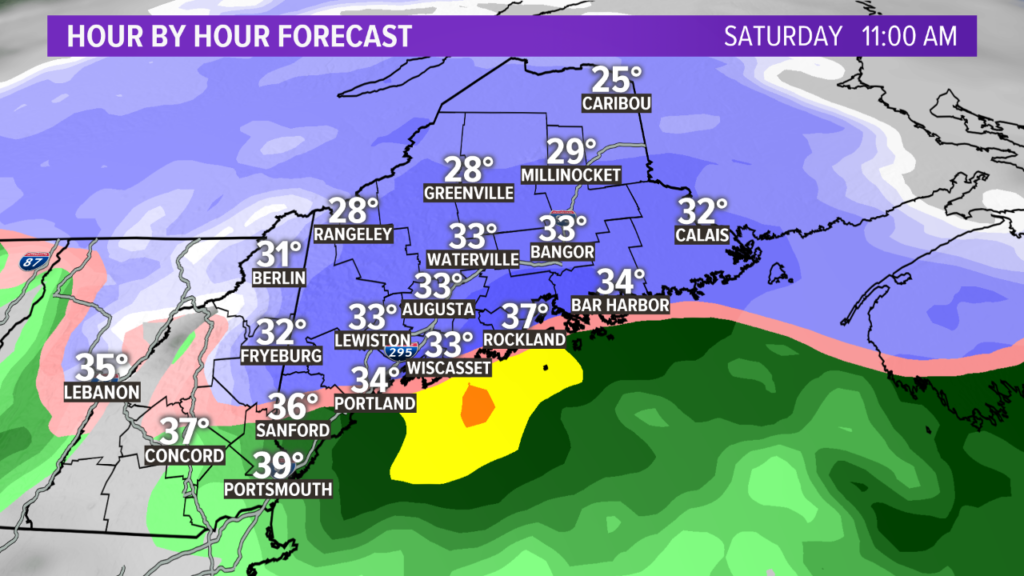
There will be some low level warmth that sneaks in through the day on Saturday. Before noon, coastal sections will start to see a mix with some sleet and plain old rain. This will cut back on totals a bit.

Clearing happens through the afternoon and evening Saturday. NEWS CENTER Maine
The mixing takes over along the coast for the rest of the day, capping snow totals early.
Inland, though, snow continues. Expect a clearing from west to east through the evening on Saturday.
NEWS CENTER Maine
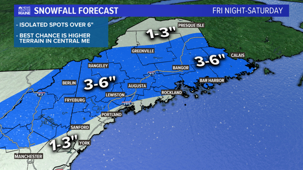
Updated snow map alert! I expanded the 3-6″ range to include all of the western mountains and also dragged it closer to the coastline.
My caveat with this map is there will be someone who sees 7″ from this. It will likely be somewhere along Route 2. I expect those 7″ reports will be pretty isolated, though, so I’m not adding a 6-8″ area.
If the trends look a little more promising by Friday evening, I’ll add it in.
Another one Monday?
I’m still watching Monday closely. Here’s the latest trend from the American weather model.
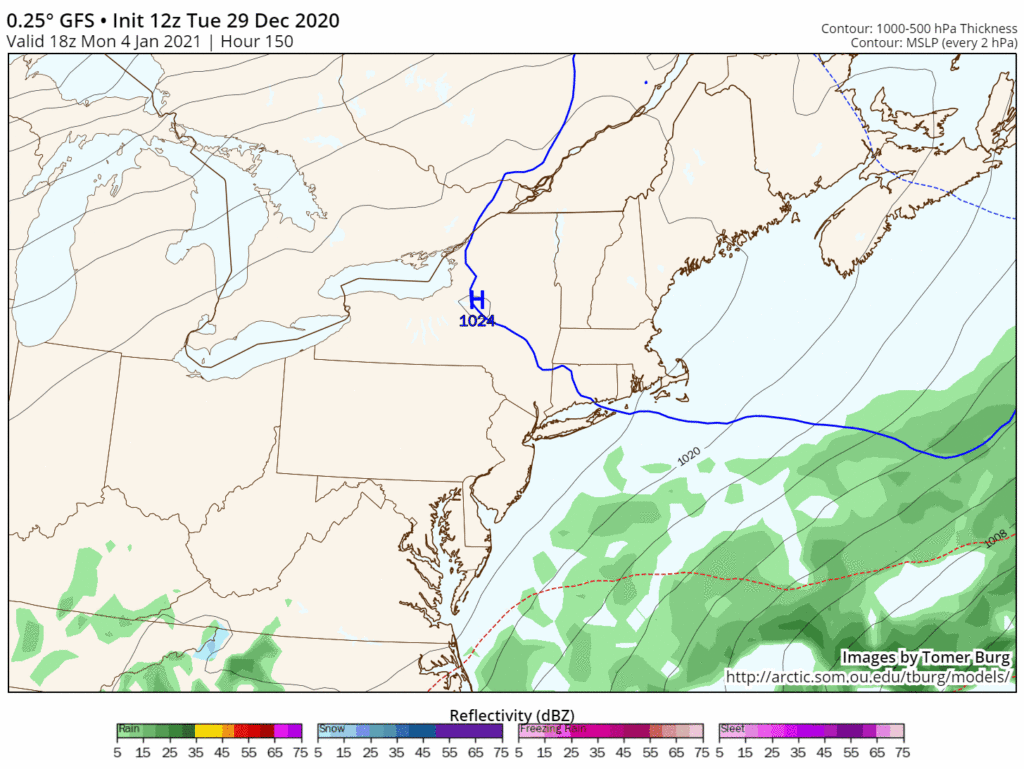
The first frame is the oldest model run; the last frame is the newest. This model shows a northwest trend with the storm. Tomer Burg, @burgwx
Note that the last frame, which is the most recent model run, has the storm coming in a little bit more slowly. This could spell out a better chance for snow, if it verifies.
I’m hesitant, though, because other models keep the storm away from us and kick it out to sea!
We just have to wait another day or two for more data before we can figure out the storm track and therefore the potential snow or rain.
Stick with me here or on my Twitter, @MikeSliferWX.
Send questions/comments to the editors.

Comments are no longer available on this story