

AUGUSTA — Much of Maine was under a flood watch Monday, with between 1 and 3 inches of rain forecast to fall statewide through Wednesday.
Central Maine was expected to get hit the hardest, with the heaviest rains likely causing minor flooding in Augusta, Hallowell, Gardiner and other areas, said meteorologist Tom Hawley of the National Weather Service in Gray. At the same time, strong winds could cause problems along the southern Maine coast, Hawley told The Associated Press.
The weather service put Kennebec, Somerset, Franklin, Lincoln, Sagadahoc, Cumberland, Androscoggin, Knox, Waldo and York counties under a flood watch Sunday, saying that runoff and snow melting in the mountains could keep the threat of flooding high through Tuesday night.
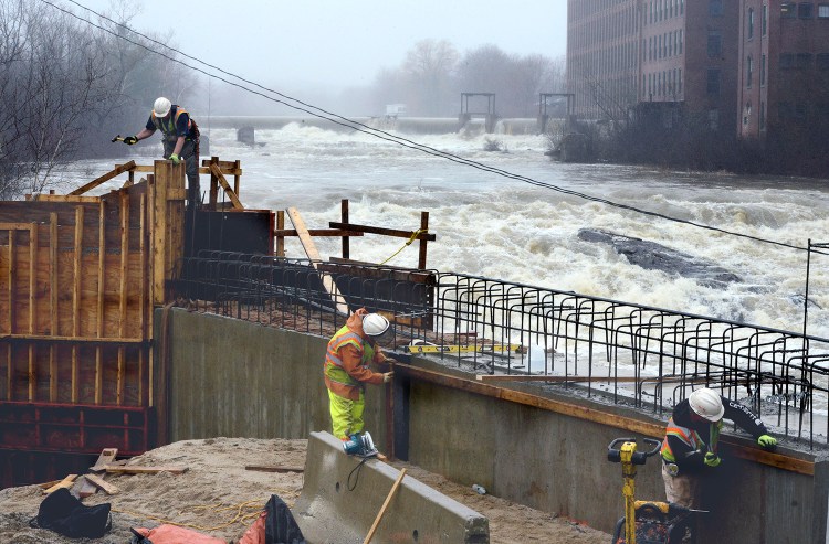
Hawley said the Kennebec River will likely get above flood stage, sending water into low-lying places such as the waterfront parking lot in downtown Augusta and Front Street in downtown Hallowell, but he said it should be “nothing major.” Minor flooding could also occur on the Androscoggin River in Auburn, he said.
Coastal flood watches are in effect from York to Washington counties.
“We are in the middle of some of our highest tides of the year,” Hawley told the AP. “With the wind blowing that water up on shore, there could be some coastal flooding and beach erosion.”
Forecasters have larger concerns in other parts of Maine. Near the town of Mattawamkeag in Penobscot County, the Mattawamkeag River went above flood stage on Monday morning with the minor flooding expected to last there through Wednesday.
In Aroostook County, the weather service said ice jams on the St. John River near Van Buren were starting to move. Ice jam floods have been a large problem on the Canadian side of the St. John in Perth-Andover, New Brunswick, where 200 people were evacuated as that river and another threatened to exceed their banks, according to the CBC. The evacuation order was lifted on Monday.
“We will be watching the northern rivers in particular very closely to see what rise we get in the rivers as a result of the rain,” Mark Hyland, operations and response director for the Maine Emergency Management Agency, told the AP. “When you get a jump in the river elevation, that tends to create more ice jams and create bigger problems.”
Some residents in Washburn were already stuck in their homes because the roads were flooded and impassable, although that’s not unusual for this time of year, Darren Woods, director of the Aroostook County Emergency Management Agency, told the AP.
On Monday, the Kennebec River was well within its banks in low-lying spots around Augusta. Sean Goodwin, interim director of the Kennebec County Emergency Management Agency, said without high rain totals in the river’s headwaters, the river’s flood potential isn’t much of a concern. However, if between 2 and 3 inches of rain fall locally, he said he’d be worried about washouts and culvert problems along rural roads in places like Mount Vernon, Vienna and Readfield.
“We’ll start gathering information tonight and obviously into tomorrow as things progress,” he said Monday.
Copy the Story Link
Send questions/comments to the editors.

Success. Please wait for the page to reload. If the page does not reload within 5 seconds, please refresh the page.
Enter your email and password to access comments.
Hi, to comment on stories you must . This profile is in addition to your subscription and website login.
Already have a commenting profile? .
Invalid username/password.
Please check your email to confirm and complete your registration.
Only subscribers are eligible to post comments. Please subscribe or login first for digital access. Here’s why.
Use the form below to reset your password. When you've submitted your account email, we will send an email with a reset code.