


Unseasonably warm weather last month gave Maine an early spring, and an early fire season.
Since the first week of March, firefighters across the state have battled nearly 50 wildfires. Although the risk for fires is predicted to be moderate today, the danger is expected to be high on Thursday for nearly all of Maine.
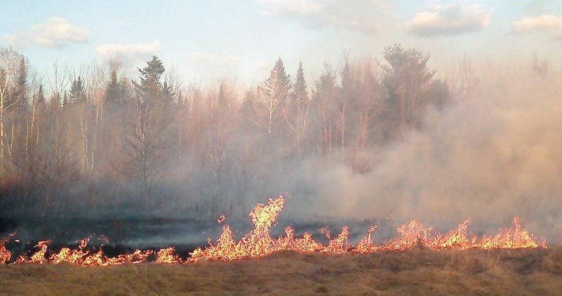
Additional Photos
This week, firefighters have fought more than a dozen blazes, said Lt. Jeffrey Currier, a ranger with the Maine Forest Service.
In Clinton, forest service rangers and the fire department responded Monday night to a wildfire off Route 100, Currier said. The fire burned about six acres of grass and brush before it was extinguished an hour later. The cause of the blaze is still under investigation. Three juveniles have been questioned.
“Whether it was accidental or intentional, we’re not quite there yet,” he said.
Firefighters in Gardiner and Readfield were called to extinguish wildfires Tuesday, while firefighters in Augusta have dealt with two brush fires in recent days.
“This is typically the worst time of year, until stuff starts to green up,” said Augusta Fire Battalion Chief Daniel Guimond.
Guimond’s department was called to 648 West River Road around 3 p.m. Saturday after a permitted burn went out of control. The fire, which took about 90 minutes to extinguish, burned about an acre of field. The homeowner was cited for not controlling his burn.
The department checks the state’s fire danger map every morning to determine whether to allow people to burn.
Currier said Maine has two fire seasons. The first typically runs from April through May. Then, in July, fire danger creeps up again and lasts through October.
The spring fire season has less potential for widespread damage, but it’s more volatile, Currier said. Wooded areas typically remain wet through the spring, so the fire danger is mostly confined to grass and brush — areas that dry out quickly.
But spring wildfires can break out one day after rainfall; summer fires usually don’t start less than 10 days after rain.
Currier said the forest service draws data from 12 weather stations across the state twice a day. The information is fed into a computer that calculates fire ratings from low to moderate, high, very high or extreme. The calculations also estimate how quickly a fire would spread, by number of feet per hour.
“We don’t want the public to think we’re looking out the window and pulling these (ratings) out of a hat. We actually have scientific data to go with it,” he said.
Kennebec Journal Staff Writer Craig Crosby contributed to this report.
Morning Sentinel Staff Writer Ben McCanna can be contacted at 861-9239 or at: bmccanna@centralmaine.com
Send questions/comments to the editors.

Success. Please wait for the page to reload. If the page does not reload within 5 seconds, please refresh the page.
Enter your email and password to access comments.
Hi, to comment on stories you must . This profile is in addition to your subscription and website login.
Already have a commenting profile? .
Invalid username/password.
Please check your email to confirm and complete your registration.
Only subscribers are eligible to post comments. Please subscribe or login first for digital access. Here’s why.
Use the form below to reset your password. When you've submitted your account email, we will send an email with a reset code.