

TOKYO — Concrete rubble litters streets lined with shuttered shops and dark windows. A collapsed roof juts from the ground. A ship sits stranded on a stretch of dirt flattened when the tsunami roared across the coastline. There isn’t a person in sight.
Google Street View is giving the world a rare glimpse into one of Japan’s eerie ghost towns, created when the March 2011 earthquake and tsunami sparked a nuclear disaster that has left the area uninhabitable.
Additional Photos
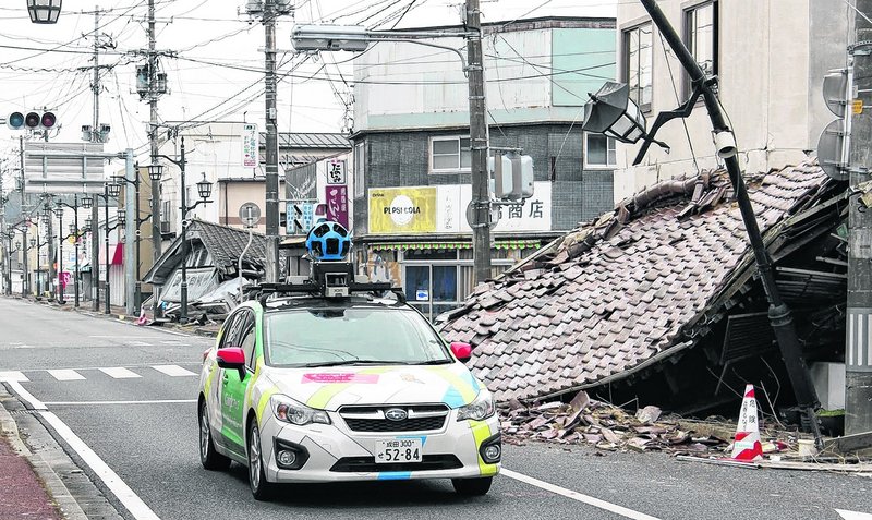
The technology pieces together digital images captured by Google’s fleet of camera-equipped vehicles and allows viewers to take virtual tours of locations around the world, including faraway spots like the South Pole and fantastic landscapes like the Grand Canyon.
Now it is taking people inside Japan’s nuclear no-go zone, to the city of Namie, whose 21,000 residents have been unable to return to live since they fled the radiation spewing from the Fukushima Dai-ichi nuclear power plant two years ago.
Koto Naganuma, 32, who lost her home in the tsunami, has only gone back once, a year ago, and for a few minutes.
“I’m looking forward to it. I’m excited I can take a look at those places that are so dear to me,” she said. “It would be hard, too. No one is going to be there.”
Street View was started in 2007, and now provides images from more than 3,000 cities across 48 countries, as well as parts of the Arctic and Antarctica.
Copy the Story Link
Send questions/comments to the editors.

Success. Please wait for the page to reload. If the page does not reload within 5 seconds, please refresh the page.
Enter your email and password to access comments.
Hi, to comment on stories you must . This profile is in addition to your subscription and website login.
Already have a commenting profile? .
Invalid username/password.
Please check your email to confirm and complete your registration.
Only subscribers are eligible to post comments. Please subscribe or login first for digital access. Here’s why.
Use the form below to reset your password. When you've submitted your account email, we will send an email with a reset code.