


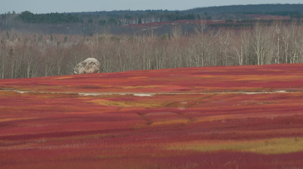
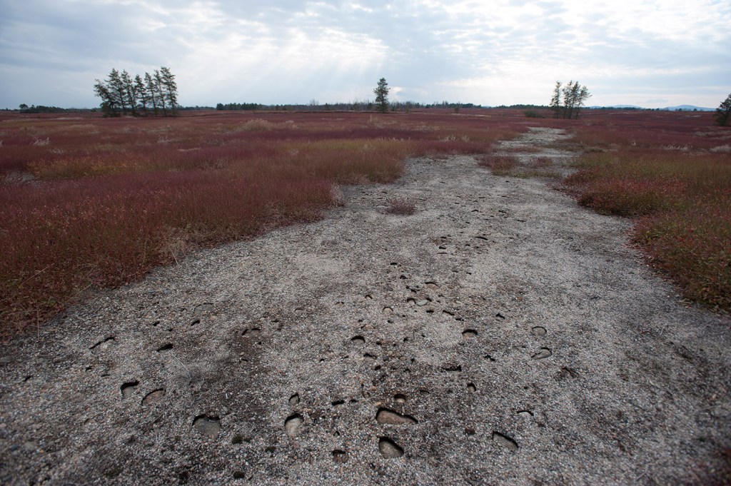
CHERRYFIELD — Some people drive across the blueberry barrens along the Down East coast and see brilliantly colored fields, scattered white boulders and the kind of wild, rolling brush found in framed photographs.
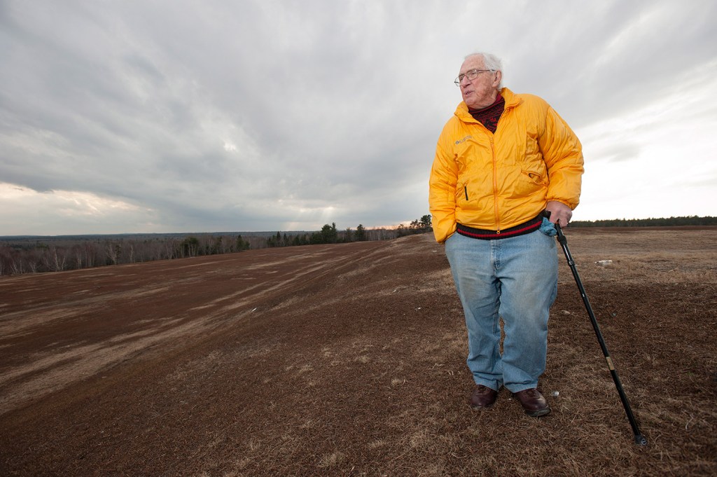
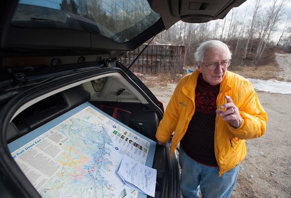
Hal Borns sees an ice sheet, two miles high, that once stood there more than 15,000 years ago. And the founder of the University of Maine’s Ice Age Trail is determined to see a new tourist destination here, as well.
Borns, also the founder of the university’s Climate Change Institute, created the Down East Ice Age Trail several years ago to document the path of the last large ice sheet to rake across North America.
“Maine’s Ice Age Trail: Down East” is a mapped trail following the path of the ice sheet that retreated northward in Washington and Hancock counties before melting and leaving depressions in the ground; silt-and-gravel ridges; and strange, large boulders in fields.
Funding from the National Science Foundation allowed the university to print maps of the self-guided glacial trail. And for the past few years Borns has led tours of the trail for outdoor groups such as Maine Audubon and Eagle Hill Institute, a natural-history learning center in Washington County.
At the age of 87 and with a newly rebuilt knee, Borns is not done.
The professor emeritus wants to put the Ice Age Trail on Vacationland’s map, with signed stops and informational panels to draw visitors to two of the nation’s poorest counties. And he wants a video that’s in the works to be used in Down East grade schools.
“The Schoodic peninsula has granite signs explaining the region. I’d like to see something like that,” said Borns, whose license plate reads “ICE AGE.”
“The geology is part of the economy here. It’s why there is clam digging and blueberry fields. Kids should have a sense of this place. This thing should be in the school systems.”
The dramatic shift of the ice sheet, he said, created the unique geological features found in Maine today.
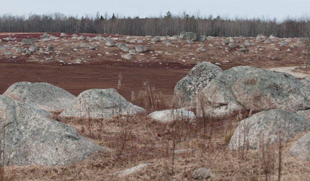
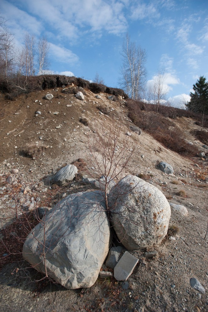
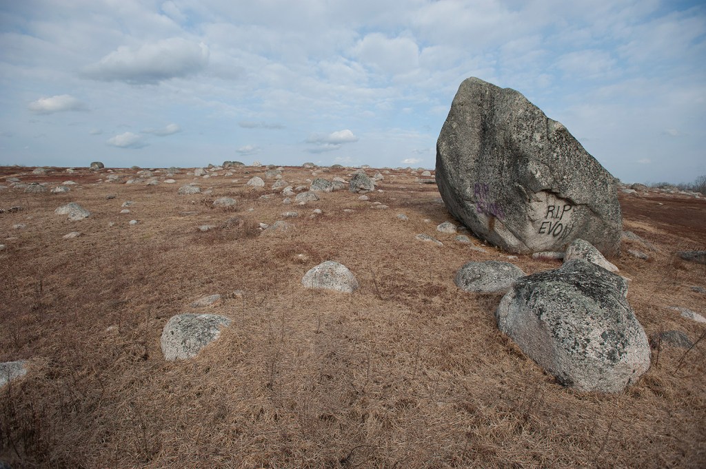
The large 15-foot-high boulders in Down East blueberry fields were “plucked up” by the ice sheet farther inland and dropped near the coast thousands of years ago. Eventually as the ice sheet advanced forward, it melted from the back, and as the climate warmed, the unique features were left behind.
Clear evidence of the ice sheet runs from New Hampshire up to New Brunswick, Borns said. Examples of it are abundant Down East, as Borns pointed out on three recent tours.
“It’s like he’s reading the landscape, interpreting it,” said Judy Marten of the Androscoggin Land Trust, who attended Borns’ most recent group tour for the Eagle Hill Institute.
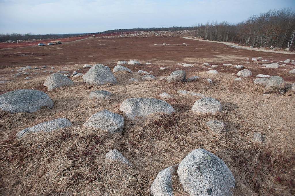
Borns brings his tour groups to the ridges that were formed when the ice sheet stopped, “like a tube of toothpaste lumps up the paste when you hold it still.” They look like dramatic small hills, but Borns explains their shape is not random.
The trail then leads to more dramatic features: a higher, more rocky ridge along a blueberry field and several wave-like hills crowned by clusters of boulders.
The trail next moves on to the ice sheet “delta,” the vast area of flat land consisting largely of sand and gravel. From here, Schoodic Mountain can be seen.
And the final stop on the Ice Age Trail is where Maine’s ice-capped land mass dropped into the ocean some 15,000 years ago, creating steep ridges beneath the water like steps to the ocean floor. These drop-offs today look like the best, steepest sledding hill you could imagine.
“The features are too uniform, it couldn’t be just random,” Marten said of the tour.
“Out on the blueberry barren, we came to what he called a ‘wave beach,’ a hill with a sharp face on one side. We went up the road, and there it was again. Then we took a turn and crossed another road and there it was, the same thing, but in different places. It was an extension of where we were at the beginning. That kind of brought it into focus for me.”
In the brochure and on the university website (iceagetrail.umaine.edu/) maps and directions to more than 40 geological features explain how the trail can be a self-guided adventure. And soon the university will offer an iPad app allowing amateur geologists to follow on a virtual walking tour.
Marten said she believes Maine’s Ice Age Trail, once signed and better promoted, will draw tourists.
“People seem to be more interested in that the past few years, the self-guided trips. We see that at the land trust,” she said.
Marilyn Mayer, the science program manager at the Eagle Hill Institute, said she can see tourists exploring Maine’s Ice Age Trail.
“He’s going to have a video going with it, which will be great. Some people don’t want to read all that information and ponder it,” Mayer said. “If this was put on more websites and Facebook pages at chamber of commerces and those sorts of groups, I think it has the potential for tourists to be interested in it.”
Copy the Story Link
Send questions/comments to the editors.

Success. Please wait for the page to reload. If the page does not reload within 5 seconds, please refresh the page.
Enter your email and password to access comments.
Hi, to comment on stories you must . This profile is in addition to your subscription and website login.
Already have a commenting profile? .
Invalid username/password.
Please check your email to confirm and complete your registration.
Only subscribers are eligible to post comments. Please subscribe or login first for digital access. Here’s why.
Use the form below to reset your password. When you've submitted your account email, we will send an email with a reset code.