
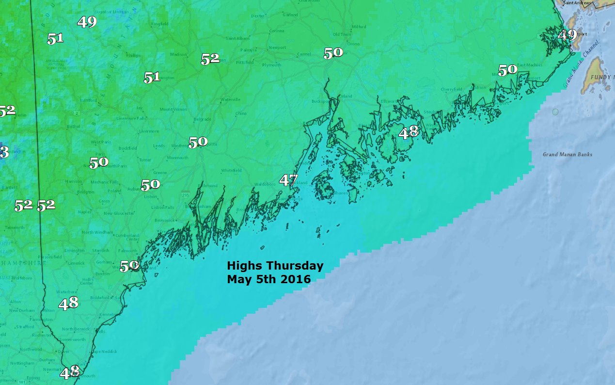
Wednesday was another very chilly and raw day. It certainly wasn’t what we’d all like in early May. On average, most of southern Maine would have seen at least one 80 degree day by now, but averages are made up of extremes, and I don’t see any 80-degree weather this year for quite a while. We’ve had 80-degree weather in March and we’ve had to wait until June to have it for the first time. This year, we will clearly be on the later side of average, at this point it’s waiting to see just how late.
Damp and chilly pattern
You are likely wondering how long this pattern is going to last and, perhaps, why it’s occurring. Weather is about balances and month after month after month, since last June, temperatures have been averaging above normal. At some point, this trend had to flip, and we are now seeing below average temperatures and a change in the pattern.
While May could end up cooler than average, it’s unlikely the next five, six, or seven months will also end up cooler than the 30-year normal.
It’s all about the atmosphere’s thickness
Without getting into Meteorology 101 too much, let me briefly explain one piece of the atmospheric puzzle: The atmosphere is not always the same thickness. In other words, if you had a very tall ladder and could climb to the top of the atmosphere around the planet, the height of the ladder you would need in each place around the globe would be different. In general, where it is colder you could get to the top of the atmosphere with a shorter ladder and where it was warmer you’d require a taller one.
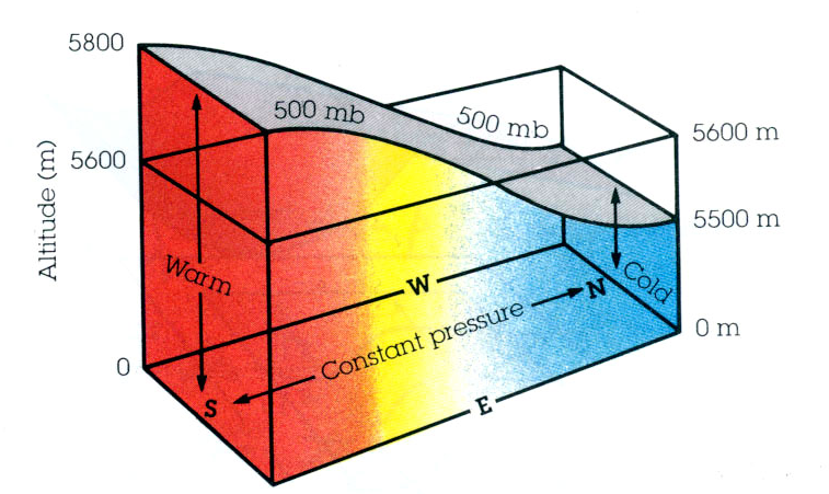
There are averages to how thick the atmosphere should be at any given time of the year and meteorologists use this data to help them forecast. When the thickness of the atmosphere is much less than average we tend to have colder weather and vice versa.
Upcoming changes
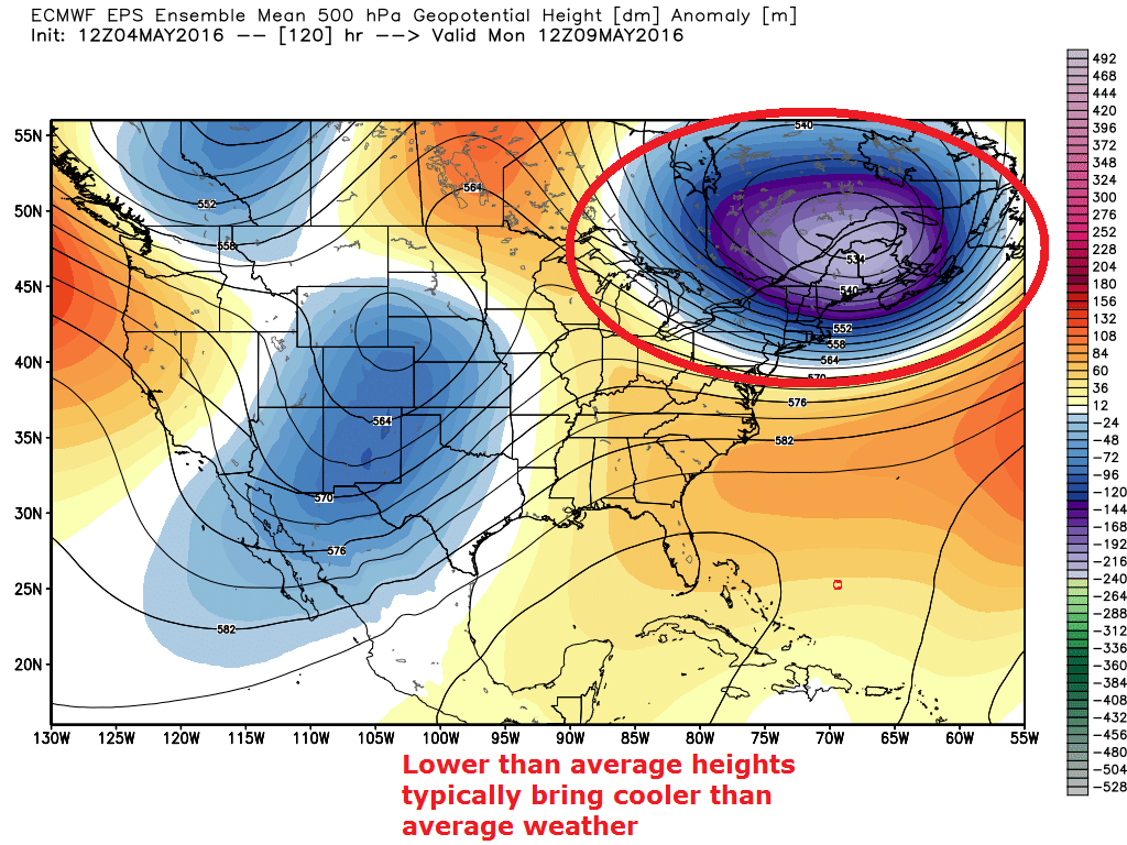
The map below shows how much above or below average the lower half of the atmosphere will be in the coming days. See all the blue over the northeast? That’s the model forecasting the atmosphere to be less thick than it would typically be in early May and you guessed it, cooler than average.
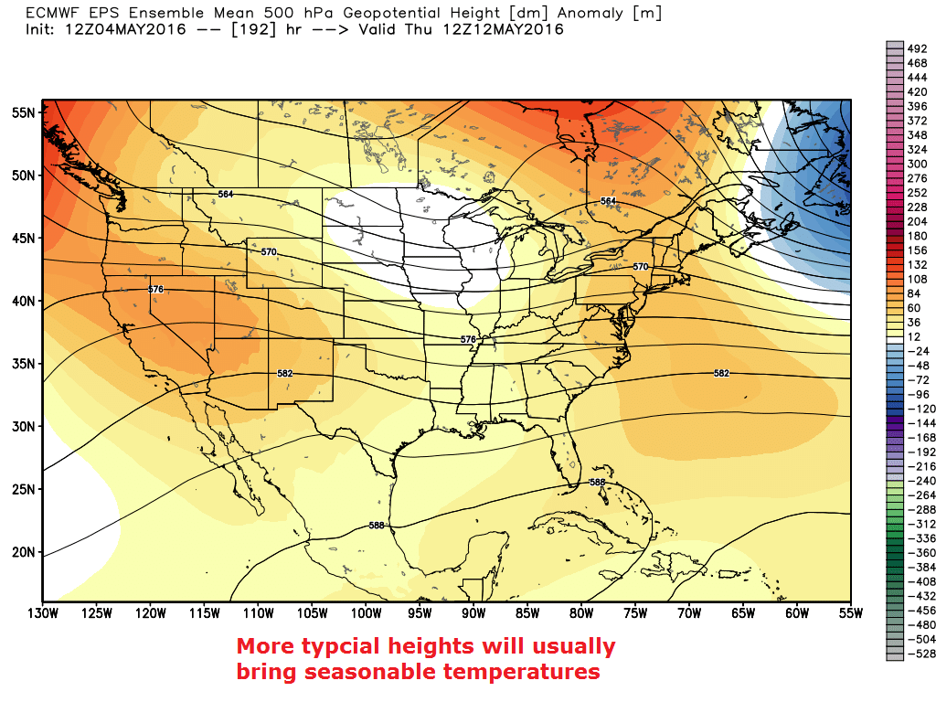
Here’s the good news, the next map is a forecast for later next week. This map shows the thickness of the atmosphere returning to a more typical mid-May state and thus a warmer trend.
The contrast between the thick and not-so-thick atmospheric areas is what creates the jet stream, and, in our case, the jet stream is allowing areas of rain or showers to reach New England every few days. That pattern is also going to continue into the weekend.
Weather is all about balance, and, for much of April, New England was on the dry side of the equation. We still have three chances of showers in the upcoming forecast: later Thursday, Friday evening, and again Sunday morning. Thereafter, it doesn’t look perfect, but certainly a bit more like the spring we are all craving.
You can follow Dave Epstein on Twitter @growingwisdom and ask any questions about the weather—and gardening, too!
Comments are no longer available on this story