

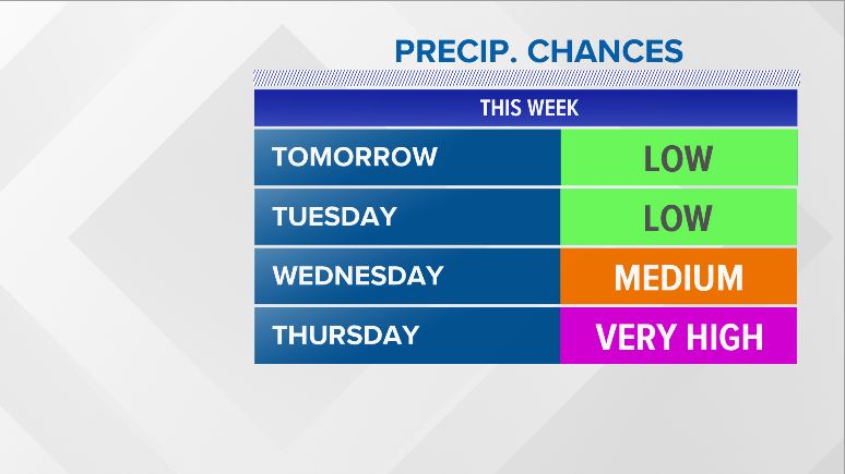
Honestly, I feel like last week lulled us into a false sense of security. The birds were chirping, high temperatures were above average, and sunshine was plentiful. We can’t let our guard down yet, though…it’s only the start of February.
The week gets stormy and unsettled by Thursday. NEWS CENTER Maine
It’s a warm start, that’s for sure. Temperatures Monday afternoon climb back into the 40s. It will be a nice day across Maine. Some snow showers will be possible in the western mountains.
Tuesday looks pretty good, too. A mix of sun and clouds will be dominant weather through the day. Temperatures do not jump quite as high as Monday, but it will still be a solid 5 to 10 degrees above average for this time of year.
Expect a few more clouds on Wednesday. A handful of showers cannot be ruled out, though most do stay dry.
Thursday is when things become a bit more interesting. As our system gets started up, snow spreads over the region on Thursday. The storm brings warmer air with it, resulting in a change to mix inland and rain along the coastline.
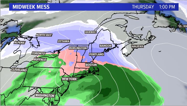
Snow on Thursday before a transition to mix and rain. NEWS CENTER Maine
As our front hangs around, a wave of low pressure forms to the west. The track of this low will have big impacts on our forecast.
What we know:
Friday will likely be an active weather day in Maine. Anything from snow to rain will be possible.
What we need to watch:
Cold air placement and storm track are the top contenders for snow or rain. With less cold north, that would favor more mixing or rain. With a further north storm track, this would also favor more mixing or rain.
We can’t write this one off just yet, and the weather will be active no matter how you slice it on Friday. We will bring you updates as the week goes on. For now, follow me on Twitter for more forecast information.
Copy the Story Link
Comments are not available on this story.
Send questions/comments to the editors.
