


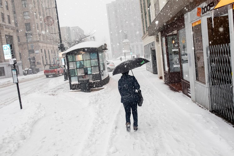
The first wave of a two-day, mixed-precipitation storm led to school closures and multiple accidents Thursday, and the Friday morning commute is expected to be difficult if not downright dangerous because of icy conditions in Greater Portland.
The biggest threat Friday is likely to be ice and sleet accumulations in Portland, said Chris Legro, a meteorologist with the National Weather Service in Gray. Legro anticipates that two-tenths to a quarter inch of ice will accumulate overnight.
“It’s not enough to bring down branches and power lines, but the roads will be slick during the Friday morning commute,” Legro said.
A wintry mix is forecast for the rest of the day in Portland, but precipitation should end by late Friday afternoon and evening, Legro said. Saturday looks to be a bright, sunny, but cold day with high temperatures reaching into the mid-20s.
“It’s definitely going to be your kitchen sink type of storm, with a little bit of everything mixed in,” he said. “But I think the worst of it will be during the morning commute.”
By the time the storm ends, coastal areas will wind up with 3 to 6 inches of snow, the National Weather Service is forecasting. The area between Fryeburg, Rumford, Waterville and Skowhegan could see 6 to 12 inches, with the mountains between Rangeley and Jackman getting buried under 12 to 18 inches of snow.
The Portland International Jetport reported 5.1 inches of snow fell Thursday, while Bangor and Caribou reported 2 and 3 inches respectively.
The Maine Legislature announced that all legislative offices will be closed Friday.
The first phase of the storm moved into the state early Thursday morning, prompting school closures and creating slippery driving conditions that contributed to multiple crashes in southern Maine. Snow-covered roads and slippery intersections slowed traffic and caused cars to slide off roads, but no major injuries were reported.
A tractor-trailer crash late Thursday morning blocked both northbound lanes of the Maine Turnpike in Falmouth. The travel lanes were reopened shortly after noon.
Reports of multiple motor vehicle crashes across the state started during the late afternoon and evening hours.
An afternoon wreck in Freeport sent at least one person to the hospital. Two cars collided near the intersection of route 136 and 125 about 2 p.m., and a person was transported by ambulance for treatment, a dispatcher said. No further information was immediately available.
A tractor-trailer jack-knifed in Amherst on Airline Road, a tractor-trailer overturned in Chelsea on River Road, a plow truck hit a utility pole in Lisbon Falls on Main Street, and there was an unconfirmed report of a fatal motor vehicle crash on Main Street in the Penobscot County town of Lincoln.
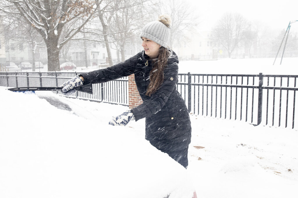
Kelsey Lambert clears the snow off of her car in the West End before heading to work Thursday morning. Staff Photo by Brianna Soukup Buy this Photo
The speed on the turnpike was reduced Thursday morning to 45 mph from the New Hampshire state line to Mile 109 in Augusta, a speed reduction that remained in effect throughout the day.
The National Weather Service issued a winter weather advisory, which will remain in effect through Friday evening for coastal and southwestern Maine. A winter storm warning is in effect for inland and northern areas, where higher snow totals are expected.
School districts across York, Cumberland, Oxford and Androscoggin counties canceled classes on Thursday, though some schools along the immediate coast remained open.
Copy the Story Link
Send questions/comments to the editors.

Success. Please wait for the page to reload. If the page does not reload within 5 seconds, please refresh the page.
Enter your email and password to access comments.
Hi, to comment on stories you must . This profile is in addition to your subscription and website login.
Already have a commenting profile? .
Invalid username/password.
Please check your email to confirm and complete your registration.
Only subscribers are eligible to post comments. Please subscribe or login first for digital access. Here’s why.
Use the form below to reset your password. When you've submitted your account email, we will send an email with a reset code.