
Memorial Day will be pretty different, depending on where you are in Maine. Along the coastline, moisture coming in off of the ocean will keep overcast conditions around during the day. Temperatures only make it into the mid to upper 50s. As you move inland, closer to Lewiston and Augusta, partly cloudy skies will push highs into the 60s. In northern Maine, most make it back above 70 degrees.
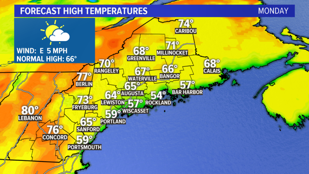
Some coastal fog will be possible again Monday afternoon or evening. Temperatures fall into the 40s statewide.
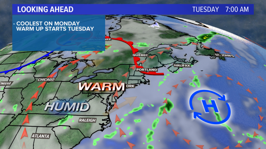
The warmer air knocks on our door for Tuesday, pushing temperatures from the 40s into the 70s. Partly cloudy skies are expected. It looks like a pretty solid May day in Maine! A sea breeze is likely in the afternoon.
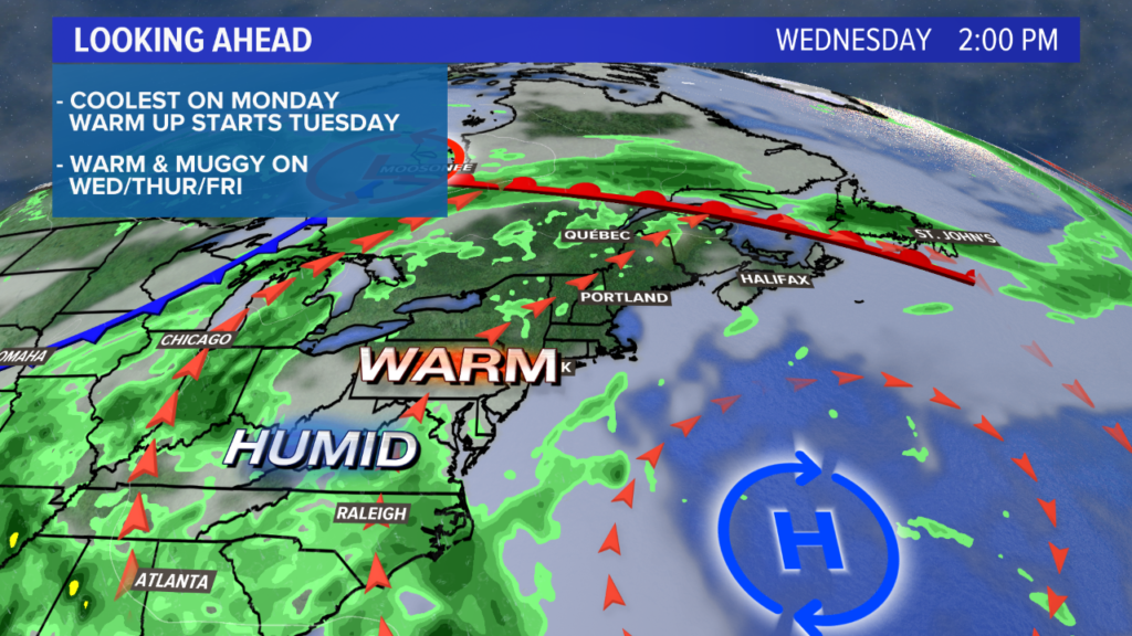
Warm and humid air builds in steadily overnight and into Wednesday. Low temperatures Wednesday morning will likely be in the 50s, setting the stage for a fairly hot afternoon. High temperatures spike into the 80s. Coastal towns will top out in the low 80s, but inland areas keep warming up and top out in the mid 80s. A stray thunderstorm is possible Wednesday, but I think a lot of us stay dry.
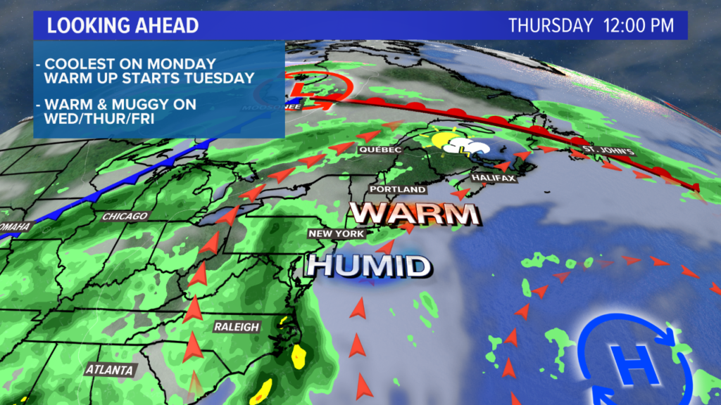
Thursday looks even warmer! High temperatures will be in the mid 80s, with some inland hot spots jumping into the upper 80s. I think some areas, especially closer to Bangor and Lincoln, could break 90 degrees. It’ll be toasty.
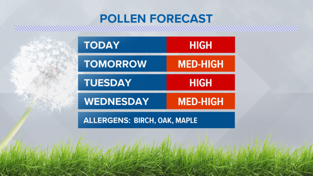
Ample heat and humidity prime the atmosphere for some scattered afternoon thunderstorms. Severe weather is unlikely, but we could really use the rain. Until then, pollen counts remain high and plants remain parched.
A cold front sweeps in on Friday. This will be our best chance as widespread showers and thunderstorms for the next week. Temperatures will still be above average for this time of year.
The weekend trends drier and cooler, but ultimately we end up back in the 70s. More details as we get closer!
Until then, follow me on Twitter and Facebook for forecast updates.
Comments are no longer available on this story