

A dynamic storm is slated for Sunday evening in Maine and New Hampshire.
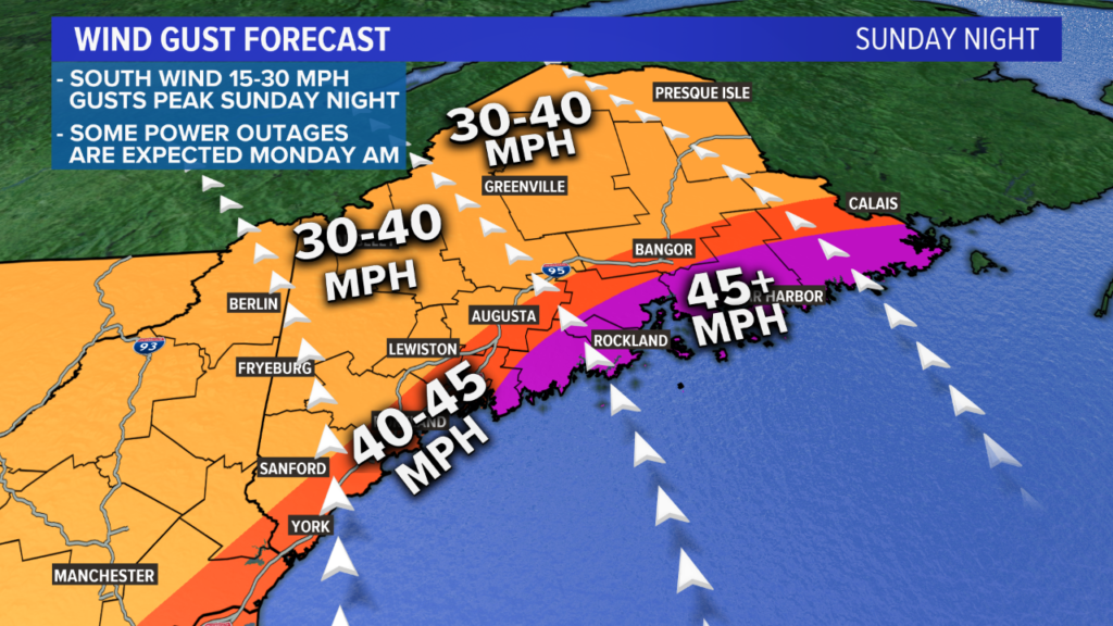
The biggest threat with this storm will be strong wind gusts. Gusts could approach 55 miles per hour along the coastline Downeast. Elsewhere, coastal sections will see gusts top out between 45 and 50 mph.
With a south or southeast wind direction and such strong wind gusts, power outages are becoming more likely by Monday morning.
The secondary threat with this storm will be a period of snow across northern and western sections of Maine and New Hampshire.
Accumulating snow is a possibility and could cause slick spots. Despite this, the wind is still a much bigger story.
Sunday Storm Setup
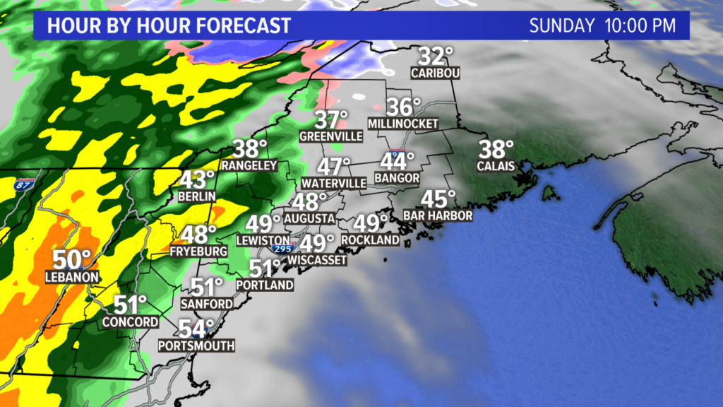
Sunday starts off fairly innocuous. There will be some clouds on the western horizon, but expect at least some sun to start the day.
By the time sunset rolls around, the storm will be intensifying to our west. Showers are likely in western Maine by this point. There could be some mixing in the valleys and some snow along the higher peaks.
NEWS CENTER Maine
The storm will continue to strengthen as it moves closer to Maine.
Wild is the Wind
David Bowie put it best when describing the forecast for Sunday night and early Monday morning.
NEWS CENTER Maine
I think the strongest gusts will be along the Midcoast and Downeast. Given the current model trends, a few gusts could approach 55 mph just after midnight on Monday morning. Otherwise, expect gusts to be near 50 mph.
The western coastline is likely to experience wind gusts between 40 and 45 mph. This will push inland into central Maine, with some strong gusts expected from Augusta to Bangor to Calais.
Note: the biggest piece of uncertainty is how far inland the 45 mph gusts will reach. Should the forecast change from here on out, it will be from moving that contour inland slightly. Be on alert for changes from Fryeburg to Lewiston and along I-95 between Augusta and Bangor.
Elsewhere in Maine and New Hampshire, the wind gusts will generally fall between 30 and 40 miles per hour.
Possible Power Problems
As with any forecast, there are pros and cons to the way the weather unfolds.
Pros:
• the trees have lost their leaves
• less lawn furniture and decoration out
All the leaves are brown, and the sky is gray.
With bare trees, wind tends to be a bit less damaging since the wind can pass through more easily. I still think power outages are in the cards for Monday morning.
It also helps that Halloween decorations have been taken down and Christmas decorations have yet to be put up.
Cons:
• wind direction
• time of day
The wind direction is the biggest issue with this forecast. Trees in New England are used to strong gusts out of the northwest and northeast.
NEWS CENTER Maine
When the wind has a southerly component to it, such as the forecast wind gusts on Sunday night, the trees are not as fit to withstand the stronger gusts.
I also mentioned the time of day because overnight storms tend to be underreported until the morning.
In other words, while impacts occur immediately, there is a lag time between reporting incidents and responding to them since most people are asleep.
The Calm After the Storm
Well, kind of, at least.
NEWS CENTER Maine
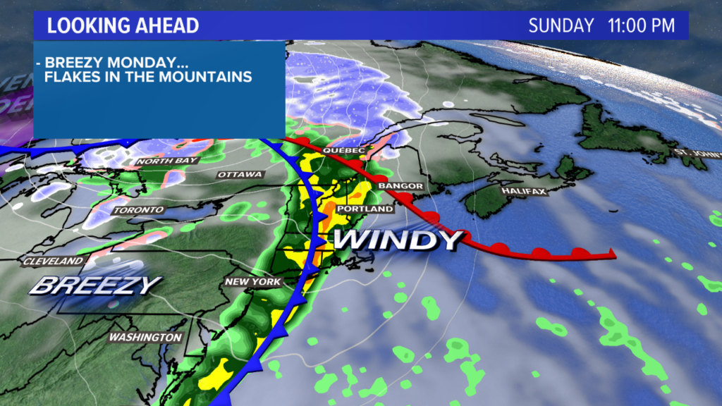
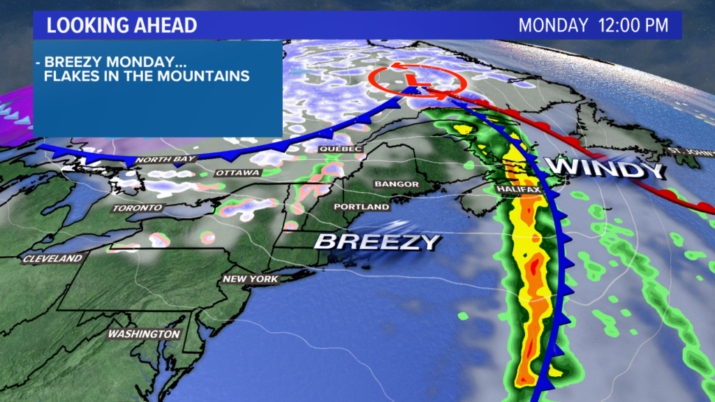
Monday will be a bit less dramatic as sunshine returns across southern Maine. Lingering flakes are possible in the mountains.
It remains blustery through the day, but wind gusts will not be nearly as stout as they will be Sunday night.
Stay informed with updated forecast information by following me on Twitter and Facebook. Make sure your devices are charged up Sunday night so you can get weather alerts if your power goes out.
Copy the Story LinkSend questions/comments to the editors.

Success. Please wait for the page to reload. If the page does not reload within 5 seconds, please refresh the page.
Enter your email and password to access comments.
Hi, to comment on stories you must . This profile is in addition to your subscription and website login.
Already have a commenting profile? .
Invalid username/password.
Please check your email to confirm and complete your registration.
Only subscribers are eligible to post comments. Please subscribe or login first for digital access. Here’s why.
Use the form below to reset your password. When you've submitted your account email, we will send an email with a reset code.