
The Ides of March are almost upon us, and a big storm slips through just before March 15th.
This storm will act as many March storms do, with some rain at the coastline and a bigger threat for snow inland.
Timing
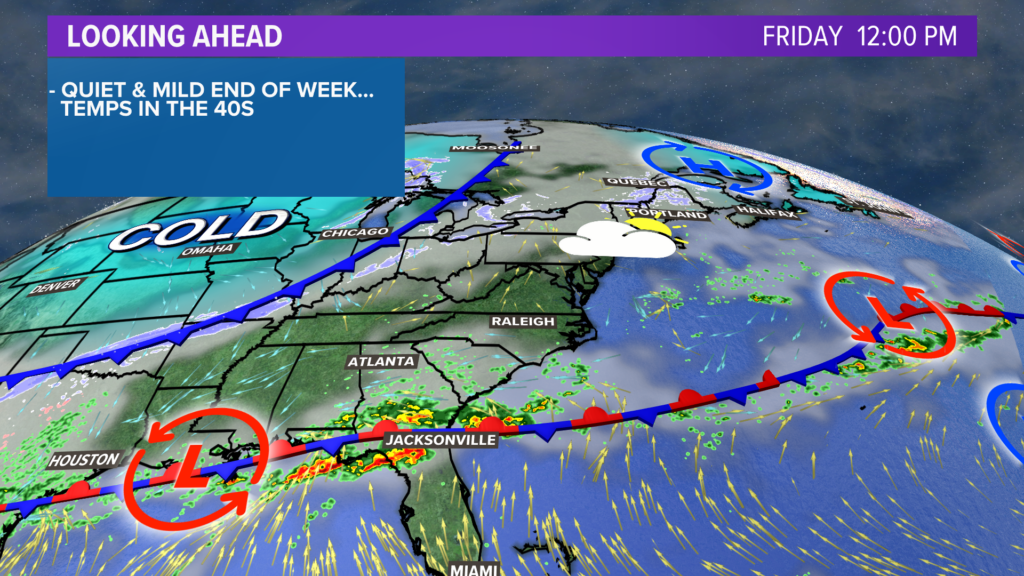
Friday in Maine will be a nice day overall. Clouds thicken up, but temperatures will be seasonably warm in the mid-40s.
Warmer air moving in will set the stage for rain, aside from the mountains and The County.
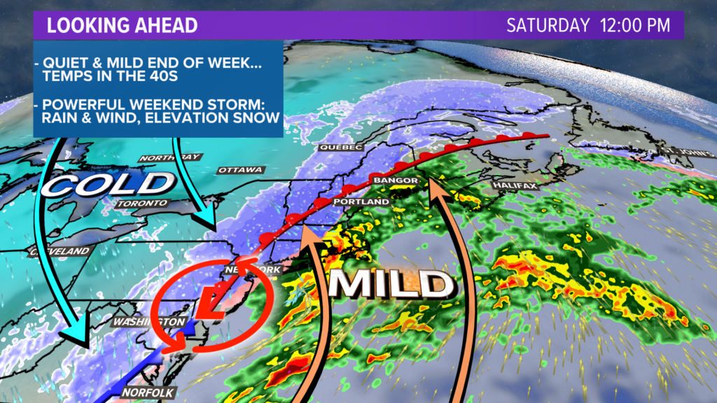
In true March fashion, a big battle of the air masses will spawn a strong storm.
Arctic air will slide into a warm air mass from near the tropics.
The result is a spectacular display of atmospheric dynamics and our resulting storm.
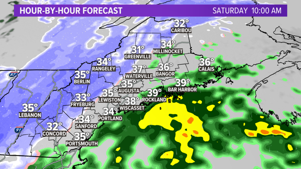
While there could be a few showers in the mountains and northern Maine on Friday, the bulk of the precipitation arrives on Saturday morning.
There could be just enough cold air for a quick burst of snow everywhere, but warmer air eventually changes over to rain at the coast and in southern spots.
Steady precipitation continues into the evening. Higher elevations will likely see the most consistent snow and, therefore, the highest totals.
Even some of the low-lying areas in western Maine will mix with rain at points on Saturday.
I will have a more detailed timeline on the storm tomorrow. Travel will be challenging across western and northern Maine for most of the day on Saturday.
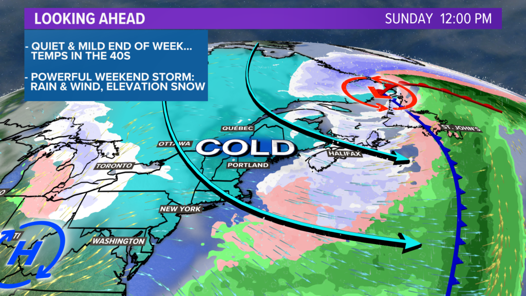
Snow showers wrap up around sunrise on Sunday. The biggest story for weather impacts on Sunday will be the wind.
High temperatures also stay in the 30s, which will be the coldest day out of the next week.
Impacts
The first question everyone wants to know is how much snow we should expect.
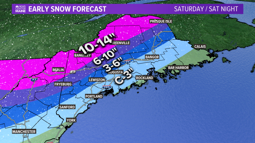
This should be a good one for the mountains. Ski mountains should be excited, as it will be a great addition to the base as the season winds down.
Central Maine sees a lot of variability in snowfall amounts. Southern areas could see as little as a coating, but further inland areas with a bit of elevation will approach a foot.
With snow only at the end of this system, the coastline will not end up with much at all.
Snow growth seems variable throughout the day. I expect a lot of the snow to be fairly wet and heavy, especially closer to the coastline.
The fluffiest powder will be across the high peaks and into the Northwest Woods.
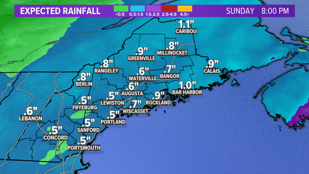
The flip side of this, of course, is that southern Maine gets hit with rain. Totals will end up near an inch. This falls in roughly 12 hours.
The ground is still frozen, so the amount of runoff is increased.
Standing water will be possible if any storm drains end up clogged with snow.
The overall flood threat from rivers looks pretty low, too. A bit of extra runoff may change that, so we will be watching closely.
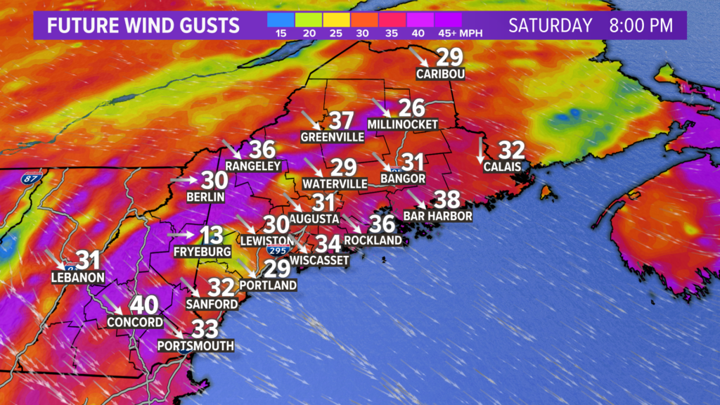
Wind will be interesting, as there are two times to watch.
Thankfully, the storm track will likely keep the strongest southerly wind gusts offshore on Saturday.
However, the first kick of northwest wind gusts on Saturday night will be fairly strong as the storm strengthens.
Through the evening, especially in the mountains, gusts will be between 35 and 45 mph.
Winds will relax for a little while overnight.

As the colder air pours in and mixes out on Sunday morning, wind gusts will spike again.
The highest are likely in the mountains, where gusts could exceed 50 mph.
Elsewhere, gusts will most likely end up between 35 and 45 mph.
Some power outages are possible both Saturday and Sunday.
Monday looks much, much nicer. Most of next week will be near or slightly above normal with a lot more sunshine mixed in.
I’ll have more over the next couple of days and especially this weekend. Follow me on Twitter: @MikeSliferWX.
– Mike Slifer
Comments are not available on this story. Read more about why we allow commenting on some stories and not on others.
We believe it's important to offer commenting on certain stories as a benefit to our readers. At its best, our comments sections can be a productive platform for readers to engage with our journalism, offer thoughts on coverage and issues, and drive conversation in a respectful, solutions-based way. It's a form of open discourse that can be useful to our community, public officials, journalists and others.
We do not enable comments on everything — exceptions include most crime stories, and coverage involving personal tragedy or sensitive issues that invite personal attacks instead of thoughtful discussion.
You can read more here about our commenting policy and terms of use. More information is also found on our FAQs.
Show less