

Kayakers approach Two Bush Island. Ron Chase photos
Two Bush Island is the most distant island in the Muscle Ridge archipelago. Located about 4 miles from Spruce Head, it’s home to historic Two Bush Island Light.
Situated near the heavily trafficked southwestern entrance to Penobscot Bay, the lighthouse was built in 1897. Typical of Maine lighthouses, it has a rich history of hazardous ocean rescues and keepers surviving harsh winter storms. The lighthouse was automated in 1964 and keepers were discontinued. In a seemingly unlikely occurrence, the keeper’s house was leveled by the Green Berets during a demolition exercise in 1970.
Only visible by boat or from the air, the lighthouse continues to be an important navigation aid. The 42-foot light tower now stands alone on the rugged otherwise barren atoll and is owned by the U.S. Fish and Wildlife Service. The two bushes for which it was named have long since vanished.
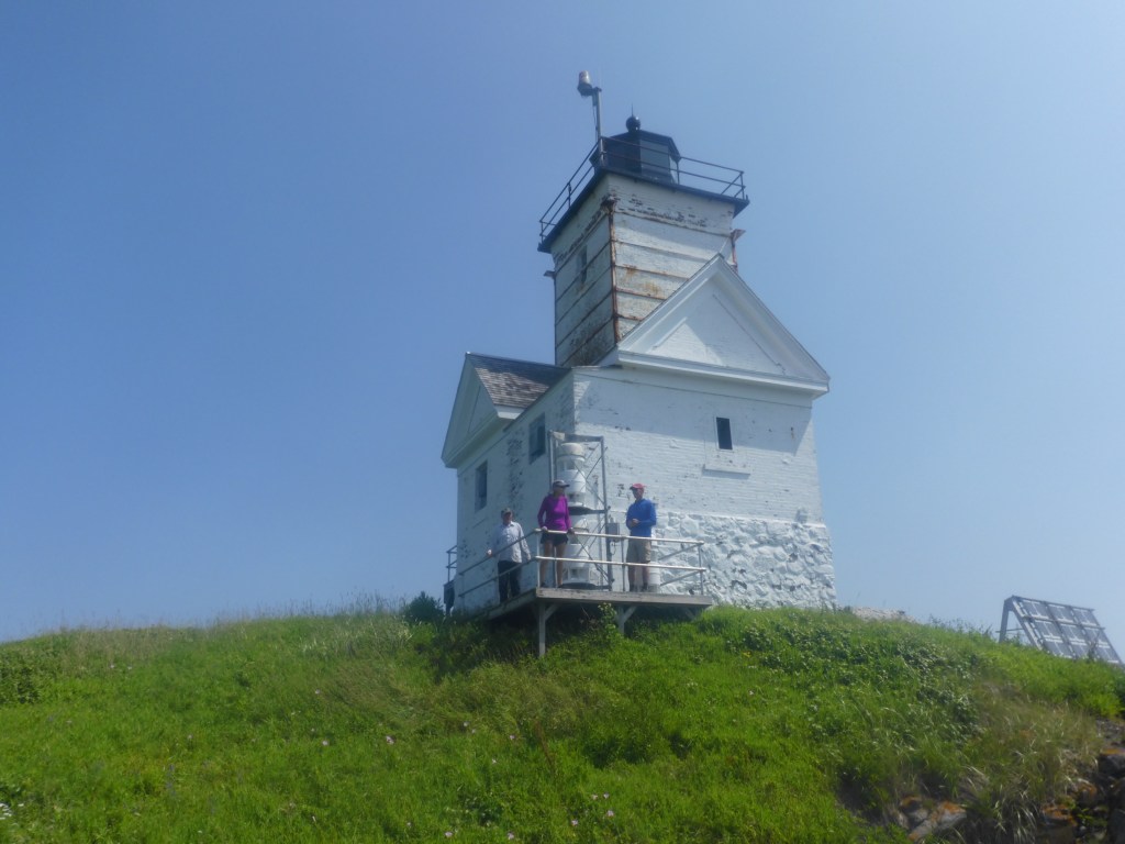
Paddlers enjoy a rare visit to Two Bush Light.
Each summer, I try to organize a Penobscot Paddle & Chowder Society sea kayak trip to Muscle Ridge. About 15 years ago, I had the good fortune to visit Two Bush during one of those trips. Subsequently, the remote island has been an elusive destination. Fog, rough seas and hazardous landings have prevented a return.
Recently, I endeavored to organize a Muscle Ridge kayak trip with Two Bush the primary objective. A small, hand-carry landing adjacent to Spruce Head Island Bridge is the closest launch site for a paddle to the distant atoll. Access and egress at the landing can be a muddy misadventure at low tide, so planning around that eventuality is important. Fortuitously, I identified a favorable forecast on a day when low tide was 11:30 a.m. Departing mid-morning and returning mid-afternoon would work perfectly.
Three paddling friends agreed to join me. The weather forecast was superb, calling for light winds, partly sunny skies and warm temperatures. However, the Maine Coastal Waters forecast was mixed. Advantageous 2-foot seas were predicted but patchy fog was anticipated in the morning. Since visibility was expected to be over a mile, we decided to assess the situation when we arrived.
Conditions were clear when we met in Spruce Head. However, fog was observed in the distance. Equipped with maps, compasses and a GPS, we felt adequately prepared to kayak around Spruce Head Island and traverse across Muscle Ridge Channel to the nearest island in the archipelago, Graffam Island. Whether circumstances would permit continuing to Two Bush was uncertain.
Our paddle along the north side of Spruce Head Island was uneventful. At the eastern end, we could see Graffam Island partially enveloped in fog. After collectively confirming the correct compass bearing for Graffam, we embarked on the busy, 1.5-mile crossing. Relative tranquility was experienced during our traverse. By the time we arrived at Graffam, the fog had dissipated to haze.
Turning the southern terminus of Graffam, Crow Island was visible a long mile southeast. Situated to the east of Crow, there was no sign of Two Bush or the lighthouse.
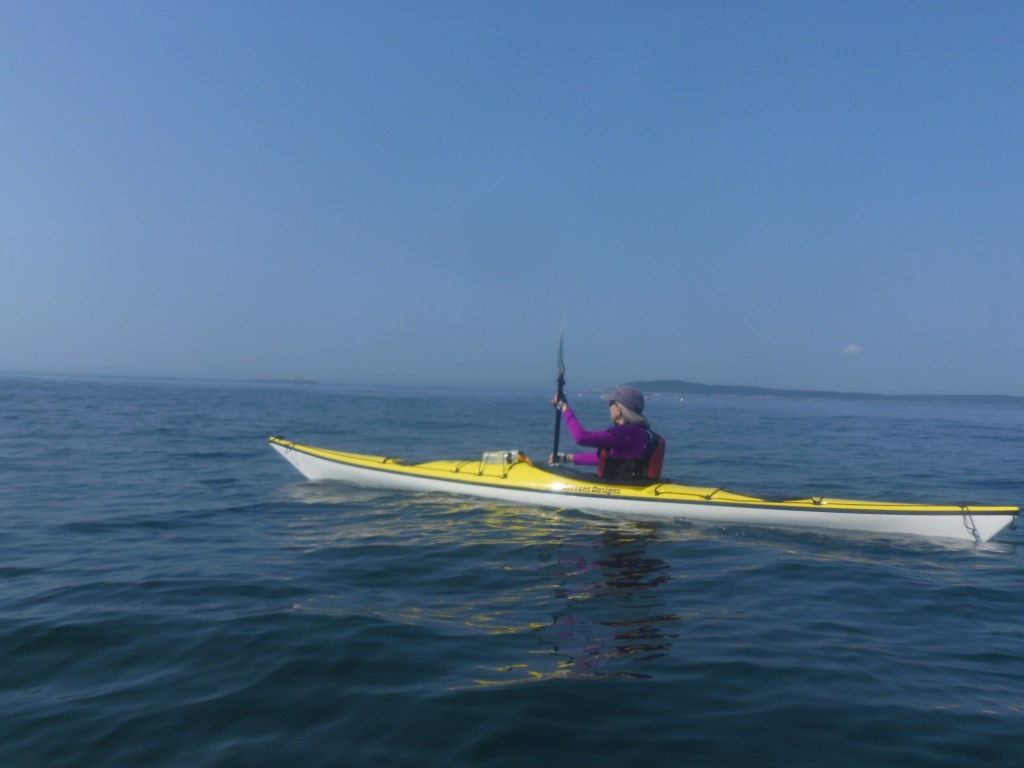
Ellen Nelson kayaks Muscle Ridge Channel. Ron Chase photo
Cruising along the southern periphery of the archipelago, we proceeded to the northern perimeter of Crow. Rounding the rugged shoreline, first the lighthouse then the entire island could be seen through the haze. Reaching Two Bush seemed likely. Landing was still uncertain.
A welcome calm was experienced during our crossing to the island. Landing on the western end was too hazardous. However, a rocky beach was found on the extreme eastern terminus where we successfully disembarked. A hike in tall grass to the lighthouse ensued.
The weathered, old lighthouse was a delight to visit. The prominent location provided outstanding views of the surrounding area.
After completing our exploration of Two Bush Island, we paddled north to a sandy beach on Bar Island. A shaded location at the head of the beach was an ideal lunch spot.
From Bar, we navigated around the northern end of Graffam Island and entered Muscle Ridge Channel. Once past tiny Hurricane Island, distinct Target Rock was detected amid the cliffs on Spruce Head Island. That was our bearing as we negotiated through strong tidal currents and completed the traverse. The incoming tide had covered most of the mud when we returned to Spruce Head Landing, concluding one of the most remarkable voyages on the Maine coast.
Read about eight more exciting sea kayak escapades in my book, “Maine Al Fresco: The Fifty Finest Outdoor Adventures in Maine.”
Ron Chase resides in Topsham. His latest book, “Maine Al Fresco: The Fifty Finest Outdoor Adventures in Maine,” is available at northcountrypress.com/maine-al-fresco or in bookstores and through online retailers. His previous books are “The Great Mars Hill Bank Robbery” and “Mountains for Mortals – New England.” Visit his website at ronchaseoutdoors.com, or he can be reached at ronchaseoutdoors@comcast.net.
Send questions/comments to the editors.


Success. Please wait for the page to reload. If the page does not reload within 5 seconds, please refresh the page.
Enter your email and password to access comments.
Hi, to comment on stories you must . This profile is in addition to your subscription and website login.
Already have a commenting profile? .
Invalid username/password.
Please check your email to confirm and complete your registration.
Only subscribers are eligible to post comments. Please subscribe or login first for digital access. Here’s why.
Use the form below to reset your password. When you've submitted your account email, we will send an email with a reset code.