

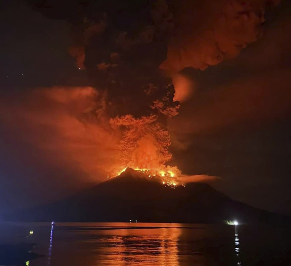
Hot molten lava glows at the crater of Mount Ruang as it erupts in Sanguine Islands, Indonesia on Wednesday. Sitaro Regional Disaster Management Agency (BPBD Sitaro) via AP
Indonesia’s Mount Ruang has erupted at least three times this week, forcing the evacuation of hundreds of people. On Wednesday evening local time, the volcano’s eruption shot ash nearly 70,000 feet high, possibly spewing aerosols into the stratosphere, the atmosphere’s second layer.
The volcano is part of Indonesia’s North Sulawesi province, in the Sangihe Islands archipelago. That puts it about 60 miles north-northeast of Manado, the province’s capital.
Indonesia’s National Disaster Management Agency posted on X that the situation corresponded to a Level 3 on a 1-through-4 scale, with 4 being the most severe.
In Laingpatehi village, there were reports of ash fall and communication issues. Indonesian authorities urged residents and tourists to remain at least 4 kilometers, or 2.5 miles, away from the volcano.
Satellite imagery depicted a massive eruption around 8 p.m. Wednesday local time, which shot ash about 65,000 to 70,000 feet high. That’s roughly twice the altitude at which commercial aircraft fly.
There are nine formal centers worldwide that monitor the location and movement of volcanic ash clouds, because they can pose major dangers to aviation and cannot be tracked on radar. The Volcanic Ash Advisory Center in Darwin, Australia, which is overseen by the Australian Bureau of Meteorology, wrote that there were “two volcanic ash layers discernible on satellite [at the surface and 47,000 feet] moving west-southwest and expected to dissipate within 12 to 18 hours.”
At the surface, ash was moving northwest, but at the upper altitudes, it was moving east.
The eruption produced prolific lightning, as is often the case with volcanic explosions. Friction between ash particulates results in charge separation, yielding static discharges in the form of lightning.
Chris Vagasky, manager of the Wisconsin Environmental Mesonet, a network of weather and soil monitoring stations across the state, reported that nearly 4,000 lightning strikes had been detected associated with the Ruang eruption as of 8 a.m. Eastern time.
The plot image he shared on X may resemble a bull’s eye of sorts, with an apparent ring of slightly lesser activity observed between a central dense spattering of strikes and a dense outer ring of observed strikes. Why the drop-off in between? This was probably a region of subsidence, or sinking air. As the volcanic plume ascended rapidly, pockets of heated air and ash collided with the tropopause, or the “ceiling” of the lower atmosphere; while some of the momentum probably continued upward, potentially injecting aerosols into the stratosphere, some of the momentum was reflected back downward. That created a local minimum in lightning activity. (Farther outward radially, it appears that the sinking air then heated up and began rising again.)
That was observed during the January 2022 eruption of the Tonga volcano Hunga Tonga, which by some reports sparked more than 400,000 lightning strikes.
Ruang’s massive plume can be seen on infrared satellite; after the initial blast, notice the slightly lighter colors, corresponding to warmer and lower cloud tops, on the west side of the plume. That is from subsidence.
The summit of Ruang stands 10,932 feet above sea level, with a caldera that is about two miles wide. Eruptions are relatively common, though explosions this high are rare.
When volcanic aerosols make it into the stratosphere, they can have minute effects on Earth’s climate. The stratosphere begins around 20,000 feet above the ground at the poles, but 60,000 feet or so in the tropics. It is too early to know how much material, if any, made it into the stratosphere, which is above the troposphere, or the lowest layer of Earth’s atmosphere. Weather occurs primarily in the troposphere.
Comments are not available on this story.
Send questions/comments to the editors.
