

The Farmers Alamanac may have predicted a rough winter – all the way back in August – but meteorologists say it’s difficult to say whether Tuesday’s blizzard marked a turning point for a winter that had, until this week, delivered relatively little snow and mild temperatures.
Another storm expected Friday could bring another half a foot of snow to parts of Maine. Some forecasts predict the state could get two more snowstorms next week, on Monday and Thursday.
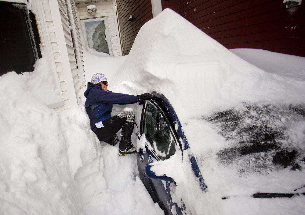
Additional Images
The National Weather Service in Gray, however, is being cautious. “We really only look out 10 days,” said meteorologist Margaret Curtis at the NWS office.
Curtis said that while the Washington, D.C., office of the National Weather Service creates computer models with three-month outlooks, those models say only whether weather patterns are likely to be normal or abnormal. And the current three-month outlook for Maine is “normal,” she said.
“We really don’t have the ability to forecast that far out,” Curtis said.
But Curtis said she could say with some certainty that the forecast for the next week looks “very active.”
“In the beginning of the winter, we were off the storm track, and now we are certainly back on,” she said.
Meteorologist David Epstein, who writes a weather blog for the Portland Press Herald, said it’s too soon for him to confidently forecast next week’s weather, let alone whether Tuesday’s blizzard set a new tone for the rest of the winter.
“Let’s not jump to conclusions,” Epstein said. “It may mark a turning point in what we see, and that’s a definite possibility, but we need to get further away than we are now.”
The one thing he could say conclusively is that the pattern of the jet stream has shifted. The jet stream, a river of wind high in the atmosphere that generally flows from west to east across the country along the boundary between hot and cold air, is now flowing closer to New England.
“The jet stream has definitely changed. So storms that were going to the north and south and west of us in January, that has now changed,” Epstein said. “It is now more favorable for snow.”
Kevin Mannix, a weather forecaster for WCSH-TV, said the shift in the jet stream is “what we call a pattern change,” but he agreed that it’s too soon to predict what that change will bring in terms of snowfall or temperatures.
“You can look at a 30-day model, but it’s only good, really, 10 days out. After that, it can give you an idea of how it may evolve, but there are always changes,” Mannix said.
Mannix said Friday’s forecast, for example, is based on current atmospheric patterns in the Canadian prairies and another system that moved to the east from the Pacific Ocean and is now over the Midwest.
“With the next one Monday and the next one after that on Thursday, it’s just energy out of the Pacific,” Mannix said. “The closer you get to the event, (forecasts are) more accurate.”
Mannix said the early forecasts for Tuesday’s storm show how predictions can change: New York City shut down as officials braced for what had been anticipated as a storm of historic proportions, but turned out to be an unremarkable storm with only around a foot of snow.
“The storm’s evolution – and we say this for a lot of storms – was a matter of miles,” Mannix said. A shift in a storm’s track either to the east or west can significantly affect snowfall totals.
While New York City was largely spared, Long Island received two feet in some places. Similarly, parts of western Connecticut received 10 inches of snow or less, while parts of eastern Connecticut got 20 inches.
Mannix said his early forecasts for Portland and midcoast Maine leading up to Tuesday’s storm were for 10 to 20 inches. But as the storm got closer, it was 25 miles farther east than earlier predictions, leading him to change the forecast to 20 to 30 inches of snow.
Both Mannix and Epstein also dismissed the notion that Tuesday’s blizzard disproves global warming.
“It makes me cringe, because it’s an uneducated opinion,” Epstein said.
NASA and the National Oceanic and Atmospheric Administration on Friday declared 2014 the hottest year since modern measurements began, based on separate analyses of weather records dating to 1880.
Driven in part by steadily warming oceans, average temperatures edged past the previous records set in 2005 and 2010. The 10 hottest years in modern times all have come since 1997, NASA scientists said.
While global warming is used to describe the general warming of the entire planet, its effect could make some places wetter than before, while other places actually become colder, Epstein said.
“It changes the global circulation pattern. It impacts areas differently. It doesn’t mean that everywhere is warming up,” he said.
In 2014, large portions of the American West baked under epic droughts and heat waves, and glaciers and Arctic ice sheets continued a decades-long retreat.
In one of the rare exceptions to the warming trend, however, the eastern United States was cooler than average in 2014, as an unusual dip in the jet stream sent waves of Arctic air plunging southward. Seven Midwestern states had among their 10 coolest years on record. Maine, however, experienced its 28th-warmest year in the past 120 years.
Epstein said he sees Tuesday’s blizzard as a notable aberration, like a torrential storm last Aug. 13 that caused flash floods in Portland after more than a half-foot of rain, or the record snowstorm on Feb. 9, 2013, that blanketed Portland in 31.9 inches.
Mannix said he doesn’t find talking about climate change useful in his business.
“I believe weather goes in cycles,” Mannix said. “In our business, we go with averages over a 30-year period, and those averages aren’t deviating much.”
Copy the Story LinkSend questions/comments to the editors.

Success. Please wait for the page to reload. If the page does not reload within 5 seconds, please refresh the page.
Enter your email and password to access comments.
Hi, to comment on stories you must . This profile is in addition to your subscription and website login.
Already have a commenting profile? .
Invalid username/password.
Please check your email to confirm and complete your registration.
Only subscribers are eligible to post comments. Please subscribe or login first for digital access. Here’s why.
Use the form below to reset your password. When you've submitted your account email, we will send an email with a reset code.