

Maine will plunge into a mercifully brief deep freeze Sunday after coastal parts of the state got a glancing blow from a snowstorm that pummeled southern New England and the mid-Atlantic on Saturday.
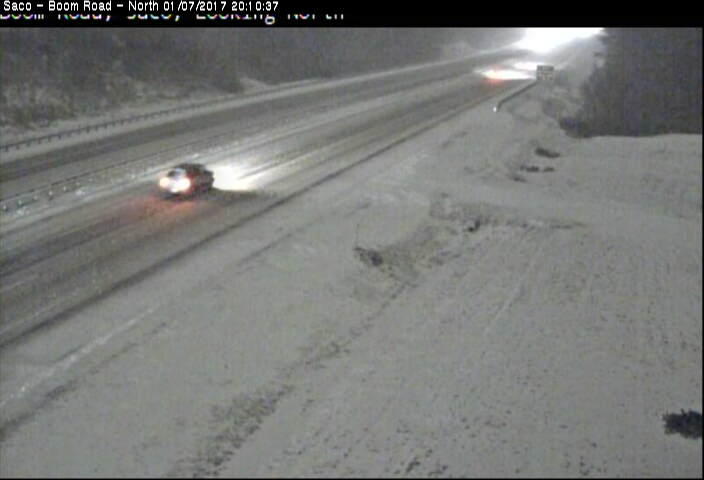
Light snow broke out in Greater Portland at midafternoon Saturday and continued into the night, but the impact varied widely, with heavier snow in York County and elsewhere along the coast and some parts of Maine’s inland not even seeing a flake.
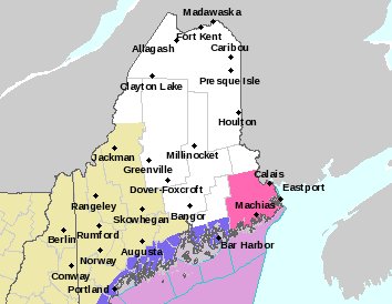
The heaviest snowfall was expected in Down East Maine. A forecaster at the National Weather Service in Gray said as much as 8 inches of snow could fall in northern Washington County, near the border with New Brunswick.
In southern Maine and along the midcoast, coastal towns and cities should see 4 to 6 inches by Sunday morning, but amounts west of the Maine Turnpike will be minimal.
Overnight parking bans were announced in Biddeford, Brunswick and York.
Very cold air is following the storm, with highs Sunday expected to reach only about 20 degrees in southern Maine and lows Sunday night around 0 degrees, said Margaret Curtis, a meteorologist with the weather service office in Gray.
Curtis said cold air will linger Monday, but temperatures will start to rebound on Tuesday, with highs that day reaching above freezing. Then milder air will move in, and highs by Thursday should be in the mid-40s, she said.
Send questions/comments to the editors.

Success. Please wait for the page to reload. If the page does not reload within 5 seconds, please refresh the page.
Enter your email and password to access comments.
Hi, to comment on stories you must . This profile is in addition to your subscription and website login.
Already have a commenting profile? .
Invalid username/password.
Please check your email to confirm and complete your registration.
Only subscribers are eligible to post comments. Please subscribe or login first for digital access. Here’s why.
Use the form below to reset your password. When you've submitted your account email, we will send an email with a reset code.