
The storm possibility you’ve been hearing about for the past week hasn’t looked like a good set up for skiing for several days so if there isn’t going to be natural snow for them, why get it at all at this point in the season? This morning, I gingerly looked at the computer models hoping the trend I have been seeing the past three days continue. The good news, if you didn’t want a big snowstorm, is that the trend of keeping the storm weaker and further east is indeed happening and this bodes well for little or no snow.
One of the reasons I am always reluctant to put out snow amounts days before a storm is because things change. There is a saying in the weather biz that goes something like this, “the trend is your friend.” The meaning of this is when the models are inching closer to a small or bigger storm; ultimately what actually happens usually follows this.
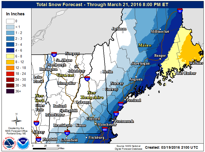
There can always be last minute shifts in the forecast and until the storm passes by the area I won’t be totally comfortable. The most likely areas to plow will be east of Portland along the coastline although even in the city a couple of inches may fall.
Why No Big Storm?
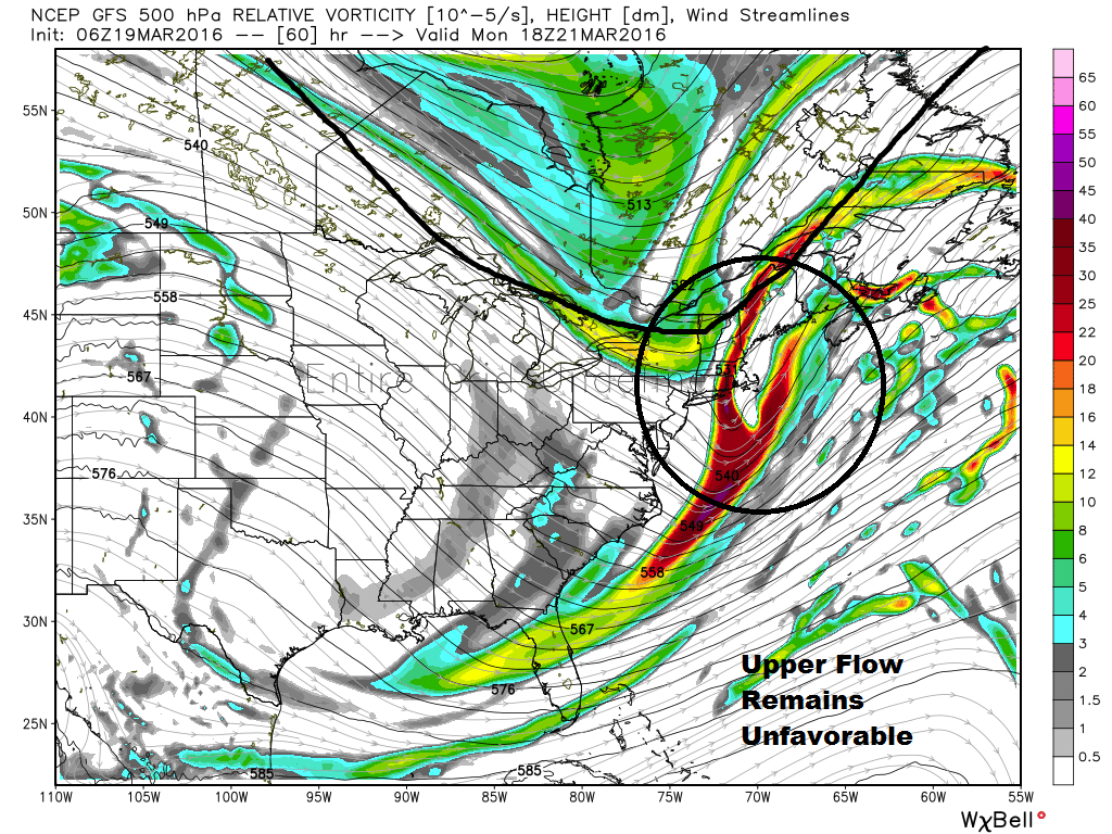
The reason we aren’t getting a big snowstorm is because the northern and southern jet streams aren’t going to come together at the right time. Additionally, the strength of the entire system just isn’t big enough. The storm that will eventually form will remain on the weaker side and too far east.
Certainly big storms do occur this late in the year, but for the coastal plain a major snowstorm this late would definitely be an outlier. The mountains can still see significant snow well into April.
Could This Change?
It’s weather, so of course I could end up needing to update the forecast. If the storm looks like it will move further west and be a big stronger then all of the coastal plain could see a light to moderate storm. More tomorrow.
When Will Snow Fall?
If you are going to see snow, most likely fall late Sunday night to early Monday morning through midday. Since the storm is forecast to stay east, the mountains won’t see much if any snow and there will likely be developing sunshine in the afternoon. Notice the very tight banding of snowfall totals around southern Maine. A small shift of just 30 miles will impact snow totals several inches. DownEast Maine will see the highest totals.
Warmer Temps Ahead
It will be chilly behind the storm with highs only in the lower 40s Monday and Tuesday, but I do see milder air by the middle to end of the upcoming week and 50s aren’t out of the question by next weekend.
Comments are no longer available on this story