


A U.S. Coast Guard official said two vessels were on the Kennebec River on Tuesday ahead of a larger ice-breaking operation this week as the river’s water level continues to climb slowly because of warmer weather and steady rain.
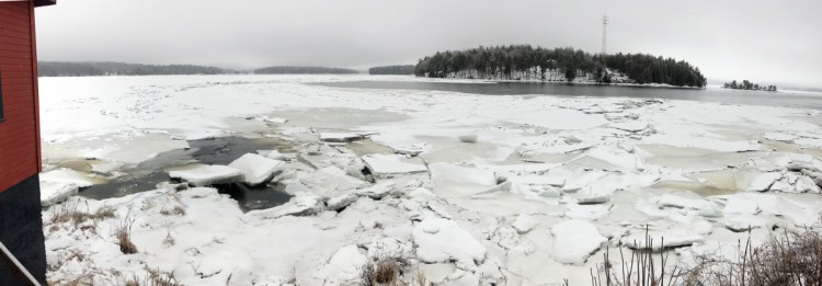
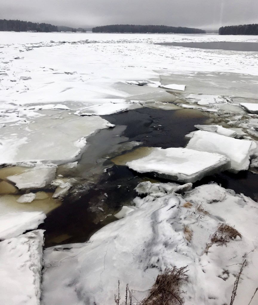
The unusual midwinter effort comes more than a week after a sudden ice jam on the Kennebec caused destructive flooding in low-lying areas in Augusta and Hallowell, where businesses were flooded and vehicles were encased in icy water.
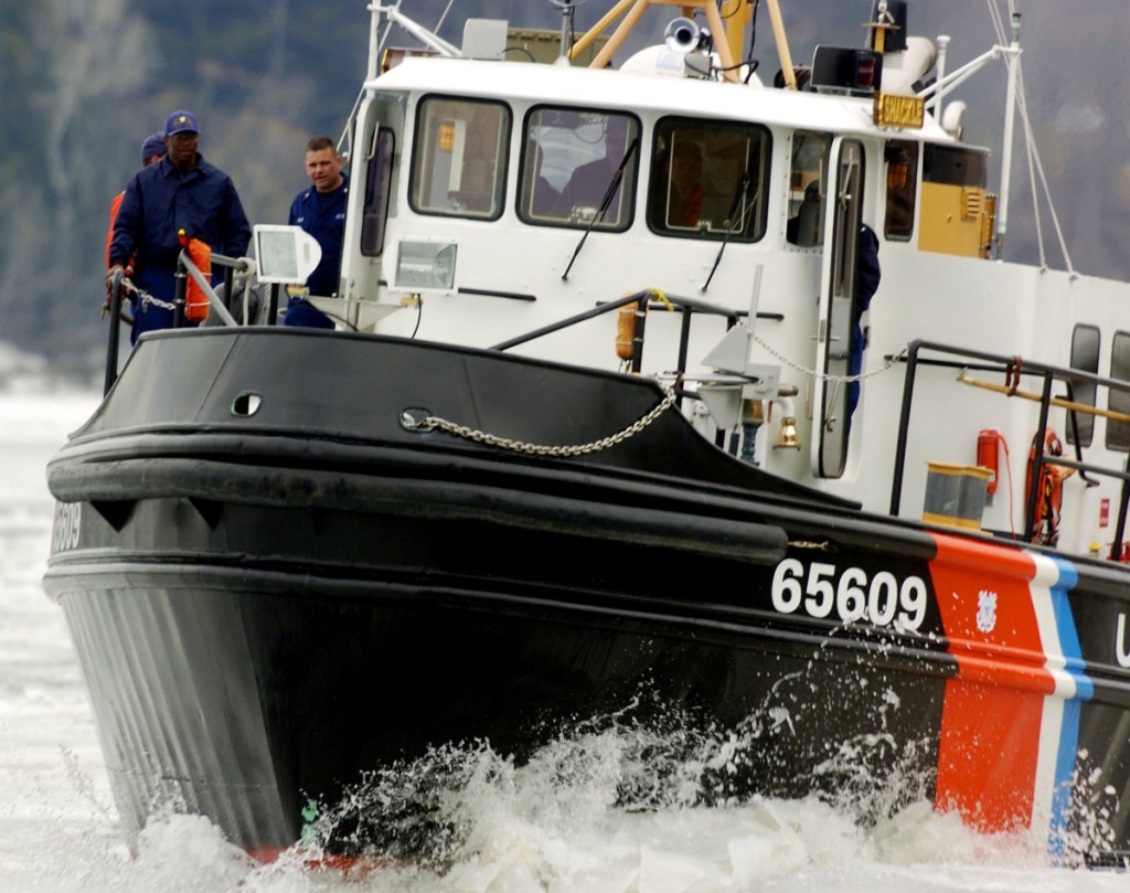
Lt. Matthew Odom, the chief of the Coast Guard’s Waterways Management Division in Northern New England, said two 65-foot ice breaking tugs are on the river gauging the conditions before an additional 65-foot vessel and a larger, 140-foot ice breaker join the operation later in the week.
Icebreakers were scheduled to come up the river Wednesday toward Chop Point in Woolwich, where the two 65-foot cutters will work in tandem to break ice.
Shortly after 6 p.m. Tuesday, the Kennebec River was at 10.24 feet at the U.S. Geological Survey gauge at the Calumet Bridge at Old Fort Western in Augusta. Flood stage is 12 feet — and it has risen slowly since Monday.
The early arrival of the icebreakers comes as downtown Augusta and Hallowell remain vulnerable to midwinter river flooding like that caused by an ice jam on Jan. 13-14 that stranded many vehicles and sent icy water into businesses. The icebreaker operation, typically known as the Kennebec River Spring Breakout, is usually conducted in late March or early April.
The Coast Guard received a request a week ago from the Maine Emergency Management Agency to break out the ice on the Kennebec to ward off further flooding. The depth of the river and low height of the Pearl Harbor Remembrance Bridge linking Gardiner and Randolph limit the Coast Guard’s ability to reach the ice jam, but it will break ice to open up water downriver to improve the river flow, according to Odom.
The National Weather Service in Gray issued a flood watch through early Wednesday morning and said flooding was possible from Tuesday into Wednesday, but the conditions that prompted the watch to be issued didn’t materialize.
While rain, freezing rain and sleet fell over much of the region Tuesday, National Weather Service meteorlogist James Brown said Tuesday evening that not much of that is flowing into the Kennebec.
“There’s not a lot of runoff, because it’s too cold,” Brown said.
And while the temperature moderated through the day, it stayed close to freezing.
Brown said the weather system was moving out of the area and it wasn’t producing a lot of precipitation. The rain was expected to stop Tuesday night, giving way to clear skies overnight into Wednesday.
Jason Pafundi — 621-5663
Twitter: @jasonpafundiKJ
Send questions/comments to the editors.

Comments are no longer available on this story