

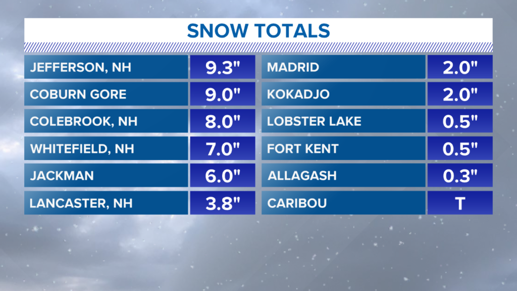
Another wild weather weekend for Maine! Snow coated the high peaks in Maine and New Hampshire on Saturday. Snow is not exactly unheard of this time of year, but it is still pretty early in the season. Totals were most impressive along the Canadian border where some areas approached double digit accumulations.
NEWS CENTER Maine
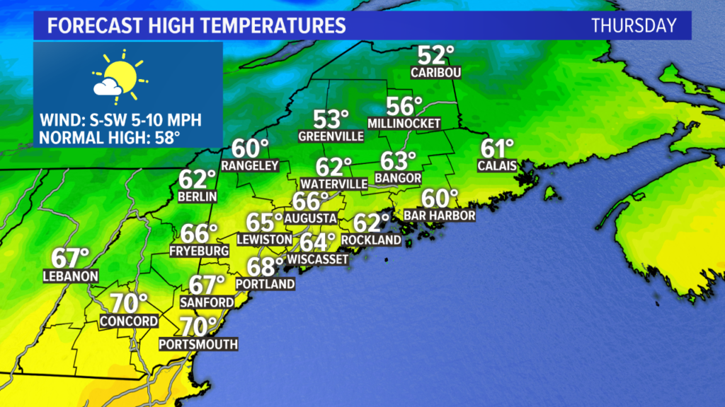
Put the snow shovels away for now, though. This week is going to be more reminiscent of September, with temperatures generally in the 60s. With a bit of luck, a few spots could even see 70 degrees by the end of the week.
Partly to mostly cloudy skies on Monday kept the mountains in the 50s while the coastline made it to near 60 degrees.
NEWS CENTER Maine
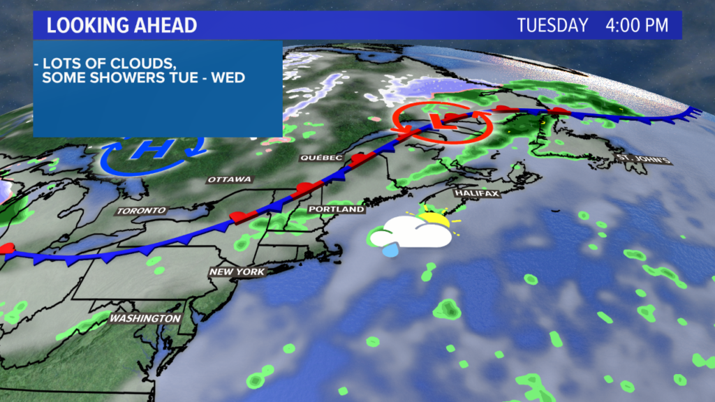
The front gets closer on Tuesday. This will be the best chance for widespread showers, especially in the afternoon. Again, the milder air on the warm side of the front (where we are) will keep temperatures in the low 60s.
NEWS CENTER Maine
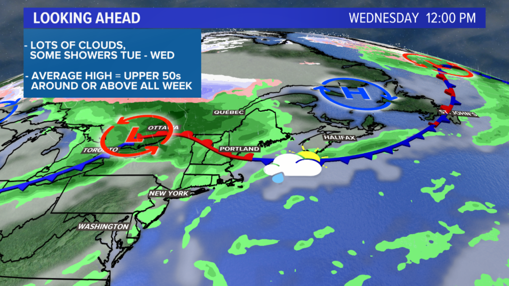
Wednesday features more of the same as our pattern remains a bit stagnant. It looks quiet to begin the day on Wednesday, but showers are expected through the afternoon. High temperatures end up near 60 degrees, despite the cloud cover.
Looking great! NEWS CENTER Maine
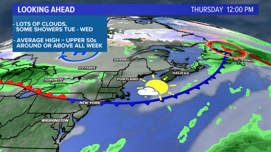
Milder air surges in on Thursday. The pattern also breaks in such a way that sunshine will accompany this shot of warm air. Expect partly sunny skies Thursday afternoon.
NEWS CENTER Maine
Right now, the best chance at 70 degrees is still southern New Hampshire. There is a real possibility, though, that some spots in southwestern Maine get in on that warmth and ultimately end up near 70 Thursday afternoon. My forecast for a few days out is 68 degrees in Portland and 70 in Portsmouth. We should have a better idea of the actual numbers as we get closer, but I feel pretty good about this forecast as it stands.
Beyond Thursday, both Friday and Saturday are looking quite nice. More days in the 60s with more sunshine looks likely given the overall pattern.
NEWS CENTER Maine
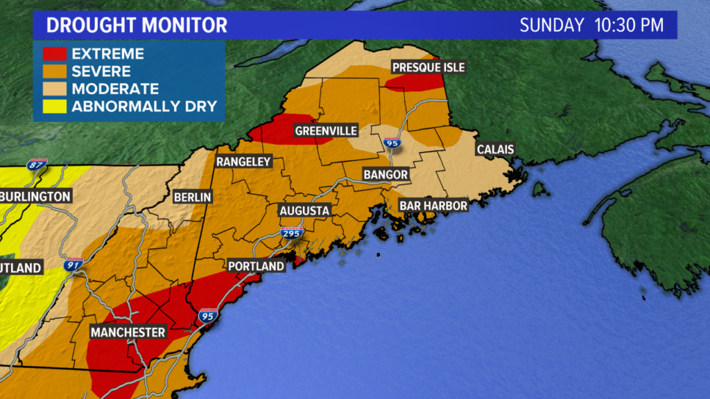
The drought monitor above still shows that Maine needs rain.
A couple of notes…this does not include most of the rain we saw last week, nor does it include the rain from over the weekend. It also does not get released again until Thursday morning. So while this drought monitor does show an ongoing drought, most of the region has seen at least some improvement. That will all be discussed in next week’s blog, though. Stay tuned!
Check out my Twitter feed for more local weather and forecast information.
Comments are not available on this story.
Send questions/comments to the editors.
