

A powerful rain and windstorm will move into Maine late Sunday into Monday. Though the storm should last 24 hours or less for most of the state, flooding and power outages are possible, especially as we get into Monday morning.
Let’s discuss the new details:
Low pressure will develop along a strong cold front that will slice through the Pine Tree State early Monday morning.
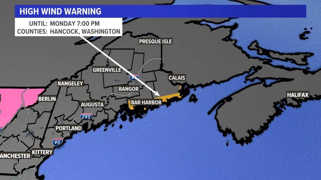
A high wind warning is in effect for Hancock and Washington counties, where the highest probability of damaging wind is likely. That’s due to a low-level jet stream transporting wind energy down to ground level. Imagine airplanes were flying very low to the ground, and you felt some of those wind gusts. The heavy rain will help to send that wind to the ground.
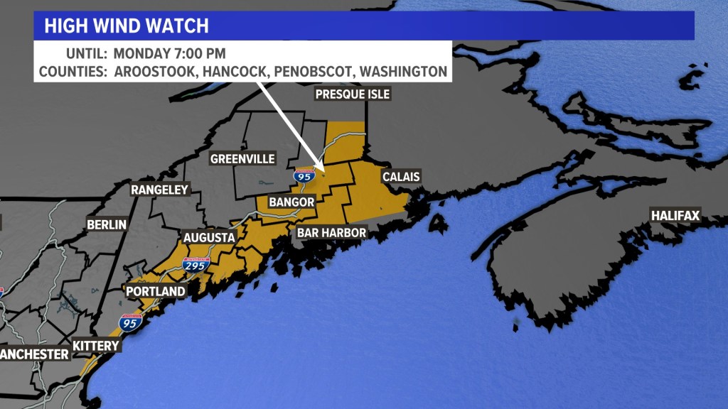
A large chunk of the state is under a high wind watch due to potential gusts exceeding 50 to 60 mph early Monday morning if the cold front should track a few miles west.
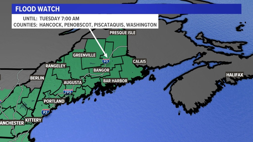
A flood watch covers nearly all of Maine, with a lot of moisture in the air that could fall heavily Sunday night into Monday morning. Rainfall rates of more than 1 inch per hour and totals near 4 inches in the Kennebec River Valley are possible.
The heavy rain combined with high dew points will cause rapid snowmelt on streams and creeks. I also expect the rivers to rise Monday during the runoff.
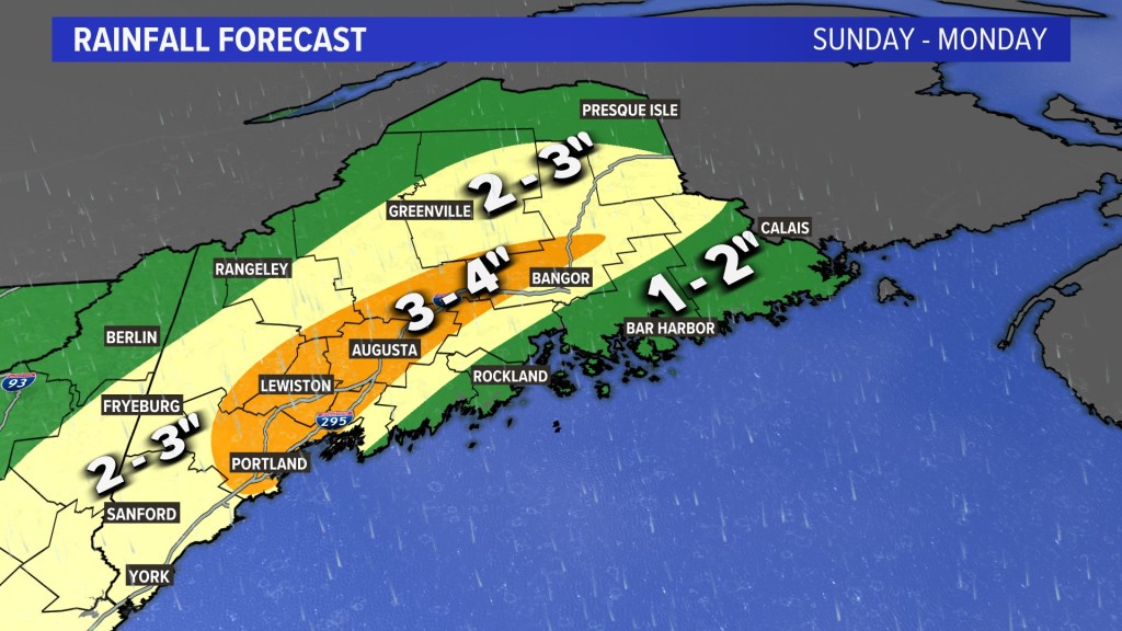
The rainfall map of the state shows that the heaviest amounts should fall across the central part of the state, including Augusta, Lewiston and Portland.
Lighter amounts are expected Down East and farther north.
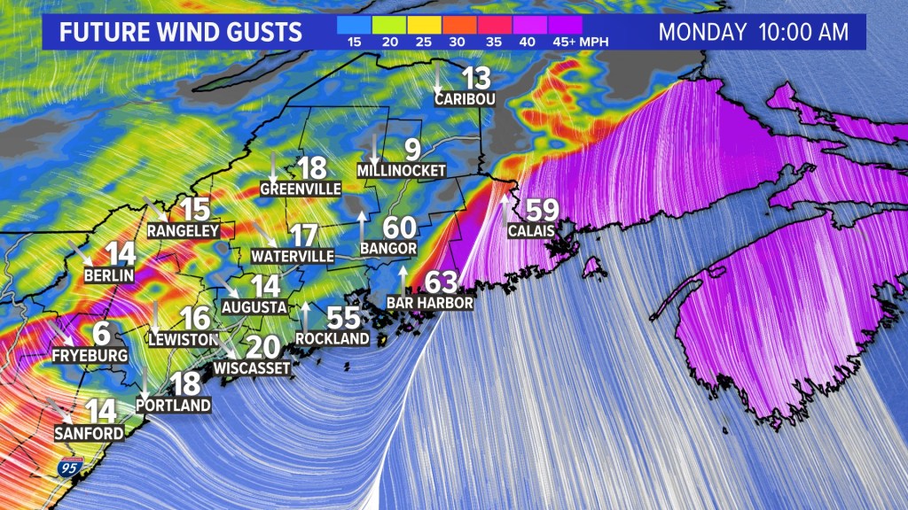
If the front stays east, the worst of the wind gusts will hit Down East.
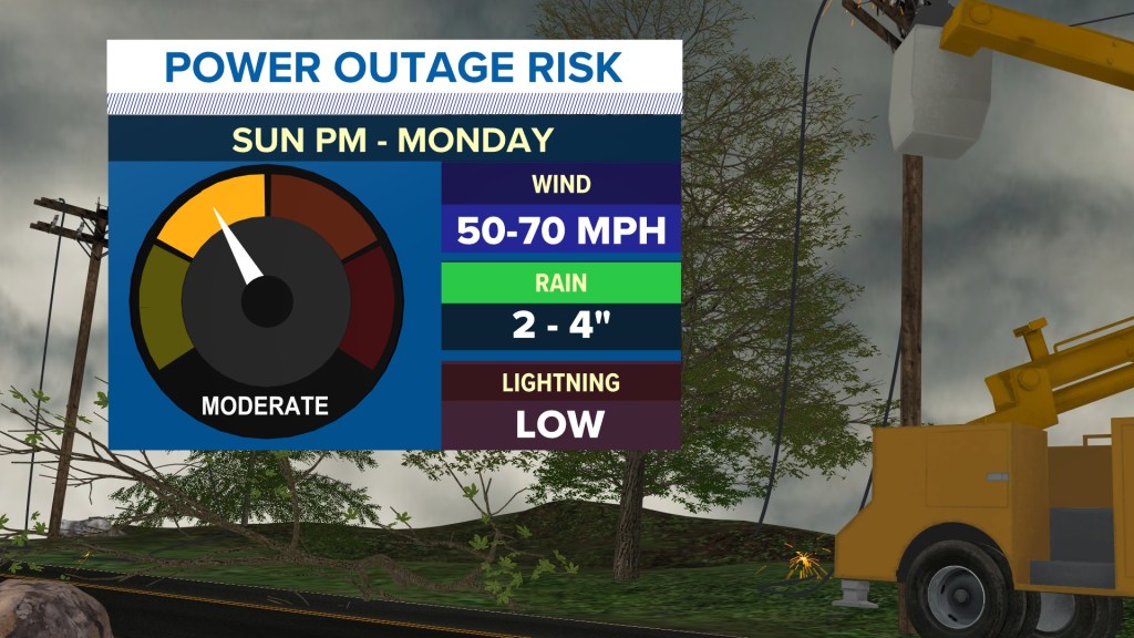
The power outage forecast is still at the moderate level, thanks to the amount of wind energy available.
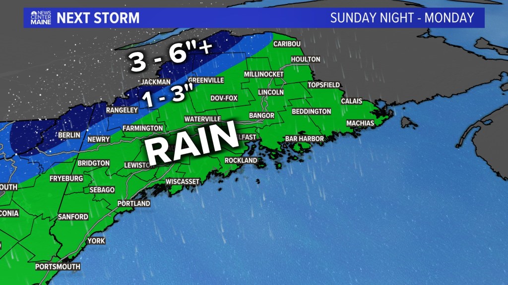
I’m not expecting much snow from this storm, but the high peaks of the western mountains and the boundary plateau have the best shot for accumulation.
STORM TIMELINE
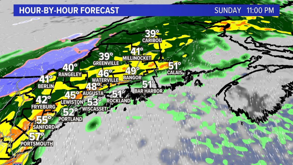
The first batch of heavy rain arrives Sunday night.
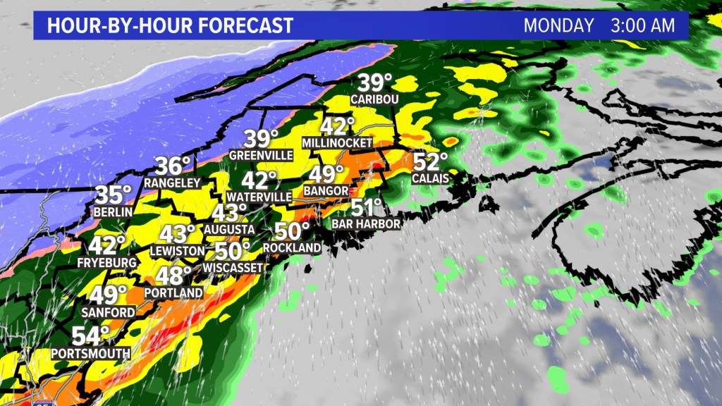
The rain continues into Monday morning and will be very heavy.
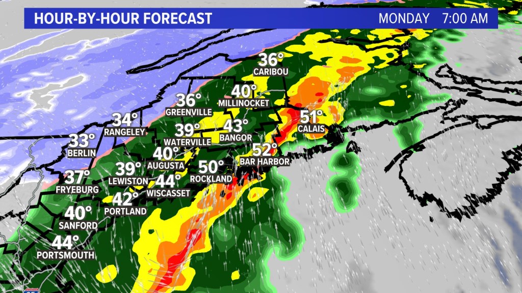
Most of the state will still be getting heavy rain at 7 a.m.
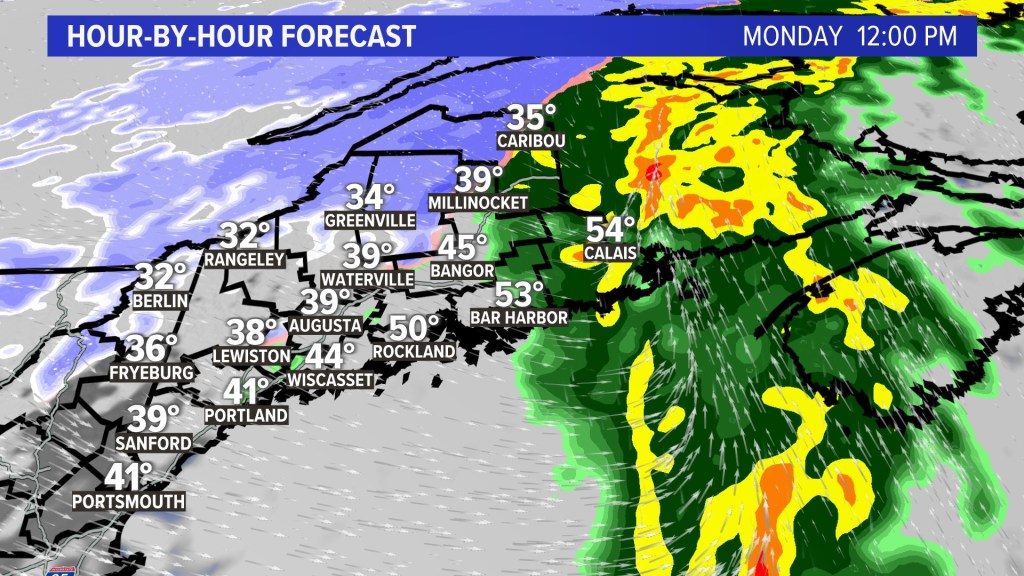
By noon, the storm should be done for most of Maine except for the state’s northern tip and Down East.
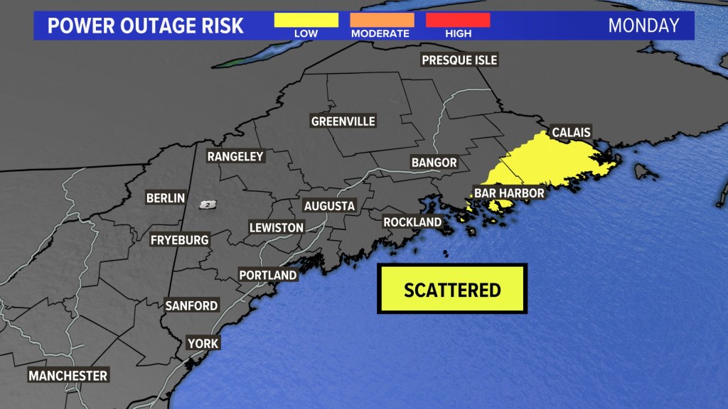
The outage risk map shows Washington County in the bullseye for scattered outages Monday.
Copy the Story LinkSend questions/comments to the editors.

Success. Please wait for the page to reload. If the page does not reload within 5 seconds, please refresh the page.
Enter your email and password to access comments.
Hi, to comment on stories you must . This profile is in addition to your subscription and website login.
Already have a commenting profile? .
Invalid username/password.
Please check your email to confirm and complete your registration.
Only subscribers are eligible to post comments. Please subscribe or login first for digital access. Here’s why.
Use the form below to reset your password. When you've submitted your account email, we will send an email with a reset code.