

Here comes the rain.
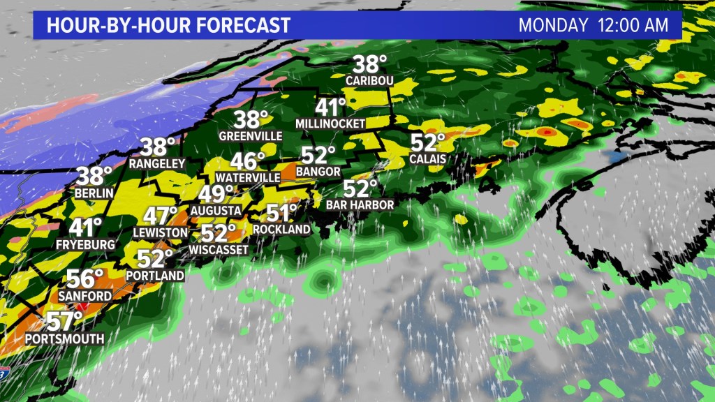
A strengthening area of low pressure that formed along a cold front late Sunday slowly move dnorth into Maine overnight. The storm will bring several inches of rainfall to the Pine Tree State through this morning’s commute. Give yourself extra time if you need to get to work or school.
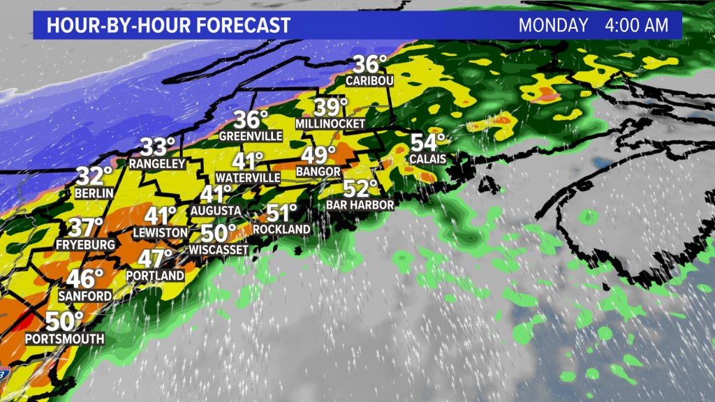
There will also be strong wind, up to hurricane force along the coastline in Down East Maine on Monday. On the backside of the cold front, snow in the mountains will be heavy near the boundary plateau and high peaks of western Maine.
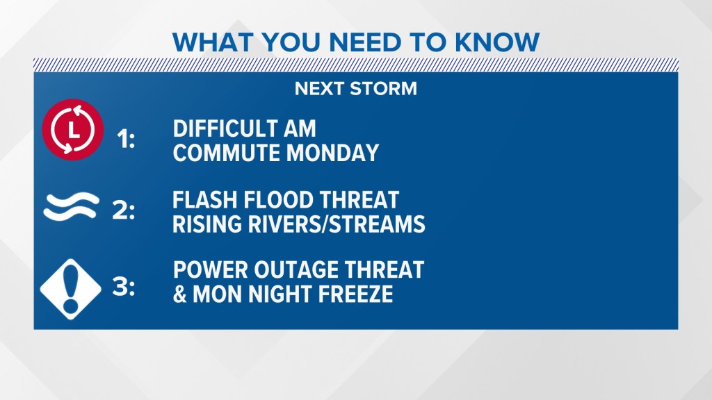
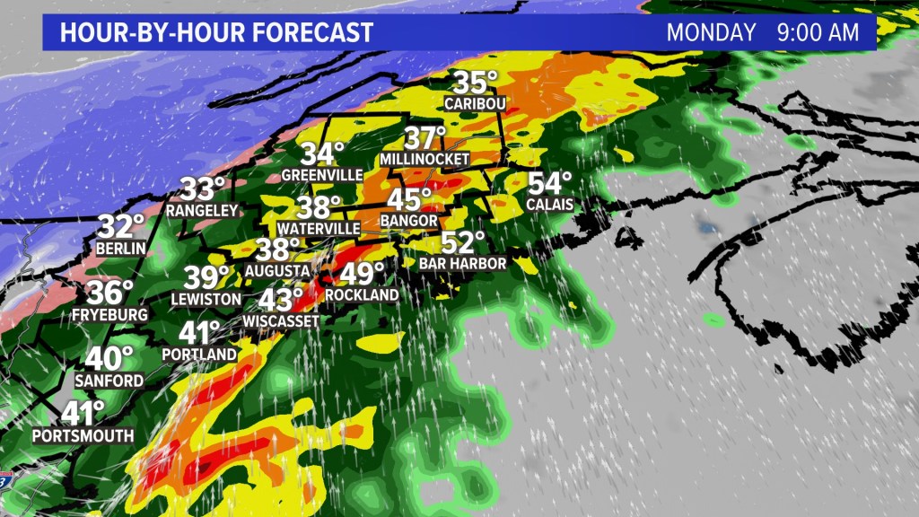
Today’s morning commute will be difficult due to the heavy rainfall, a flash flood threat, and rising rivers and streams.
This will transition to a high wind and power outage issue along portions of Down East Maine, where more than 50 mph gusts are expected. Winds up to hurricane force can not be ruled out along the immediate coastline. Mariners will see nearly 20-foot waves.
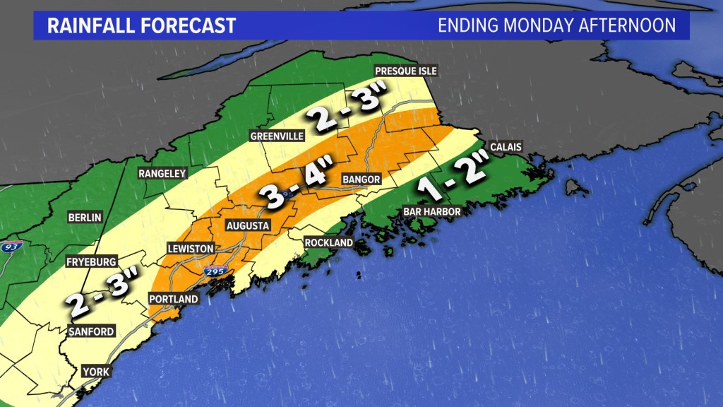
Total rainfall accumulations will be in the 3- to 4-inch range from near Casco Bay through the Augusta region and into the Kennebec River Valley.
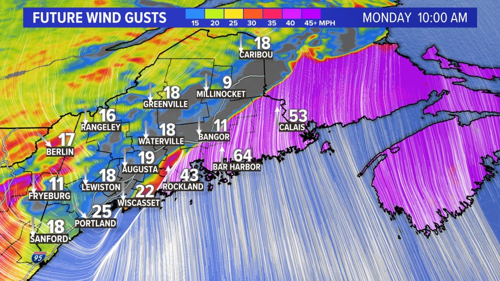
Wind will peak during the day, with the highest gusts Down East. Get your generator fueled up.
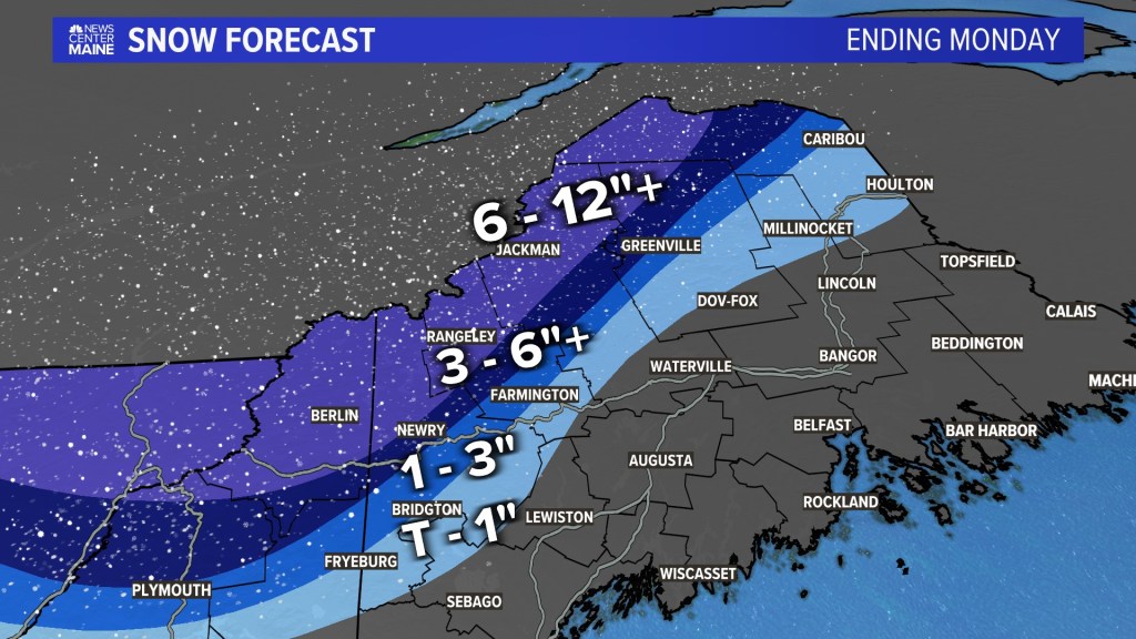
Snow will arrive on the backside of the cold front in the western mountains, with significant accumulations expected.
Here’s a timeline of the storm for the state:
As morning arrives, heavy rain is expected to drench the whole state.
 Copy the Story Link
Send questions/comments to the editors.

Success. Please wait for the page to reload. If the page does not reload within 5 seconds, please refresh the page.
Enter your email and password to access comments.
Hi, to comment on stories you must . This profile is in addition to your subscription and website login.
Already have a commenting profile? .
Invalid username/password.
Please check your email to confirm and complete your registration.
Only subscribers are eligible to post comments. Please subscribe or login first for digital access. Here’s why.
Use the form below to reset your password. When you've submitted your account email, we will send an email with a reset code.